Wednesday, April 7, 2021

Place Names

I set out from the sea heading up the Neck and through the Sneak.  The high tide passed an hour or so ago but the current is still light.  It is a beautiful spring day - warm, mostly sunny and with a light wind coming down the river.

The Osprey count looks to be about 40 percent.  Some of the nests have pairs busy refurbishing their abode with new sticks.  Some of the nest boxes are bare showing that the mated couple hasn't returned.  Great Egrets are back and in the winter-stomped spartina I can spot a half dozen at good distance with no trouble at all.

The view from Bailey Creek (it's real name)
Nearing the Big Bends but still 300 yards below, I spot several large dark birds at the edge of the first bend.  They move too quick to be Canada Geese and they are entirely in the wrong place to be Wild Turkeys.  I get the binoculars and find that they are, in fact, a half dozen white tail deer and that they aren't on the shoreline but instead, another 300 yards back wading where the marsh and forest meet.  Above the bends I find a half dozen Yellow Legs working over the stomped spartina.

Deer disappearing
Lately, I've been thinking about place names in natural settings.  Before I wade into this, one of my all time favorite names is Ice Crackin.  It is a lake that was on our summer Boy Scout canoe trips.  It's not Lake Ice Crackin or Ice Crackin Lake, it's just Ice Crackin.  It's delicious in that you almost have to "belong" to get it.  

Yellow Legs

Back to the East River -  The Big Bends, the Sneak, the Gravel Flats and Pocket Knife Corner are names in this river that pretty much only I can attach to a particular feature.  I created them to keep track of my observations as my world is much more micro than the government map world.  They seem appropriate to me, definitely more appropriate than many of the official honorific names that the government bestows on places.  Denali becoming Mt. McKinley because President McKinley looked favorably on mining is an example of poor naming.  Of course, it has since officially reverted to Denali as it should be.  Out west in Union Bay where I started this whole canoe journal thing, I named a good number of features to keep my observations orderly.  There was Number 1 Island, Number 2 Island, Broken Island, Birch Island, the Lunch Counter, West Lodge, Hidden Lodge, and Keg Island.  I changed names on some others, Foster Island became the Burial Island as it had been a Native American burial site.  The Ship Canal, which had been a portage route with a Duwamish name that translated into "crossing over place" became the Crossing Under Place.  And that leads to how places become known by names.  Google, in it's massive and somewhat sloppy effort to map the world with satellite images, adopted the names, Number 2 Island, Broken Island and Birch Island, even though I informed them not to do that.  In time, Broken Island made its way into a Masters Degree dissertation and then into Wikipedia.  I suspect it is permanent.  Number 1 Island was left out, which makes Number 2 Island look silly.  Broken Island was named because at high water a 3 ft wide channel develops cutting the island in half.  Birch Island simply had 3 small paper birches growing on it.  Keg Island is where I retrieved a beer keg while cleaning the marsh, and the Lunch Counter was a favorite spot for Bald Eagles to eat Coots.

Approaching Pocket Knife Corner

I paddle up to and just passed the Stagecoach Crossing, which is know as Bear House Hill Road, which is a fine enough name as well.  I return from there riding the ebb current and catching a tail wind for much of the way

Saturday, March 27, 2021

Shephaug Cascades

I put in up in the cove that once was a brook where a railroad once ran.  The railroad is gone and the bed was submerged by the building of a dam in the 1950's.  I paddle out and across the main river, where the remains of a trestle (probably just the foundation) are down a good 50 feet or so.  It is a beautiful spring day with rather calm air and a good amount of sun.

I round the point and head up the Shephaug arm.  I don't believe that I've been here this early in the year.  I base that on things that I can see in the forest that I did not know were there.  There is a nice classic white house on the ridge just behind where the purple wisteria vines will be blooming later this summer.  The rock formations that I see mean that the ridge is not just glacial till.  I'm no geologist, but the rocks look like they have a volcanic origin.

I paddle north with little to comment on other than it is a nice paddle.  Eventually, I see some Buffleheads and pairs of scattered Common Mergansers.  There are quite a few of the later and it appears that they have paired up for nesting.

In the last mile of the outbound trip I find where the railroad bed climbs up out of the reservoir.  It's quite obvious with the foliage down.  The rail line ran up to Litchfield.  It was taken out around 1940.  It must have been a beautiful train trip.

Obvious railroad bed climbing to the right

In the last bend there is a great deal of beaver sign.  Quite a few trees are well gnawed and the chewings are fresh.  At first, I suspect that they are bank burrow beavers as there's not a lot of swamp land along the shore. 


I look for but don't find any scent mounds... the amount of chewing looks like more than one colony-worth of beaver.  But without the territorial scent mounds it might just be one active colony.  Back in a little inlet I find a typical conical lodge.

Lodge

I turn back at the cascades, as there is no further way up through the gorge that contains the rapids.

I pass the same birds on the way out.  I pass the same shorelines and trees.  But, I always come out different.

Wednesday, March 24, 2021

Osprey 1 through 5

 I gather up M for a trip into the East River marsh.  We haven't been out together since last fall and the weather, although cloudy, is pretty good for canoeing.  The water is still in the 40's, so weather gets extra consideration.

As we set out, there is a Red-Throated Loon fishing where the Neck River meets the East.  A mature Bald Eagle is perched in a familiar spot about a 1/4 mile downstream.There is a bit of ebb current, but nothing worth complaining about.  As we head up the East River, we flush a couple of small flocks of Buffleheads.  Otherwise, it is fairly quiet with respect to birds.

In Bailey Creek


 Rather than head up the East River, we turn into the Sneak and connect up with Bailey Creek.  A few days ago, there were several Vultures up higher in the creek and it is worth an explore to see if we can spot what might have interested them.  But first, M spots a turtle shell on the bank, which we collect with some skillful rope tricks.  It's a good sized "painted type" turtle shell about 10 inches long.  We ascend the creek up to the road where it disappears and then return spotting nothing other than a few Mallards.
Osprey #1

When we get down to the confluence with the Neck River, we turn up that flow.  I haven't been in this are for a couple years.  It passes close by a "natural" Opsrey nest which is still unoccupied.  But, we spot our first Osprey of the year at a nesting box just upstream.  We continue up to the end of the paddleable river and return passing the Osprey again.  Then, as we get back down to the confluence with the creek, we spot a second low flying Osprey and hearing calls find a third hovering up high.  As we are taking out I spot a fourth on the far side of a river carrying a branch to the nearest nesting box.  It looks to me like there might be another on the nest.  M gets the binoculars and confirms that number five is in fact at the nest.


Monday, March 22, 2021

Lieutenant River

The tides are rather low with little variation this week.  Some of my planned explorations of tidal areas are on hold while waiting for the timing to be right.

I put in on the Lieutenant River.  Whether the tide is still dropping or not seems not to matter much.  The water is low.  I head upriver to the area I call Boulder Swamp.  There is an Eagle nest there.

Boulder Swamp, as aptly named by me
 

The day is pleasant and sunny with springtime temperatures and a light wind coming in off of the sound.  There aren't a lot about, but all the same it is a fine day.

As I reach Boulder Swamp, I spot one of the Eagles on the far side perched where I have often seen one of them.  Boulder Swamp is lower than expected but I manage to pick my way in until I am below the nest.  Due to being close under the nest, I can't see any activity although I suspect there is an Eagle up there tending eggs.  The other Eagle flies over and heads downriver.

I pick my way back out and continue on past my put-in down the back channel of the Connecticut River. There are a few ducks - Buffleheads, Common Mergansers, Black ans Mallards, I spot a few Red Wing Blackbirds and quite a few Crows.  Again, this area is pretty quiet.  

 Almost down to the other state launch I turn up the Back River, which is actually just a half mile channel heading out to the main river.  I return on the main river before turning back into the Lieutenant.


Saturday, March 20, 2021

Spring

It's just after low tide when I put in. The tide coefficient, the difference between high and low tide, is low today, so the tide will rise only about 4 ft and the currents will never be strong. There is a bit of wind but it is sunny and the temperature will climb into the 50's.  We've had several good canoe days but my first covid vaccination kind of knocked me down for a couple days.  I can't wait for that junk to be behind us.

Buffleheads and Red-Throated Loons

 Today's trip is mostly a bird check.  One of these trips will be the last trip without an Osprey or Willet sighting.  But, today is not that day.  At the first bend up the East River I see several white patches far ahead in the water.  With the binoculars, I find them to be about fifteen Buffleheads and three Red-Throated Loons.  The Buffleheads fly when I get up to that bend, but the Loons just swim up river, diving for fish and maintaining distance from me.  Just below Cedar Island, one of them takes off and flies past me back down river.  Most of the time Loons evade by submerged swimming, so it is a treat to get a closeup of the Loons streamlined body as it passes.  The shape reminds me of that of a seal, which makes sense considering the underwater abilities of both species.  A couple hundred yards above Cedar Island a second Loon takes off and heads downriver.  The third one continues up at least as far as the railroad bend.  There, it dives and although I scan all around for it, I don't see it again.

At the Big Bends are maybe two dozen Canada Geese.  Heading on I pass a couple Killdeer on the bank.

Above the stone arch bridge I spot a Kingfisher.  Another comes in and splashes down right in front of me.  It's not a typical headfirst fishing dive.  It looks much more like it was evading the other Kingfisher.  Anyway, it pops up and the two go to separate corners.

The graveyard is on the left bank

With the low water I call my high point at the small pox graveyard, beaching the canoe to make the short walk up to the stone wall enclosure.  I didn't know it, but there is a plaque in the center explaining the graveyard.  There are no headstones.  Captain Scranton and the remnant of his unit are buried here having returned in 1760 from the French-Indian war infected with small pox.  From an old map, I know there was once a house just outside the walls.  I suspect the wall was built later as it would have been rather gruesome to build a graveyard wall while the men were still alive.  It is a well built wall.


Small pox graveyard

I spot a Harrier just above the railroad bridge.

I head back down and try the Sneak when I get to that point.  The water is still too low as I discover after poling myself to the halfway point and seeing that it is exposed mud as far as I can see, about 75 yards.  A flock of Black Ducks flushed from over in Bailey Creek alerts me to a Bald Eagle.  There are also a half dozen vultures circling over in that area.

Rather than pole back out, I clamber up onto the spartina and drag portage the canoe.  With no rocks or shells, just long dry grass, dragging the canoe with the bow rope is easier than carrying it.  It's a technique that is frequently used above the tree line in the north country.  The only trick here is getting in and out of the canoe without sinking knee deep in the silt.  The spartina itself is firm as any lawn.

On the pull, I surprise a Willet-sized marsh bird.  Without the obvious wing bars of a Willet, I suspect it might have been a Clapper Rail.

I put back in on the East River and head out.

Friday, March 12, 2021

Eagle Nest Check

I set out from Pilgrim's Landing into an strong wind that was not on the schedule, a wind that makes the plan seem a bit optimistic.  Although I am paddling in back channels, this section of the river is a half mile wide and the low treeless islands don't account for too much of wind break.  I head across the channel and tuck in close to the shore of Goose Island.  This island is owned by a hunting club that doesn't seem interested in eradicating the non-native and invasive phragmites, even though I would think it would improve habitat for the birds they like to shoot.  Phragmites only real purpose is to provide a wind break for canoes, it's a crappy plant for wildlife.


At the top of the island the channel opens up into the 1/3 mile diameter Goose Bay.  It looks nasty.  The water is choppy and it appears to have a stiff wind scudding across it.  But as I leave the protection of the island, the wind turns out to not be so bad.  The chop is typical as the bay is only one to two feet deep at low tide, so waves get going with little effort.  I cross again to the east shore, which is the most scenic with several bedrock finger ridges that run out descending into the water.  The wind drops off to nothing.

The wind today is coming in extended gusts.  It blows hard enough to register in the trees for about 5 minutes, then it dies off to nothing for fifteen, then it repeats the cycle.

The top of the bay gradually tapers into a channel.  Here, I start seeing Ducks.  A few (and the only) Buffleheads fly off first.  Then, as I get farther into the marsh I start seeing flocks of Common Mergansers and Black Ducks.  Those two species are the dominant ones today and I see them throughout the trip mixed with a few Hooded Mergansers, Teal and Mallards.

 Eagle Nest with Eagle tending eggs

I reach my goal in just under an hour and a half.  There are two Bald Eagle nests in the top of the cove.  The newest one, which might be only two years old if I remember right, is a third of a mile distant but easy to spot.  Using my binoculars, I see no activity.  But, a egg sitting Eagle might be below the edge of the nest, so I can't say for sure if the nest is in use.  The other nest is near the water and has been in place for several years. The head of one of the adults is visible and egg tending is surely in process.  This nest pair are deserving of Hall of Fame status as they have fledged three Eaglets each year for at least the last few years when I became aware of the nest.  The female is the biggest Eagle that I've seen in this area.  While I'm perched in the arm of the cove, I spot a Red Tailed Hawk.  It's an easy ID as this hawks tail is about as red as it could be.  Then, a Harrier soars through circling and looking for prey.  I usually see Harriers skimming the marsh, so this is a treat to watch it circle and glide.  Again, the Harrier is an easy ID with an obvious white rump patch and a blunt owl-like head.

Harrier - note the rump patch

I start back out taking the side trip up the Bridge Arm.  The Harrier comes by again - The Nest Arm and the Bridge Arm of the cove are separated by a narrow fifty foot high bedrock finger ridge - maybe a hundred yards across.  I flush a few more flocks of Ducks on the way.  The paddle out is easy with the wind behind me and the falling tide.  A mammal swims across the channel halfway down Goose Island.  I get a photo before it disappears.  I ID by ruling out animals - clearly not an otter, doesn't have the block head of a beaver, doesn't seem to have the rat tail of a muskrat.  Probably a mink.

Mink


Wednesday, March 10, 2021

Not Quite Spring

 I set out with the high tide already an hour or so behind me.  It was a beautiful not quite yet spring day with a mild wind and a lot of sun.  A Common Loon was busy fishing in the river where I put in.  It moved upstream as I got situated in the canoe.  A Loon's comfort distance seems to be about 150 yards or more, at least when I am sharing the water.  It moves upstream as I do, maintaining the distance.  But as typical, it keeps that distance by performing long submerged swims.  I am hugging the east shore to catch a little relief from the breeze and after the first bend, the Loon moves to the west shore.  The distance starts to shrink.  I pretty much know what's coming.  75 yards away, it dives.  It is behind me when it resurfaces.

On the stretch up to Cedar Island I flush about two dozen Buffleheads.  They nest in the boreal forest in Canada and winter here and further south.  I suppose they are getting ready to go. 

At the railroad bend, I spot another Loon.  This one is a Red-throated Loon, smaller than the Common and lighter colored.  I see these most often in the spring.  While Common Loons winter in the area, the Red Throated some through on northerly migration and I'll probably see a few more during the next three weeks.  Like the Common Loon before, this Red-throated dives and comes up behind me and although I had my camera ready, I'm not flexible enough to get the shot.

Just past the railroad bridge I notice that the fiddler crabs are out sunning themselves.  I haven't seen any since fall.  None of them is larger than an inch by the longest dimension.

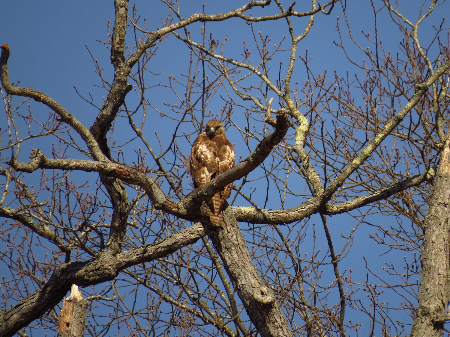
It is a quiet and pleasant paddle with little more to say or think about other than moving the canoe.  At the bottom of the Big Bends I spot a Red Shouldered Hawk.  I almost missed it as it was perched right on top of a break in a tree such that it looked like bare wood. It gave me some good aerial views so that I could see both it's bottom and top.  After that, I see a dozen or so Black Ducks in the Big Bends, but not much else.  With the lowering tide I will run out of water at the Gravel Flats, so I turn back when I get to the old saw mill dam.

Coming into the Big Bends I spot a couple Killdeer and a pair of smaller Plover.  Their markings are rather similar but the Killdeer has a second black band at the bottom of the throat.

The current from the dropping tide outperforms the headwind and the return is quite fast.