Thursday, April 14, 2022

Post-winter Survey

At this time of the year I head out to many of my favorite places to see the changes that occur over the winter.  I especially make an effort to visit prime bird nesting spots and beaver habitat.  

The day turned out fine with sun and a light wind out of the south with temperatures predicted to near 70F. I put in below Salmon Cove.  The water level was higher than I expected, but not out of the ordinary for April.  Right away, I made a short side trip into the cedar swamp that buffers the cove from the main river.  With the cattails and other swamp plants still dormant, the side channels are easy to spot and twice as wide as in summer.  

Continuing up the cove, I follow the edge of the cedar swamp.  I know of two beaver lodges, and know that there must be a few more in there.  The beaver have even built dams, which are unusual in that they don't hold a flowing current, but rather catch high water events on the Connecticut River.  At least for a few days, the dams make a difference.  The first lodge has doubled in height and tripled in volume during the winter.  I've seen this before and it has always been a sign that the mated pair are now breeding.  The second lodge has grown as well, doubling in size by the addition of an attached second lodge.  It kind of looks like a beaver condominium.  I am not sure if both modules are in use or if the second one is just a replacement.  In this same stretch there are two active Osprey nests and one that is not being used, except by a half dozen Cormorants perching there when I pass. Nests in this area were damaged and blown down a few years back by a strong wind storm.  The rebuilt nests - all in new locations, have fallen out of use.  These two current nests look like earnest nesting attempts.

I follow the shoreline up the cove, spotting an immature Bald Eagle at the point where the cove becomes the Salmon River.  From there, I continue up taking the back channels around islands. Just down from the fish hatchery, I watch an Osprey on the hunt, circling and hovering.  Finally, it signals prey sighted.  I probably had time to get my camera up, but it would've ruined the experience.  The Osprey dives deep into the river just 50 or 60 ft in front of me.  It's a miss and the Osprey flies off with a couple of quick shimmies to shake off some water.  

The Moodus blow-downs

I paddle up to the Leesville Dam via the culvert channel.  There is a full span of water coming over the dam, but even with the extra flow, the water has been quite clear - a good day to scan the bottom for stuff.  I play in the current for ten minutes before heading back out.

I take a second side trip back into Pine Brook.  The entrance is 200 ft wide and clear of marsh plants.  I'm more use to this being a narrow meander, but the marsh plant that creates the meanders is wild rice, which dies back completely during winter.  I find  and collect a large vertebrae from about 3 ft deep right near the turn back point.

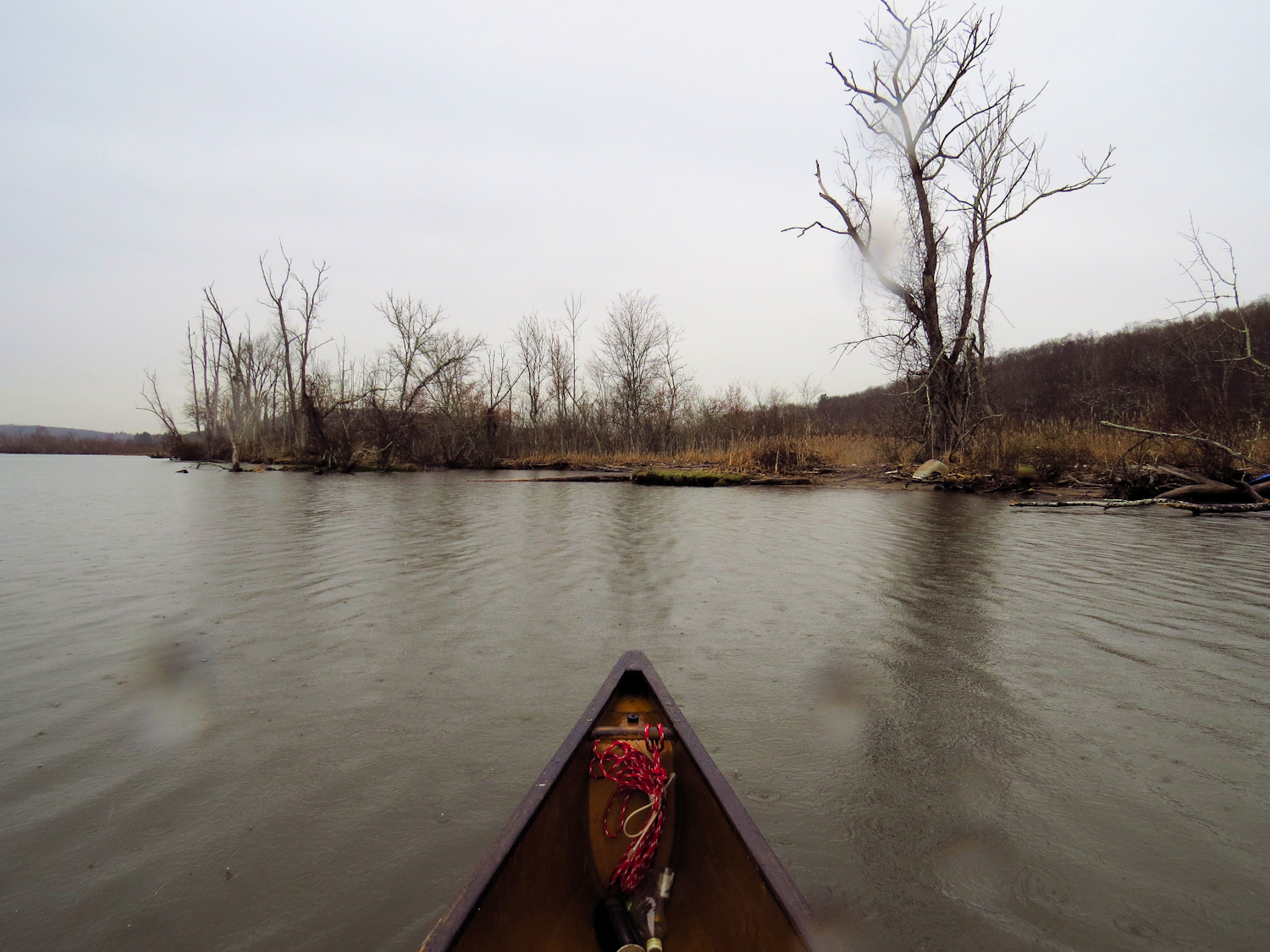
The third side trip is back into the Moodus River.  The blow downs that prevent access to the last 1/2 mile are almost passable and by next summer it might be possible to squeeze past without much effort.  There is a lot of beaver sign - trimmed plants, cut trees, one obvious lodge and a submerged dam.  As I head out I see a small beaver slip off the bank.  I stop and wait for it to come up, but instead, a fairly large beaver surfaces and begins to check me out.  Then, a muskrat comes speeding downriver and heads off into the bank.  The beaver eventually slips past me and I find it watching me from the other side.  Then we, more or less, agree to disappear from each other and I head out.

Tuesday, April 12, 2022

Rain Day, Selden

The forecast is for eventual clearing and a sunny warm day, but right now this looks like one of the thousands of rainy Pacific Northwest days that I've paddled and hiked through.  I put in at Ely's Ferry and follow the shore upriver.  It is raining steady and will do so for the next hour and a half.  The river is high and murky with runoff from recent rain and extra water coming down from up north, and the tide has just peaked, so the ebb current will gradually add to the mayhem.  There is a good downstream current, but it is tolerable by staying close to shore and ducking into the occasional eddy.

Red Throated Loon

If you're dressed for it, paddling in the rain has definite advantages.  For one, no one else is out. For two, rain muffles background noise - if there is any traffic or machinery in the area, the sound is often absorbed by the rainfall.

I spot a Kingfisher, a couple of Blue Jays, get overtaken by a Cormorant, and note a pair of Osprey setting up their nest on a navigation light.  The rain is keeping the activity to a minimum.  Just below the entrance to the Selden channel, I spot a Red Throated Loon.  There is also a new Osprey nest in a river-left snag near that spot.  

The channel has a 2:1 current running today.  This is unusually strong for this side channel and I figure it is due to the river level more than anything.  I spot a swimming beaver about a 1/4 mile in.  It does a nice tail slap and disappears.  I spot about ten Osprey before getting to the top of the channel.  There is a new nest about 3/4 of the way up, built in an old bare wood (no bark left) snag on river left.

The Elf Forest

I turn back at the cove and the current becomes a bit more obvious as I leisurely speed downstream. The sun comes out, the clouds moving off rather suddenly.  Before leaving the channel, I take a side trip back into the Elf Forest...  quite a few birds back in here.  I flush about thirty Black Ducks, a few Mallards, a pair of Mergansers, a pair of Canada Geese.  A movie Eagle (Hawk) screeches from the forest, but I never spot it.  As I spin to head back out, a Snipe darts up out of the grasses...and disappears just as fast.  Pass another (or maybe the same) Red Throated Loon just before leaving the channel.  

I follow the same shore back, noting some spiffy chop where the current is banging into submerged geography.

Friday, April 8, 2022

Big Runoff

It rained all last night, and that made it sound like the wind was stronger than it was, and the wind made it sound like it was raining harder than it was.  It must have kept the cats awake, as they were about an hour late in waking me so that I could feed them.

I put in at the launch about a mile up the main river from where I started my last trip.  It was mostly cloudy, but the clouds were cumulus, so the sun showed through more than I would have expected.  There was a moderate wind coming down the river and it was strong enough to peel off a third of my paddling speed.  The other shore was probably a bit more protected from the wind, but I didn't figure the crossing distance to be worth it.  As it was, the wind settled once I got up a mile where the river narrows and begins long meanders.  The steep forested hillsides provided an excellent buffer.

The river is cloudy, a faded khaki color due to a great amount of silt in the runoff from last night's rain.  I cannot see the tip of my paddle when it is in the water.  There is also a great amount of leaf litter.  They must have got some pretty heavy rain last night.  


On the drive up, I noticed that the lowest reservoir on the river, which lies between the 150 year old Shelton Dam and the Stevenson dam, was higher than I have ever seen it  This first reservoir is small and doesn't have extra capacity - it is five miles long, but fairly narrow.  So, when a lot of water is flowing in, a lot of water has to be released.  There can be a stiff current in there, which is difficult to judge because, unlike most rivers, the current has little to do with the height of the water.  The current is driven by the amount of water being run through the reservoir.  There is a rock shelf about a mile below the top that is always the issue.  If the current is running fast, I cannot bust it over that shelf.  Today, as I drive past, I note that there are 2 foot high standing waves about a 1/4 mile below the shelf... the current is going racehorse fast.  When I get to the dam (the road crosses on the dam) I see that the main spillways are open.  I've never seen that before.

Bach to my paddle - when I get to Poison Ivy Island, I note that there is a current, although not much, maybe a 1/2 mile/hour.  This is a big reservoir and I've never see any current.  This explains why the paddle up seemed to be a bit more of a crawl than usual.  There is a lot of water being flushed through the system today.  I turn back at Lover's Leap.  A pretty good current is running out of that narrow gap.

Lover's Leap

I've not seen to much in the way of wildlife.  Just some Wood Ducks, Canada Geese, and one female Merganser.  Just before turning into the final stretch, I spot a mature Bald Eagle come in to perch in the tops of a grove of pine trees.  It disappears pretty well in there.  Then, a second one comes in, and disappears as well.  I find a nest up in the trees.  It seems a little small for Eagles, but it could be new ( I never noticed it before).

Tuesday, April 5, 2022

Back in the Shephaug

It is a pleasant day, supposed to hit the upper 50's with some sun and only light winds.  I put in at the long cove, a former creek until the area was dammed.  Most of my route today will be over an old railroad bed, although I won't see any evidence until I am more than an hour out, where the rail bed finally meets the artificially raised level of the water.  In the meanwhile, I scan the forest hillsides for old stone walls.  With the leaves and brush down, and a bit of good sunlight, the walls are obvious.  Stone walls are the dominant man-made feature of New England, and most of these are near 200 years old.  When they were built, most of the forest had been leveled for pasture land - no farmer with half a brain built a stone wall if they had suitable wood nearby to build a rail fence, and wire fencing doesn't arrive until after the Civil War.  Then, as the pasture land was overgrazed, more rocks came to the surface and were added to existing walls or used for new walls.  A lot of this pasture land was for merino sheep, which had been smuggled from Portugal and Spain in the early 19th century, in case you were wondering.

Note the stone wall on the hillside.  It runs about a mile without break
I head down and round the point into the Shephaug arm flushing a few Common Mergansers along the way.  They are paired up now, and the groups are mostly two to four ducks. I follow the shore close enough that i can see well back into the trees.  No one else is out save a couple of fishing boats.  

I pause my paddling for a second and realize that the whole forest is singing.  It is a large flock of very small song birds and it takes me a few moments before I can locate one.  Unfortunately, I can't get a zoom on one with my camera, so I cannot identify them.  Their twittering chatter is also a language that I am unfamiliar with.  I paddle off and leave them behind, and the forest goes silent again.  Soon, I come across another flock.

Up at the last two bends before the cascades, I spot two pairs of Wood Ducks, a Kingfisher, and an Osprey.

I turn back at the cascades.  Above them is a deep gorge of rapids that even the whitewater paddlers don't go into, as there is no way to scout the rapids from shore and there is no way out of the gorge in the event of a swim.

I return following the same route.  I spot two Great Blue Herons, a Vulture and another Osprey.  I stop to write my notes under another flock of those songbirds.  Again, I cannot get a good photo of them.  While I write, the entire flock flies off and the forest goes silent.