Tuesday, October 31, 2023

The Shipwreck Reach of the Connecticut River

I reread my favorite books about nature, exploring and deep thoughts about about those two topics quite often. Those good reads are not much different than my frequent canoe trips; no matter how many times I've been there, I always find something different, it's always a new experience. I'm currently rereading, "Disappearance: A Map" by Sheila Nickerson. As a Juneau based State of Alaska employee, one of her colleagues disappeared during a private airplane trip between Yakatut and Anchorage. More than a few people have disappeared in that enormous area of glaciers, water and forests. The book is about more than that, but that is her leaping off point. 

My trip today has nothing to do with disappearing, at least in a physical sense. But Nickerson's book is some of the motivation. That's how things work.

I put in at the Rocky Hill Ferry. Last time I was here, the river was raging and I did not bother to unload the canoe. Today, the river is at a normal gauge level of 6 feet or so. It was 4 feet higher last week, and when you look at the photos, imagine what it looked like in July when it was 14 feet higher. I head upstream against a moderate 2:1 current and a light headwind. It is warming up to something around 50F, and it is more than sunny enough.


A text book beaver bank burrow
The low brush pile halfway between the canoe and the left edge of the photo at the top of the bank marks the burrow. The brush covers the air vent hole at the top of the burrow. The green willow branches in the water right of the canoe are the start of a winter food stash. A deep excavated channel under that brush leads to one of the burrow entrances.

Within a hundred yards, I enter a very large bend in the river. I follow the river-right bank, which is usually too weedy to mess with in warmer weather. I find a text book example of a beaver bank burrow about 5 minutes out. The bank burrow changes the chapter. From now on, I am in wild land, at least until something man-made drags me back. Not much farther on, I find a sailboat wreck, the hull filled with dirt and a variety of shrubs and saplings growing from it. Someone has been here, but they are gone.

I decide I should name this section of the river. It is personal geography - naming places with your own names. It make sense for when I want to refer to a specific place in the future. My personal geography names also are more descriptive. Should this section be the Shipwreck Reach, or should it be the One Hour Bends? While there aren't any actual shipwrecks, for some reason, this part of the river has more than a half dozen boat wrecks, with 3 or 4 downstream of my put-in and 3 upstream. This might be because there are only a handful of houses that can see this 5 or 6 miles of river. It is low flood plain and the only dry land is farm fields that flood at least once a year. So, no one is around to complain about the abandoned boats. It is the only place on the river where I have seen this phenomena. As to the One Hour Bends - there are 3 big bends above the put-in, and they are big. If it was foggy, say a 200 yard visibility, one would never know that they were paddling a big long curve. 

I paddle upstream for two hours. Like a clock, I complete two bends; one hour turning left, one hour turning right. I see a distant soaring Hawk, a partially submerged upside down motorboat, one Great Blue Heron, and a Duck that speeds away so fast that I cannot identify it. The second bend has a nice crop of willow saplings on the outside of the curve right at the water's edge for almost a third of a mile. Beaver have been feeding here, but not in any concentrated spot. The saplings are all just the right size so that they can be bit off and nibbled without effort. It's a bag of potato chips for beaver.

Willow saplings

At two hours, I cross the river and follow the river-left bank back, keeping my eyes peeled for more bank burrows - I did not see any burrows or lodges near the willows. This side of the river also has a lot of willows, but they are full grown trees. I find a third boat wreck - an inboard motorboat lodged well into the river bank trees. But, no bank burrows.

As I cross the river back to my start point, a mature Bald Eagle flies past.

I decide that I have paddled the One Hour Bends section of the Shipwreck Reach of the Connecticut River. It rolls off the tongue.

Friday, October 27, 2023

Foliage Attempt

With the turning of the leaves, the paddling has been quite the visual experience. The forecast for sun did not come through, unfortunately, but I got S out for a long overdue canoe trip anyway. We put in on the Menunkatusuck River. This river meanders through a wide salt marsh that is hemmed in by our eastern hardwood forest - mainly swamp maples, which turn to a vivid yellow gold before the leaves drop. It turned out that besides the overcast, the leaves weren't at peak, with a few days or maybe a week to go. 

The tide was very high with the cord grass on either side of the river well flooded. The wind was calm and the temperature rising toward 70F. We were able to cut across the meadows, at least on the way down river. 

We spotted several Kingfishers, some Yellow-Legs, a few Great Blue Herons and Mallards. At Opera Singer Point, an immature Bald Eagle was perched in the spindly top of an evergreen. The Eagle stayed put the entire time we were in the area.

It was a very easy and relaxing trip. Afterwards, we retreated to a fine old school breakfast diner in Clinton.

Wednesday, October 25, 2023

Wood Duck Day

I put in at Deep River and headed out past the top of Eustasia Island and across the river to Selden Island, the shore of which I follow downstream to the back channel.

It is sunny with temperatures rising into the 60's and a light south wind. The river is running high and the water is murky with suspended silt.

Making use of the high water, I head back into the Elf Forest. It is a dead end marsh about 200 yards wide and not quite a half mile long hemmed in by forested hills. After the first couple tight bends, I flush 40 Wood Ducks from an unseen spot to my left. Then, the channel sidles up against a mature forested hillside. Whenever I am in here, there is always a cool draft coming down out of the trees, and it carries a punky, almost smoky odor rotting leaves and wood. It reminds me of what the floor of the forest is made of - it is a comfort smell and one of the main reasons I come here. When the channel narrows enough so that it is "work," I turn and head back out with a total count of 60 Wood Ducks. Swamp Marigolds are still in bloom.

The Elf Forest is named for the small stunted and
gnarly trees growing there

With such good finds in the Elf Forest, I decide to not worry  bout getting anywhere and instead, check all of the several side channels. 

The Bandit Camp channel comes next. The name is due to a unofficial camp that someone once had. I spot 8 more Wood Ducks. The campsite looks somewhat restored, as if it hasn't been used for a few years. I do note that there is a submerged man-made rockery at the rough landing. The stones are sized like rectangular bowling balls. So, this landing has been in use for a long time, and I imagine that the stone work dates to when the island was used as a quarry and farm. The stones might even date to when the island wasn't an island (which might explain why the rocks are submerged). Selden Island was a peninsula until a massive 1855 flood blew through and changed Selden Creek into a back channel of the river.

I don't spot any birds in the next two channels. But, at the top of the channel across from an old dock, I spot a floating brush pile. It is mostly beaver cut branches and I am pretty sure there is a bank burrow entrance beneath the tangle.

Bank Burrow camouflage
The wind has come up. When I get out to the main river, I decide to cross directly guessing that the far shore will block the wind. It is a choppy crossing with no real wave pattern - a result of a strong current in opposition to the wind. I guessed right, and the far shore is a calm and easy paddle back down to the Deep River landing.

Tuesday, October 24, 2023

The Baldwin Site

 Last week, while browsing the natural history and science section of the town library, I found a simple yellow covered publication, "The Baldwin's Station Site and Its Environs." It turned out to be an archaeology monograph, which is a rare find in any public library, in part because people aren't interested, and in part because archaeologists like to protect sites from relic hunters. Anyway, these documents are heavy on data and light on story telling, but loaded with information if one likes that sort of thing.

I put in under the highway bridge on the lower Housatonic with the purpose of paddling to the Baldwin Site. I am quite familiar with the location having paddled by it a good many times, I just was unaware of its significance. I delayed my start an hour longer than I should have, for no reason other than to enjoy the morning. That put me behind the tide, which was whistling along beneath the bridges, enough that I hopped eddies from abutment to abutment to get upstream to where I cut to the far side. Then, I headed up between Carting and Peacock Islands, flushing a dozen Black Ducks and a pair of Wood Ducks. At the top of the islands, I spotted a mature Bald Eagle and somewhere in there flushed a couple Great Blue Herons. All in all, it is not a busy bird day.


The Baldwin Site is under the houses on the left. The ferry
dock would have been in the center of the photo

The Baldwin Site lies on the east side of the river, just upstream of the top of Fowler Flat (island). The "Baldwin" name goes back to before 1800, but I don't know anything other than that. At one time, it was commonly known as Baldwin's Crossing or Baldwin's Station, and this usage is Civil War era. There is a railroad a bit over 300 yards inland and in the mid 1800's this was Baldwin's Station. It was a flag stop where passengers would flag a coming locomotive and the engineer would stop to pick them up. Baldwin's Crossing was an associated ferry landing where train passengers could get a ride across the river to or from Stratford. The site is a gently sloping shelf of bottom land, about 20 to 40 feet above the river. During the 20th century, it has been a dairy farm and a tree farm, with some plowed fields. It became a housing development starting in 1999. A last note, "Baldwin's" appears on topographic maps as late as 1960 - a disembodied name without attachment to any map feature carried over from previous maps where it had meaning. It has been dropped from the most recent topographic series.


1960 USGS topographic map

The real meat of the Baldwin Site is that it had some artifacts that can be dated to more than 4000 years ago. There have been two archaeology surveys of the site, one in the 1950's and the other in the 1990's (from which the publication comes). The artifacts are include stone points, scrapers, awls, fishing net weights, pottery, adornment items. The 1950 excavation also located 49 hearths and a dog burial. 

Stone wall near the ferry landing

I hoped that I might find some remains of a ferry stop. I found an old stone wall in the right location, but as I continued, I found more of the wall - too much more of the wall. The wall is a river defense and probably dates to when there was a farm. 

A side effect of reading the report is that I now know of the Eagle Hill Ridge Site, which is located somewhere on the high ground near the Wheeler Marsh. It is no surprise that there was a village sized site in the area, but now I have a rough idea of the location. "Eagle Hill" does not appear on any maps that I have seen, so I have to go with the obvious lay of the land in that area.

Monday, October 23, 2023

The Mattabesset and Coginchaug

A busy week that ended with a few days of strong winds is behind. While it is still gusty near the sound, the inland areas are much more manageable. I head, once more, to the Mattabesset. 

My last trip here was on a windy day that kept me in the tree lined sections of the river. Where the Coginchaug River joins, there is a large marsh, perhaps a short mile by a half mile in area. Paddling through there is no fun in heavy winds. 

Today's plan is to make a full survey of the beaver lodges and see how they are doing. July's flood waters on the Connecticut River backed up the Mattabesset some 10 or 12 feet, which of course, completely submerged the lodges and forced the beaver to build new shelter. Then, when the flood receded after about 3 weeks, they had to find new shelter again, as the entrance tunnels of the flood shelters would be exposed.

I put in at my usual spot. The water is unusually high, which is a surprise as I had not checked the tides or river gauge. In fact, the forest floor is just barely awash, and the tide alone cannot account for that. So, some of our rainy days last week must have been very rainy farther upriver. (When I get home it I find the gauge showing 5 foot increase over the last 36 hours).

I pass two racing canoes about a mile down river, although I pass them going the opposite direction. It's the tandem couple and the solo outrigger guy. They train here and I see them often. Their doing something like 6 mph, I do a bit over 3 mph. But then, I look at a lot of stuff.

The trees have just started to pop. Some are still green, some are half green, but many have gone to brilliant gold and reds. Fortunately, the recent winds haven't blown the leaves off, it is a matter of a day or two of good timing. 

The Coginchaug

The new lodge at the point is looking okay, although I suspect that the water might be right at the level of the living space. I see no other new dwellings as far as the Cognichaug. A bit into that river, I make a good side trip into a backwater that I've never explored. Then I come out and head upriver. The Big Lodge looks like it might be in use, although it is hard for me to be sure. This was a very large lodge before the July flood. It is reduced in size, but there is wet mud mixed into the wood pile. I'm not sure about it because there is not any fresh cut wood added to it. There is another lodge upriver, but I cannot be sure about it either. There is just a general dishevelment about it. Winter will show whether or not these two lodges are in use as the beaver will fortify the exteriors if they are in use.

There is a good current running down the Coginchaug, which given the water levels is odd. I have no idea what might be draining upstream on this little river. I turn back when I get to a log that I would have to step over. It is an uneventful but beautiful paddle back out.

Sunday, October 15, 2023

Dodging the Wind

The rain let up during the night and while the day started cloudy, partial sun was the prediction. But, it is windy and I head up to the Mattabesset River, which lies low and well surrounded in most places with plenty of trees.

There is quite a bit of wind in the parking lot, but the 15 foot drop down to the river makes a huge difference. On the water it is near calm even as the tree tops sway. Every so often, a few acorns plop into the water from the overhanging oak trees.  I head upriver.


There were half a dozen "canoe cars" in the lot, but they seemed to have all gone down river. I have the upper section all to myself and I can't say more than it is, peaceful. There are newly fallen leaves on the surface of the river, leaves that would not yet have fallen except for the wind. Most of the trees are just barely starting to change. The bow of the canoe catches the floaters. The usual silent cutting of the bow is replaced with a noisy spatter. It is pointless to clear them as it would just happen again within 10 yards. 

A half hour out, I come to a bank to bank deadfall. It would not be hard to lift over, but I know what comes next - a couple sandbars that have to be waded, a short portage through an old trestle, and then a stretch of fast water that I cannot power through at this normal water level. I turn back.

I pass the put in and continue down river. The trees eventually fade away and it becomes open marsh. There is more wind, but it is not too bad. I find a new beaver lodge about a 1/4 mile upstream of the Tepee Lodge site. It is small and probably home to a nonbreeding pair. I don't spot any nearby feed sites or scent mounds, but some of the construction branches are fresh cut. It cannot be much older than two months anyway, based on the flood waters of July that flooded out all of the lodges.


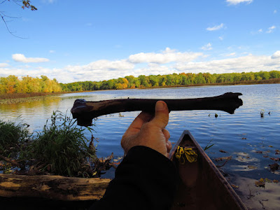
I stop and inspect what is left of the Tepee Lodges. I find a leg bone in the original. It's beyond my zoological knowledge, but it could be either a deer or goat - there is hobby farm with goats not too far upstream. The bone is dense and solid and probably was deposited when the beaver were building the lodge, and they might very well have put it there. I retrieve a lost Mallard decoy across the river. It is an odd folding design made of neoprene that I've never seen before. With that, I head back.


Saturday, October 14, 2023

Wool Pants Day

It is raining and 50F, but with little wind. Solitude comes easier on such day. The noise of town is hidden by the raindrops striking the surface. And the fun-boaters do something indoors. As I full well knew, it is me and a handful of fishermen well scattered up and down the big river. this morning, I dug out my Swedish army pants. They are thick, indestructible wool trousers that I've used for almost 15 years. They will get wet and yet far surpass any modern miracle fabric in comfort, and they have already outlived numerous Leak-Tex and other plastic marvels. I remember paying $4 for them. If I could find another pair, I would pay 10 times that without a thought.

I put in under the highway bridge and cut across through the old stone foundations of the railroad bridge, which leads me to the narrow back route behind Carting, Peacock, Long and Pope's Islands. It rains a rain that can continue for hours, not a downfall nor a sprinkle. The even and thick overcast reads as good as any official weather forecast - steady rain, no more, no less, all day.

The birds are hunkered down. I spot a pair of Mallards, a cormorant, 2 Great Egrets, 2 Red Wing Blackbirds, a Kingfisher and a Great Blue Heron.

At the upstream end of Great Flat, I cut across the river and follow the east edge of that island, then the east shore of the big river until I am back where I started.

Thursday, October 5, 2023

Basketball Jones

It is a great day with a light southeast wind and clear skies. I put in under the highway bridge. It is just after low tide and there is a down river current, which my very well be the natural river flow. It is not much of a current.

I pass a mix of Egrets as I get to the top of the marsh, and then I head through Nell's channel and out into the mouth of the river, deciding to paddle to the end of the breakwater. This will be enough time for the marsh to begin filling. Heading out, only the main channels of the marsh will have enough water to float a canoe, and except for Nell's channel, most of those will dead end. I retrieve two basketballs as I paddle out.

At Milford Point, there are twenty Swans. One pair has a cygnet. They are staying off to the edge of the flock. Swans with cygnets stay isolated until the young ones are about adult sized. It looks like this is time for the parental units to introduce their young to the flock. There is also a flock of Canada Geese - maybe thirty. They flush and head out to the breakwater. On the bar before the main breakwater, I spot eight Oyster Catchers, and a lot of Gulls.

Plovers
The breakwater smells like a dirty latrine. I'm trying to figure the reason for this, when a 75 strong flock of Cormorants take off from the breakwater.  Like, duh.  I spot five Plovers in a group on top of the breakwater.

Oyster Catcher

At the end of the breakwater, I find a half dozen fishing boats. I suppose they're going for striped bass, but I just turn and leave them to it. The tide is coming back in and a little current coasts me over a large bar coated with oysters. This river is the source for 40% of all oyster seed in Long Island Sound. I try to keep a foot or two of water under me when I'm out here - oysters beat the heck out of paddles and canoe bottoms.

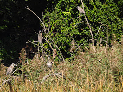
Back in the marsh, I have just enough water to take the main channels counter clockwise around the perimeter. I flush about two dozen Night Herons - almost all juveniles. They are well spaced out, still feeding from the silt as the tide comes in. I spot a Harrier working the area near the top of Nell's Island, and flush a Great Blue Heron. 

With that, I reenter the river and ride a mild upstream flood current back to my put-in.


Tuesday, October 3, 2023

Still with the Night Herons

S has not been in the canoe for a good long time. We set out from under the highway bridge on a rather perfect day, light winds out of the southwest and temperatures in the 70's. The tide is still rising, and I am a bit surprised at how high it is. This morning I glanced at the tide coefficient, which is the difference between high and low, and it was not too high, but I suppose that I missed that the low tide might not have been as low as normal.

We follow the east shore down to the marsh, passing a few Great Egrets and Night Herons in that small triangle of marsh that is attached to the mainland. Then, we head over and into the secret passage that leads up to the central phragmites patch. The patch meets expectations, again, as we flush more than two dozen Night Herons. It is a mix of Black Crowns, Yellow Crowns, and juveniles, which are hard to differentiate without a good close look. 

Then, we head over to check the trees on the east shore, which is a favorite perch for the local wading birds. We spot, maybe a dozen, a mix of Egrets and Night Herons. Most are below the refuge launch site.

With that, we head out across the marsh and diagonal in a generally upriver direction, a little misplaced for a few minutes, but finding a known channel soon enough. And back up the river we go.

Monday, October 2, 2023

Lover's Leap

It is another fine day, with temperatures in the 70's, light winds, and a mostly sunny sky. I put in on the Housatonic at Bridgewater, a mile upstream from Pond Cove.

I paddle upstream following the shoreline, staying in the shade under the overhanging forest. It is 6 miles up to Lover's Leap, a narrow gorge between cliffs that the river passes through. This is a paddling trip and while there is plenty to look at, most of it can be appreciated without setting the paddle down. 

Leaves are just starting to change, with a few trees that have completely gone technicolor standing out against a mostly green forest. I flush a Great Blue Heron not a quarter mile in. I'll see several more along the way. There are quite a few Ducks along the way, mostly Mallards, some Mergansers and one flock of 2 dozen Wood Ducks. 

I reach Lover's Leap in about 2 hours, turn and follow the west shore back.

Sunday, October 1, 2023

Birds - Menunkatusuck River

 I headed east, unsure of where I might put in. Curiosity took the lead, as it often does when I wander. I pull off the highway and stop at the Menunkatusuck put-in. No one else is here - always a good sign. The curiosity part of this stop is to check on the birds. I was here last on August 1 when there were a good many Glossy Ibises and Little Blue Herons in attendance.

After a few days of marginal to bad weather, today is a complete peach. It will top 70F with light north winds and all sun. The tide is very high - the Menunkatusuck is a salt marsh.

I follow the river channel down as far as Opera Point, spotting a few Great Egrets and thirty Mallards along the way. I have not been here at this tide level before, and it is clear that the river channel is just a suggestion today. This marsh is a high salt marsh - most of the ground is flooded only a couple of times each month. The vegetation is the short spartina patens (salt hay), a salt grass that is about 8 inches tall. Only on the sides of the channels does the taller spartina alternaflora (cord grass) grow. Cord grass is up to 3 ft tall. 

Little Blue Heron
I spot a dark wading bird and scope it with my camera. It is an adult Little Blue Heron, and two first-years are standing nearby. The first-years are white, similar to Snowy Egrets except for bill and feet colors. At this point I leave the river channel and my route aims towards any interesting birds. There is rarely less than 18 inches of water anywhere in the marsh.

From the west side of the marsh, I spot a dozen white birds perched near the Osprey platform, some 500 yards off. I head there, and get within about 60 yards without causing any concern on the bird's part. There are 2 Great Egrets, 8 Snowy Egrets, 5 first-year Little Blue Herons, 2 adult Little Blue Herons and a single Little Blue in the calico morph - a patchy blue/gray feathering of a second year bird.

Left to right - Snowy Egret, immature Little Blue Heron,
adult Little Blue Heron, Great Egret, immature Little Blue Heron

I head through the railroad bridge, where there is still a stiff flood current coming in. But the effort pays off - I get to watch a mature Bald Eagle hunting something in the water. 

Young Little Blue Heron morphing into an adult

I head back through the bridge and up into the eastern arm of the marsh. The channel here is positively intestinal, turning back tightly on itself at each bend. But, with the tide I just paddle straight up all the way into the very end of the arm, which I've never been to because of blocking deadfalls. 

I head back out, following the edge of the forest, then over to Opera Point, then across to the forest on the east side, and then back out. I head past the put-in up to the Chapman Pond Dam - just to extend the trip another half hour. 

As with my last trip, the high tide let me collect trash from places in the marsh that are normally out of reach. I finish with contractors bag equivalent.