Thursday, August 29, 2013

Visiting Town

I start out in the early afternoon not long after low tide under a sky of mostly dark clouds with little threat in them.  There is an east, or maybe northeast wind, an onshore wind, and it comes across 10 or 15 miles of open water.  The wind stagnates against the shoreline and it appears near calm to me, but the wind waves still exist.

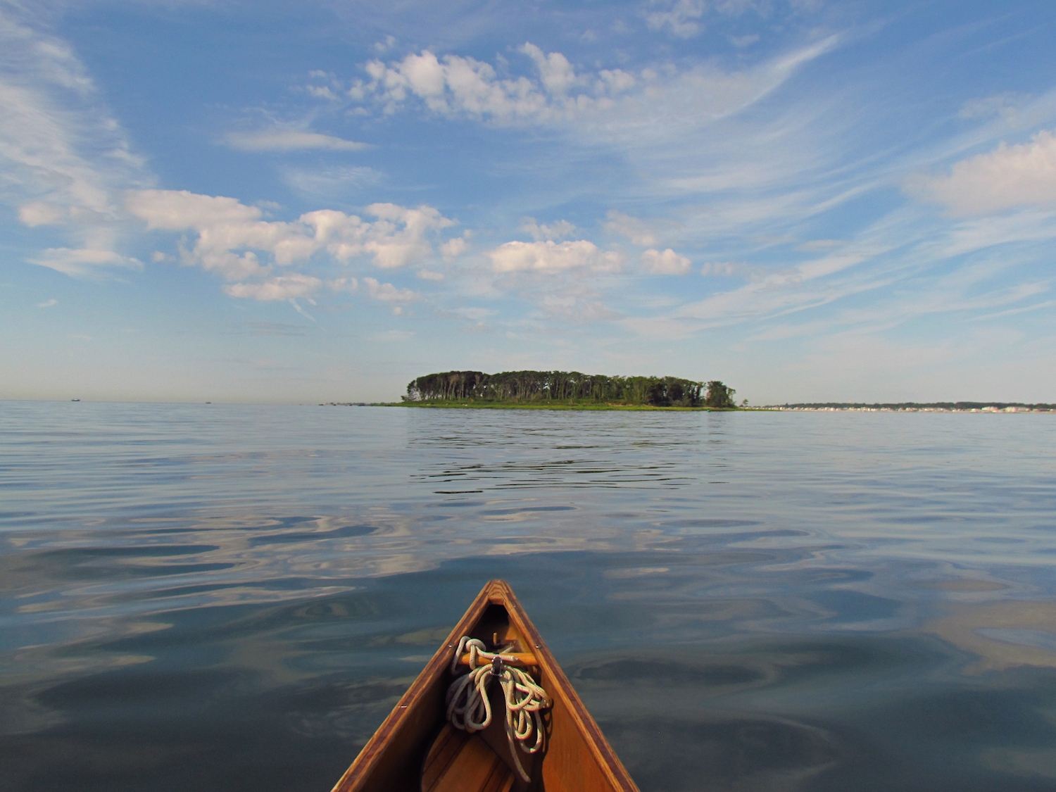
I roll my pants to my knees and wade out to keep the canoe off of the rocks while I load my gear.  I end up wading in thigh deep.  The rolled up pants are just futile extra credit.  With my pack clipped in (I lanyard my gear on flat water - in a capsize it will float free, but stay connected to the boat) I quickly take a kneeling position and paddle out into deeper water.

I ride and roll on aft quartering waves until I pass Pond Point.  There, the shallow bay calms some and I can take off my shoes and rinse them clean of the broken shells and gravel that make up what little beach there is where I put in.  The waves pick up as I reach the far end of the bay, Merwin Point, but after rounding it everything is rather calm.

Milford Harbor

I take a turn up and back in Milford Harbor if only because I haven't been there since spring.  It is, once again, filled with sailboats and cruisers.  Tomorrow it will be a busy port, but today it is somewhat sleepy with a few oystermen tending to their boats and some pleasure boaters prepping for Labor Day weekend mayhem.  The highlights are three osprey turning lazy circles above and a black crowned night heron perched ten feet up in a tree on the shore of Webster's Forest.

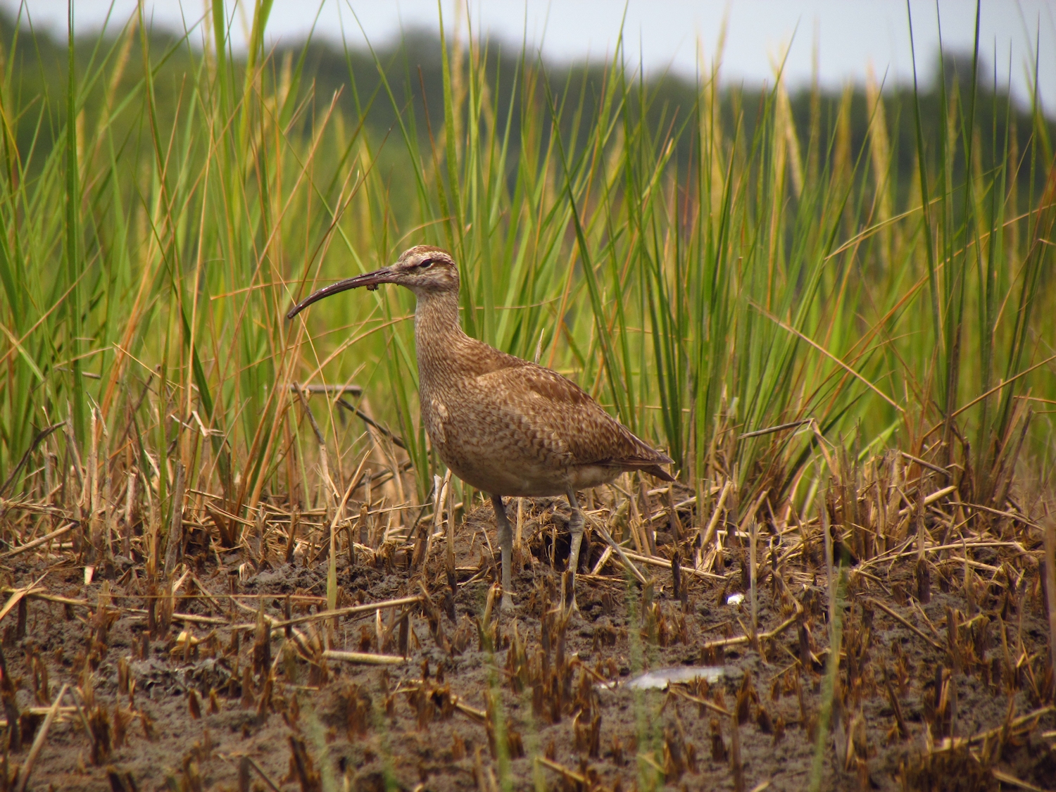
Black crowned night heron


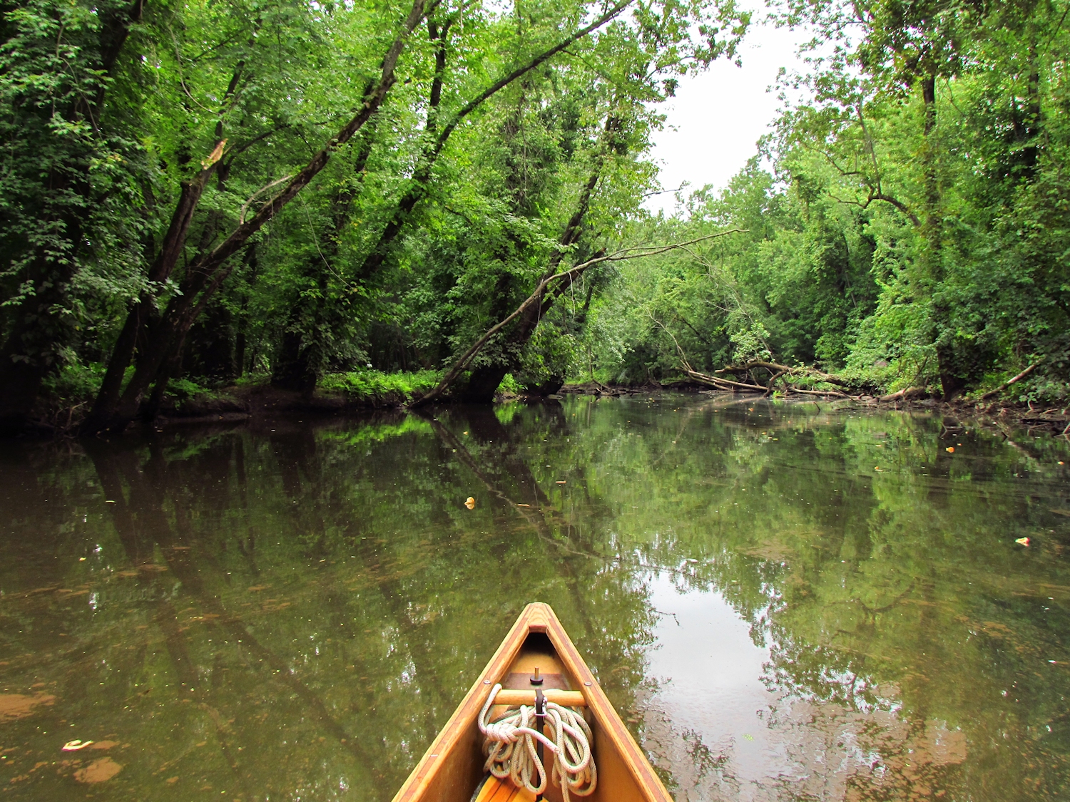
That chore finished, I turn up Gulf Pond.  The pond and the harbor share the same entrance to the sea.  There are still some egrets and herons at the edge of the grasses, the tide not yet submerging all of the mud flat.  At the top end, I ride the flood into the Indian River, although I don't feel like going up it too far.  I sit and watch, for anything.


I challenge the flood current to get back into the pond and lose.  It takes wading and stumbling and swearing and lining the canoe for about 15 feet to get past the fast water and back into the pond, where I take out and portage the mile and a half home...just because I feel like walking.

Tuesday, August 27, 2013

Where the River Necks Down

It rained most of the night, straight down without much wind, so the windows stayed open and the sound of moving water - the origins of rivers - filled my sleep.

I haven't been in this section of the big river since spring - it might've been April or May, and it was only on the last trip that I paddled upstream from the Eagle Scout put-in to near the dam.

The first mile, where the banks are populated with houses and cabins, and cabins that have become houses - a mixture of temporary, derelict and new construction, now sports docks that weren't there for the winter season, and most of the docks now have motorboats, jetskis or cheap plastic canoes and kayaks.  It looks like an unkempt toyshop and is true to the nature of people that seek out water but don't have any interest in exploring the depths that it holds.  Many of the boats are left neglected, beached but not tied or tossed on the ground waiting for a strong wind to blow them into the water...boat abuse.  Fortunately, it is a Tuesday and all of those boats are silenced.


Where the river necks down is where the river becomes worth the effort.  On that last trip, I fought the current with all my strength for ten full minutes to get past the cobbled point.  I finally pulled into shore and waded with the canoe into the pool above.  Today, the current is casual and I move past easily with no issues other than minding the six inch depth, which causes me to bring out and use my "rock" paddle.


The current stays mild when I get to my last trips high point, a big round bend where I had to pull ashore and continue by foot, as there was nothing but fast water from bank to bank.  This time, I paddle in mid-stream with the massive concrete dam appearing through the trees.  In the spring, there was a 400 yard long rolling class II rapids here with 2+ foot standing waves.  Today, it is a sparse rock garden with a current that can be paddled against.  I move eddy to eddy admiring the swirls and peering at the rocks that create them until I get to the top of it.  I sit there for awhile before turning back.


Sunday, August 25, 2013

Pursuing the Loon

I set out early after waking S. to let her know that I am going.  She asks where I am going and I tell her, "just up the shoreline, the tide is out and I can't go anywhere interesting". 

It's calm and sunny and I am outnumbered by fishermen hunting pogies by 20 to 1.  The sun reflects off of an undulating surface in a pattern that suggests code, or sinister mind control....the blinking that should have a warning label about seizures.


I head north and pass the flag rocks, and I pass the Oyster River, its mouth far too shallow at this tide level to even get near to, and I stop and turn at the next point, for which I have no name.  I haven't found any distinctive features to name it with other than the nasty chop that forms here on a south wind.  A black bird surfaces, its head held at the wrong angle for a cormorant.  Cormorants hold their heads chin high.  This bird looks loon.  It dives and I watch for about a minute before it comes up for air, a hundred yards south of where it went down.  This also looks loon.  Then, as I sit, I hear three individual "oooop"s...not the familiar loon call, but entirely in the distant swallowed echo voice of a loon.  I follow, aiming each time it dives, for the point where it disappears and scanning the surface for its next appearance - a minute five, a minute ten, seventy five yards, a hundred yards between breaths.  Whether by intention or not, it doesn't let me closer than two hundred yards.  I pass it near the flag rocks while it is busy preening two hundred yards seaward of me.


It is the first loon since they left in the spring.

Wednesday, August 21, 2013

Daydream River

I drop S at the airport, volunteering for the job even though her company will pay for it because I can spend that time with S, but also, as any of my friends can confirm, I have a hard time letting a chance to kill two birds with one stone pass, even though I don't kill birds.

I put my canoe into the water just a few miles from the airport in a town called Tariffville.  It is smooth flowing water here, a new stretch of the Farmington River for me.  It runs clean with a brown tint of tannin that lets me see a sand bottom flecked with bits of mica some six or eight feet below although the river is seldom that deep and the banks are lined everywhere with leafed out hardwood trees.


Fortunately, with the current not too strong and the river deep enough in most of its eight canoe length width, I can paddle the shade instead of paddling the slow water as I make my way upstream watching the frequent snags and downed trees from the cut banks for birds and animals.  A cedar waxwing sits on one up ahead, but as I near, it transforms into a stub of a branch that has recently been cut by beaver.  It is a good sign.


There are few birds.  I see three young mergansers, a cormorant, a great blue heron, and a hawk that sped across the river at some distance. I see a good sized trout, quite a few fingerlings, and a sparse fleet of water bugs that keep the surface looking as if a light rain is falling. There is little to keep my eyes occupied other than watching the ripples of sand and blackened waterlogged remains of trees on the bottom of the river.

It is a daydream river.


Tuesday, August 20, 2013

Lunch Hour

One of S's co-workers has been itching to go canoeing with me.  I pick C up when her lunch break begins and drive the five plus minutes to the Wheeler Marsh.  We could put in closer to her work, but we would spend 5 minutes crossing the river to the good stuff.  This way, we start right in it.

High tide has passed, but only by a half foot, if that.  A small breeze blows out of the southwest with the sky sunny.  C points out a snowy egret some 300 yards distant, and I point out a young night heron perching 50 yards away in a tree near the launch.  The night heron has better camouflage. 

We follow the main channel along the shore and out along the spit of sand that makes up Milford Point.  Bird watching is better near low tide when more food sources are accessible to more types of birds, but as we near the tip of the sand point we spot a flock of 14 mute swans.  Then as we near, we spot three oyster catchers on the backside of the spit, and a sandpiper or plover that I can't ID. 

Then we try to work our way back towards the put-in.  The marsh is a fairly round area about a mile across.  Inundated twice a day by the tides, the tall spartina grass grows here, and it is tall enough to block sight lines except at high tide.  High tide creates lots of channels and open areas that go to mud when the tide falls - it becomes a maze.  Some of the channels connect with other channels, some of them dead end, and some of them dead end tantalizingly close to the channel that you want to get to.  If you are really clueless and linger too long, you can find yourself sitting in a mud flat waiting for the tide to come back in.

We try one of the good channels, it looks familiar and probably for a good reason.  It dead ends after a couple hundred yards, and now, I imagine, I have paddled its length four or six times.  We try a larger and more likely route.  It takes us out into a patch of open water surrounded by spartina...leaves you wondering which of the two dozen doors to take to get out.  But, I've been here before and none of them actually exit although I know that the main channel is just yards away.

Lunch hour is gone by now (I warned S that besides canoe-time being unrelated to anything other than tides, sunsets and sunrises, getting misplaced was always possible) and we backtrack almost to the correct channel.  But, the one we end up in, just as it seems to be petering out, has a sneaker passage that gets us back into the main channel.

Sunday, August 18, 2013

Oyster River

There is a light wind coming down the coast when I set out.  It is one and a half hours to high tide, which gives me plenty of time to reach and enter the Oyster River, which is where I first stop to write.

An overcast sky above the sea with the sun filtering through somewhere off to the east creates the special atmospherics that big water and big deserts bring.  Objects on the horizon float above that line, although whether they are there or beyond the horizon or much closer is unknown.  It is distinctly indistinct.

In the Oyster River

(My pencil slips from my mouth as i try to take a photo of a bird and the pencil bounces twice on the gunwale and then does a quick spiral to the bottom of the river.  Fortunately, it is knee deep and with the flooding tide the water is clear.  I get my pencil back.)

Immature yellow crowned (or black crowned) night heron


Watching the great egret standing on the edge of the old stone bridge foundation I fail to notice the green heron that is just below it watching me until I am not much more than ten feet away.  It flies off behind me and then clucks its disapproval.  And while I write that, there is noise in the tree above and an osprey takes wing.


After the fourth bend there is a large tree that came down over the river.  Ten egrets - 4 snowys and 6 greats - perch there along with two cormorants.  As much as possible, I set the paddle down and drift in on them, and they stay put much more than I would expect.  The last two great egrets don't leave until I am a canoe length away, where I needed to take up my paddle to steer my way through the branches.  The cormorants, unlike cormorants, stay put and let me pass with no concern except that one of them throws up three small fish, which does seem somewhat cormorant-like at that.

Great egret


I continue and once I get passed the distractions that nature has thrown at me...egrets as sleight of hand, I realize that there might be two dozen egrets and maybe six or eight black crowned and yellow crowned night herons perched in the fully leafed trees on the south side of the river.  I pass a kingfisher, a flock of small sandpipers, two lesser yellow legs, some mallards, two molting Canada geese, and a red-tailed hawk.  I notice that invasive phragmites reeds are only in the very top of the marsh (probably due to the salinity being low enough for them to survive) and the dominant plants are the short and long spartina grasses that should be here - and this is all connected to the quantity and diversity of the birds that I am seeing.  It is good.

Yellow crowned night heron


Friday, August 16, 2013

Stupid People take me off my game

I set out from home in sunny and almost calm weather.  The tide is dropping, the high tide being a bit before I like to wake up.  This limits my options since many of the rivers go shallow or have unbeatable currents when they go to low tide.


I head south along the shore and when I get to Merwin Point, I bear out towards Charles Island.
 
The weekend approaches.  The amateur hour is nigh.  Fortunately, in the calm, the sound of boat motors carries far.


Charles Island.  A bird sanctuary closed to the public during the summer, except for the stupid people who assured me that they could walk around the edge of it.  They even take time to read the well-placed sign, and ignore it.  In all the time and chance meetings that I have had in my canoe, I have never once convinced anyone to stop doing something foolish, dangerous or downright stupid, and it is always someone with marginal skills in rental boat.  But, that is summer in a town where people come for vacations.  That is why someone drowns near Charles Island every year.  That is why I don't come this direction on summer weekends.
An immature bald eagle came in and perched in a tree on the seaward side of the island as I paddled by.  It should be hunting, but the stupid people will scare it off.  I hope it craps on them.

After rounding the island, I continued into Gulf Pond, continued out of Gulf Pond, and returned home in a mild chop with a light steady wind out of the south.


Tuesday, August 13, 2013

Game Change

Rain is the game changer. 

I put in near the mouth of the East River, but I time my start better so that I can paddle farther upstream.  Low tide has already passed by an hour and a half, so I will have the current with me.  It is calm and raining steady, but it is also warm.  The rain filters out many of the distractions of modernity.  The sound of the highway disappears and along with it the leaf blowers and lawn mowers, when one is close enough to houses to hear them.  But, perhaps more importantly, it filters out people.  The bird counters and turtle taggers aren't here today and neither are the nice couple in their sea kayaks.  I have the river to myself.  It becomes a wilder place.  Everyone responds in kind.

Egrets - great, snowy, snowy, great, great, great, great


Before I have gone a half mile, I spot thirteen egrets - a mix of snowys and greats, eight of them standing together on the edge of the river.  No one else has been this way this morning.  The osprey are out, but the willets seem to be lying low.  I find an immature black crowned night heron at the bend before the rockpile and I start spotting the occasional great blue heron. After the stone bridge, where the tall thin cattails start to grow along the banks, I spot the first of the green-backed herons. 


I get to my previous high point with plenty of water to move in.  Not much farther, the river necks down and becomes closely tree lined.  The course becomes shallow in places and is strewn with sizable boulders that must be maneuvered around.  Then, I catch up with the tide.  The current, which had gone slack now is opposing my journey.  Catching the front of the tide also means the water goes shallow.  I beach the canoe on a gravel bar and wade ahead on foot enough to see what may come on a later trip.  Further progress on the East River will require timing.  The high water tide marks show that the water was two feet higher at the last high tide.  Like my trips near home into the Indian River, exploring upriver from here will mean arriving here a bit before high tide, and leaving a bit after.

Coming out of the forest


Before I get back to the forested rock that is Cedar Island, I hear a high flying willet piping a steady warning.  A hawk is out overflying the broad plain of marsh grass, but there are few that would not know this.  For several minutes this one single willet flies circles along with the hawk, occasionally flying close, but not too close, and at a rate of several times a second, it pipes its warning without pause, until the hawk decides to hunt elsewhere, as do I.

Monday, August 12, 2013

Early Morning Marsh


I start early with a falling tide - an already low tide and I paddle upriver next to an exposed mud bank, the open vistas of the salt marsh well above my head.  The willets are active, but preening more than hunting for food at this hour.  The birds seem to be waking up.  The overcast keeps it dark enough that I can't take all of the photographs that I want, but the light cooperates on at least a few.


Cedar Island

When the sun breaks through, the glint of last night's rain, and last night's dew, and the last high tide sparkles on the spartina grass spears that line the river, and it comes together with a spiced aroma of salt mixed with mud and decay and the exhalations of the marsh plants.


Whimbrel

I come across the remains of a wooden boat just short of the railroad bridge.  It once had an engine of some sort - the pipes and metal fittings lie mixed with the wood planks and ribs.  It was hidden below the tide on previous trips.  It is not the only change that low tide brings.  Already, I am noticing a greater diversity of birds than I have before.

Willet


I get, perhaps, a half mile past my previous high point on the East River before I run out of water.  But, running out of water coincides with running into birds.  I turn back short of my geographical goal with two green backed herons, a great egret, a snowy egret, a great blue heron, a pair of lesser yellow legs, some sandpipers and an osprey all in sight.  I could stay, but the tide is not quite full out and to stay here some 3 or 4 miles upstream from the sea means staying for 3 or 4 hours, until the lag in the tide makes it back up here.

Little Blue Heron


With unexpected time and energy, just short of the put in, I turn up the Neck River, new water to me.  It runs closer to houses, but it is narrow and meanders always staying in the salt marsh.  The bird life is quite plentiful as well, with numerous osprey along with the variety of wading birds.

pair of young osprey


It has been a great day for bird sightings.

Mouth of the Neck River


For Zebulon Pike - I traveled 13-1/2 miles during 5 hours, shot 105 photographs but no deer.
Birds - whimbrel, black headed gull, osprey, willet, kingfisher, green backed heron, great blue heron, snowy egret, great egret, semi-palmated plover, lesser yellow legs, Canada geese, mallard, short-billed dowitcher


Thursday, August 8, 2013

Side Trip

My choices for wood for carving canoe paddles is limited in the turbo-Mayberry town that is my new home.  I've soured some on the easily gotten poplar, which carves easily as well.  It lacks some in the durability department.  So, a trip to a wood supplier up north is the order.  But, there is good water between here and there and it seems a shame not to take time to dip a paddle.

I set out from the town of Middleton on the west side of the Connecticut River.  It is a cloudy, warm and humid day, but a steady breeze is sweeping through the trees and myself, carrying away the stagnation and demons that hide in the dark.  It threatens to rain, but musters no more than a sprinkle.  I cross the river for the heck of it and swing back across when I get up to the old railroad swing bridge.  Then I beeline for the bottom of the forested island...because I have to pee.  There are fresh deer tracks in the sand and I also find a 1 inch diameter by 4inch cement core, something that might have been drilled as a test sample from the bridge that is right overhead.  I collect it.


It's not more than a couple hundred yards until I turn into the Mattebesset River.  It is nearing high tide, and while I am far enough from the ocean that this is all fresh water, the current still reverses with the tides.  I like this type of river/creek/swamp...too big for a creek, too small for a river, with the extra life that swamps hold.  Each deadfall that must be maneuvered around threatens to hold something of fascination.  A stone plops into the water and I quickly scan the bank for the boy that threw it.  But instead, a kingfisher climbs up out of that water after making an unusually deep dive.  Two great blue herons leave through the trees and a cormorant surfaces just ten feet from the boat, startling me and scaring the bejeezus out itself.

After a few bends, I veer right and into the Coginchaug River.  It is smaller than the Mattebesset and heads back into the forest leaving the big sky swamp of that other river behind.  The first bend of the river looks like a picket fence.  It is about as dense a concentration of beaver stumps as I've seen and it runs about 75 yards like that.  At the next bend I find the beaver colony's bank burrow. 


A bank burrow is not nearly as neat and deliberate as the more familiar conical lodge, and it is probably overlooked by many people because of that.  Here, the beaver have tunneled into the bank.  The pile of branches cover and protect a vent hole in the top of the lodge and also keep heavy animals from plunging through the roof.   Sometimes these burrows develop into free-standing lodges if the beaver excavate enough dirt from around the lodge through their dragging of branches.  This one looks like it will stay high and dry as is.  And, the next bend is another picket fence.

Another turn brings me to a homeless camp.  It is not a clean camp, with discarded stuff scattered about, but a second look shows that no all of that came from the camp.  Heavy debris such as a car axle and large pieces of cement tip me off that not only is this camp on the edge of the river, but it is also on the edge of a town dump...it's a well known and repeating story of dumping trash into someone else's drinking water, and dumping people out of sight, out of mind.


Monday, August 5, 2013

For Zebulon Pike

Passing Two Mile Island, which is no longer an island, poses a problem.  I have a map of this section of the river painted on the blade of my paddle, but since I like to study how land changes with time, it is a 90 year old map, a map from when the island was an island.  I round it to the east after finding that the west channel is the one that has had a causeway built across it and it all comes out better than expected as I find the teeth marks of castor canadensis on freshly trimmed tree branches at the water's edge.  This is the first sign of beaver that I have seen on this part of the river.  The reaches below are too near the ocean and while this area is tidal, at least the water is fresh.  They are most likely bank beaver - beaver that live in bank burrows rather than the more familiar conical lodges.  It is good that they are here.

I am here...near Wooster Island.


I put in at the feral cat park, which I haven't been to in several months.  There is a stiff wind out of the north and west, but I have the flood tide coming in underneath me and so I have the current to help me in my upstream journey.  At Fowler's Flat, the first low island upstream of the cat park, I cut across to the west side of the river hoping for and finding some protection from the wind.

A great many thoughts come and go as I work my way up the shoreline into the wind.  They seem too lengthy and involved to write down, especially for others to read, so I let them come and go as they want.  Somewhere in there, I compare river journals of myself and other travelers...from the horribly crap-written and boring journals of Zebulon Pike (clearly a man chosen to exert military presence rather than to retrieve scientific data), Life on the Mississippi by Mark Twain, the excellent journals of the Canadians - MacKenzie, and Thompson, and the gold standard journals of Lewis and Clark.  And I think about a dream I had last night, about me and a climbing partner, a partner that I have not roped up with in over 30 years.  I lead to the base of the last 10 feet of overhanging and icy rock on some unrecognizable alpine peak and stop to let my partner go first.  Next to us is a welded steel stairway leading to the top, which we ignore.  I've had this dream in different cladding before, but I always interpret it as being about the overarching importance of the journey.... and the tertiary value of the goal.  As I said one day, in complete unawareness, when someone asked me about my becoming an artists, "I just go where I end up."

An osprey shared this perch with the heron until I got too near


Today, I do have a goal of getting to O'Sullivan's Island, which lies at the confluence of the Naugutuck and Housatonic Rivers.  But, even that goal is not the goal, for the real reason to get to O'Sullivan's is to paddle a section of the river I have not seen.  Even here, it is the journey.  The new section of the river turns out to be the most pleasant stretch of this lower reach, all wooded hillsides with no buildings or houses in sight.

O'Sullivan's Island - nothing special to write home about

I have dozens of osprey sightings, including a few young ones.  A few great blue herons, lots of sanderlings, a couple of spotted sandpipers, a flock of ring-billed gulls and a few cormorants. 
For Zebulon Pike - I traveled 15 and 1/2 miles and shot no deer.