Friday, June 29, 2018

Art Party

I pick my friend JR up at the train station and we head directly out to the East River. 

The tide is high when we get there.  J, a professional fishing guide that I frequently furn into at the launch is there practicing his casting.  As JR and I paddle off up the Neck River I tell her that it's weird that J doesn't know much about birds, but then again, I don't know anything about fish.


JR keeps leaves her camera in my waterproof pack...thinking that she would prefer to soak it all in rather than interrupt the experience with the camera.  We talk about this for a few minutes as I often skip over good photo opportunities because the moment is just too rich to gum up.

As we paddle I teach Salt Marsh 101, with brief lessons about Willets and Ospreys.  Osprey young are showing themselves in the nests.  Their not big or bold enough to be up standing on the edges of the nests, but they are putting their fuzzy heads up high enough to look around.  The Willets are doing their usual thing, warning others as we near and scolding us.  They should have young in their invisible nests.
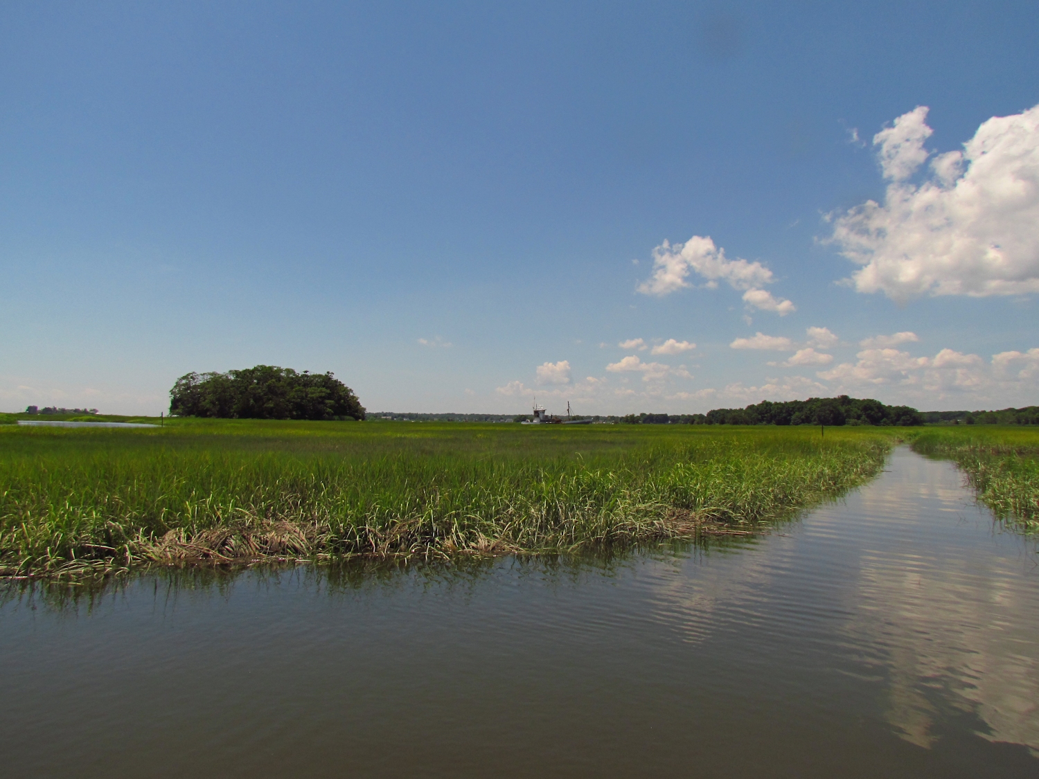
Oyster boat working the East River
We head up through the Sneak and back into the East River and just keep going passing out of the salt marsh and into the cattails and then into the forest.  We go a bend past Foote Bridge before turning back. 
Old Dams 101, and Introductory Course

I take JR on one short side trip up to the old sawmill dam.  I teach Old Dams 101...Connecticut is good for a full degree in Old Dams, but this one is a good introduction, built in the 1850's, a low efficiency undershot design that could only function seasonally as its water supply is a trickle of a stream that can be easily stepped over without getting ones feet wet.

And we paddle on, talking about art, art projects, and art problems, and catching up on a year that has passed since last seeing each other. It is something that the canoe does exceptionally well.


Wednesday, June 27, 2018

Three Rivers

I put in at the top of the big river, another comes in from the west, and another comes in from the east.  To me it geographically makes no sense...two rivers meet and they both end while a third begins.  It's the meaninglessness of naming natural features.  It's as if people were giving names to rivers before knowing where they went and what they connected to.
Yantic River
I head east up the smaller river.  It is a short trip, less than a half hour, until I reach the falls, a cascade through a narrow rock cleft about 35 or 40 feet high.  Ten feet of old stone diversion dam at the top of the cascade converts it to 45 or 50 feet.  The diversion dam channeled water into an old brick mill on the north bank, which itself has been converted into apartments.  It seems a nice place to live, on the banks of a heavily forested river at the base of a cascade.

I return and pass my put in heading up the other river.  It leaves the town behind soon enough and becomes a fairly broad and calm river cutting through the eastern hardwood forest.  This river is more industrial, or I should say, was more industrial.  Arched brick and stone outflow channels show where water was returned to the river after turning the machinery of silenced mills.  Sometimes, all that remains is the outflow tunnels, the mill buildings gone from the landscape. 

Sparse but large boulders in midstream herald the coming of a shallow and swift rock garden, which is passable by watching and carefully keeping to water that is deep enough for a full paddle stroke.

A very large mill appears...looms...on the left bank.  Four or five stories tall and a couple hundred feet long it is roofless and abandoned.  The wall facing the river has tall glass block windows...more than half the wall is glass block windows.  At the base are six outflow tunnels.  I pass by and continue on up to within a couple hundred yards of the Greenville dam.  It is typical of big river dams in Connecticut.  The state still has over 4000 dams. 
Most are small containment structures or seasonal diversion dams to power some mill that operated only when there was enough water.  Of those 4000 dams, only 4 were designed for hydroelectric power.  The Greenville dam runs a small "modern" generator, but it originally diverted water into a side canal that fed mills along the river...turning their machinery by turning water wheels.  That big glass block walled mill had several water wheels inside running its machines. 

The Greenville Dam
Spanning the river, the Greenville dam looks to be no more than 20 ft. high.  The trade off for electricity versus the ecological impact of stopping fish passage is not there. 

On my way out I stop to explore the bank near the mill.  I collect a check writing machine that fell not to far from where it was used. 
I manage to get about 75 feet up into one of outflow tunnels. 
I could poke around in this area some more....must return.


Friday, June 22, 2018

A Twofer

I start out on a section of the river that I've only barely paddled.  It's at the top of the reservoir and from here it is about seven miles up to the section that I am familiar with.  My last trip here, the reservoir level was down and so there was a strong current at a spot 10 minutes up, where I turned back.  Today there is almost no current and to start with the river is wide and calm.
Typical of the lower section
It seems that few people come through this stretch.  And, as I get farther in that becomes more apparent.  There are some downed trees, most of which I can maneuver around or under, a few that I have to step and drag to cross, but I only find one snag that has been sawn.  The section is all forest with a wide buffer of bottom land shielding the river from development.  I spot a few large Great Blue Herons, which always look record size when they are flying among trees. I turn back after 45 minutes (maybe 2-1/2 miles).   The river is beginning to be more choked with deadfall and I left my saw at the car.  As I paddle out I surprise the roundest fattest beaver that I've ever seen.

I move up to the top of the Great Swamp and put in again.  I've been here many times and the water is well down, the river narrowed to a boat length or less in most places.  But, the going is easy with only a single deadfall to step and drag over. 

Not far into this trip I spot a mother mink and two kits on a log in the river.  Usually, a mink will dart off and then return out of curiosity to observe me.  Not this time.  She grabs one kit by the scruff of the neck and drags it at a run off of the log and into the brush.  The other follows closely.  I did not see them again.

I turn back from a beaver dam that is near the halfway point.  It is a 18 inch drop today.  The water on my last trip in here was high enough that I just coasted over the top of it without touching.


Tree Swallows


Monday, June 18, 2018

Data Collection Day 2

I put in near the sea and head up the Neck River to record man made features.  The Neck and Bailey Creek have corduroy road sticking out of the bank in several places and as it is one to two feet below the spartina surface, it has to be fairly old.  My uneducated guess is in excess of 100 years before present.

Waypoints
 7   Corduroy Road - eroding from bank with some having slumped into the water
waypoint 7
 8   Nine wood posts made of limbs - 3 to 4 inch in diameter
 9   Corduroy Road and 1 square 3x3 inch post.  Section of road is 15 ft long and made of 3" limbs
10  Piling Structure. rotting but large.  This is on river left.  Built of posts and sawn 3x8's
waypoint 10, 8x15x20 ft, about 8 ft tall.

11  Corduroy Road - 4 ft section.  Made of 8 inch wide sawn side slabs (sawmill leftovers) with
      curved side up.
12  Five posts in a drainage cut.  Starting about 20 ft from water and running to water's edge
13  Corduroy Road - 6 ft section made of saplings under 2 inches in diameter
14  Four posts - two are 5 inch dia limbs, two are 2x4 sawn.  This is on river left.
15  Corduroy Road - 2-3 inch limbs
16  Corduroy Road  30 ft section  4 inch diameter or less.  at the Bailey/Neck confluence
waypoint 18

17  More of #16 exposed in cut drainage ditch.  16 to 17 is 3 canoe lengths (45 ft)
18  Sapling corduroy road exposed in cut drainage ditch
19  Upper end of 18
20  Two short posts
21  Corduroy Road  - this extends upriver to the dike/bridge
waypoint 22 - dike/bridge (upriver is to right)

22  Dike/bridge - stone and wood remnants of bridge and or dike that crossed over creek to
      Ox Meadow.  From this point on upriver there are no more man made features.  It is possible
      that this structure prevented fish passage.  Some of the posts found along the river in this area
      show rope or line cuts that suggest that they were used for anchoring nets.  It is interesting that
      there are no "net posts" above the bridge remains.
2 Osprey chicks


Friday, June 15, 2018

Data Collection

I put in at the Foote Bridge with a north wind that will blow me down river against the rising high tide current.  I'm starting a project, collecting data for a map of the river.  With the tide coming up I will be able to get a few points, mostly stone works that don't show on historic maps.  Most of the locations I need will have to be done at low tide when the features are exposed.
Heavy clouds fill most of the sky, but they are cumulus clouds in all the varieties of gray and blue-gray...they are dramatic in appearance if not in action.

Stone Feature - man made - possibly a bank fortification
I'm canoeing enough now that I am one with the terrain.  It is the "child of nature" thing that Pierre Trudeau wrote about after his teenage trip from Montreal to Hudson Bay...."paddle a hundred miles and you will have become a child of nature."
The Long Cut
The songs of Wrens and Redwing Blackbirds, Ospreys and Sparrows come and go...nonstop just as I am moving nonstop.  When I get to the entrance of the Long Cut, the tide is high enough to interfere with my mapmaking, so I paddle into the Long Cut, which takes me to Bailey Creek.  Down Bailey Creek and into the Sneak, which brings me back to the East River.

I head back up to Foote Bridge paddling and wondering at the miracle of it all.  You'd think that after some 800 days of this one would stop wondering about it...but you don't.

Wednesday, June 13, 2018

Critical Time and Distance

I head up stream from my put-in at the Feral Cat Park.  It has been several months since I've paddled here.  I usually head for places that are a bit more animal rich.  But, this stretch of river has its advantages.

The day is humid and cool with thick solid overcast and a spattering of sprinkles that does little to wet anything - it just seems to add to the humidity.  The tide is in the last hour of rising and as it is a high high tide I still have an upstream current, and a light wind at my back.  I make fairly quick progress following the east shore.

One hour into the trip I have passed only one other boat, a sailboat motoring its way downriver to the sound.  Cloudy weather and middle of the week calm the river down into something a bit more wild and pleasant.

I continue without break to the point of critical time and distance.  Normally the moving brings out many thoughts and ideas, but when a day gets longer, I drop into the "zone".  The thoughts that I have drift away and are replaced by the here and now of where I am.  I become the distance traveler and my eyes and ears record the passing of things as they pass.  It is a cleansing.

I turn just short of Sullivan's Island in Derby, the next town upriver.  I paddle back aided by the ebb current and hindered by a headwind.  It is a good day, a bit over 15 miles.

Tuesday, June 12, 2018

Pay Attention

"...so, you're not going to be there tomorrow..."

Three gusy with kayaks are setting out just as I start loading the canoe.  The experienced one in the group chats some.  "Just going up river." when I ask which way they are heading.  They paddle straight away up the East River.  But for me, it's a high tide and I go into the Neck to take the Sneak back into the East River a mile up.  I paddle steady hoping to get ahead of them via the longer route so that I can canoe up undisturbed waters...more birds, more wildlife.
Willets are around as usual, flying and calling warning patterns as I or birds of threat near.  The Osprey push the heads of their chicks down into the nests when I pass.  Likewise, Canada Geese goslings sink down into the spartina when they spot me.  I'm just a short moments interruption and probably the only person that will be this way today, or tomorrow or the next.

I exit the Sneak - the leader of the kayaks is on his cell phone, "so, you're not going to be there tomorrow..."and so forth.  I don't think he even noticed me.  I pass his friends and put distance on them rather quickly.  I spot a Glossy Ibis at the first of the Big Bends.  It is out in the middle of the spartina in an old panne, its long curved needle bill stabbing at the soil as if driven by a treadle Singer.  It minds me not the least.
As I pass under the Arch Bridge I spot straight ahead a beautiful red-brown whitetail doe.  The sun makes its fur almost shimmer.  It is one of the prettiest deer that I've seen.  We watch each other for a minute and then it moves casually back into the safety of taller brush.  I begin to write in my journal and as I drift around the bend I hear slurping in the cattails.  An equally beautiful velvet antlered buck moves away from me and deeper into the cattails.  In a second its motion is noted only by the splashing and sucking of mud as walks off.
I turn at the Foote Bridge and pass the kayaks again when I get down to the Arch Bridge.  They are turning around as well, which is unfortunate because in another hundred yards the river will change from salt marsh to fresh water marsh.  They should go farther.  

The tide is falling and I ride a good current out, making it to the Sneak while it is still passable.  All of the important things I had to say go unsaid.  It was an especially beautiful day.

Saturday, June 9, 2018

Neck and Bailey

The parking lot at the launch was packed, each car sporting kayak roof racks.  The river looked like a 32 box of spilled color crayons, a gear freak sea kayaking club was beginning a massive assault on wherever they chose to go.  Fortunately, we watched them go away.  I wonder a lot of things about people that insist on going into wild places as an army...  I know that there is safety in numbers, but 2 or 3 kayaks is about all you need for that.  I really wonder if they have thought for one second about their impact on rather natural places...and other visitors.  I'm glad they're outdoors, but fuck that shit... go away.
S and I headed up the Neck River.  I asked S which direction she wanted to go, but she said it has been so long that it was all good.  The tide was already beginning to drop, but from only a moderate high level, so the currents would be light.  I planned to record some older man-made features, but the batteries on my GPS unit died after 3 minutes of being powered on.
The birds are quite active today.  Willets must be nesting, so they are in guard mode...hassling crows and scolding canoeists.  Osprey are all around -flying, perching, rebuilding nests.  The gnats are about, but not nearly so hungry as they were on my last trip.  They're not much of a bother except when they tickle my ears or fly up S's nose.
Marsh Wren nest in use
At the fork, we head up Bailey Creek.  Add a few Snowy Egrets, a Great Egret, Cormorants, more Osprey, quite a few Marsh Wrens.  When we run out of water we turn and go back and head up further in the Neck.  Add a Glossy Ibis, more Osprey, another Egret, a family of Canada Geese, a mother Mallard riding herd on ten ducklings, and lots of panicked turtles.
11 Ducks in a row
Just before taking out, I spot a Semipalmated Sandpiper and an Oystercatcher.  ...And another Gossy Ibis.

While I take out the canoe S has a nice long chat with a fisherman.  There is no sign of the army, except for their cars.

Wednesday, June 6, 2018

Rebuild

The Osprey nest that was up in a snag on the right side of the river has vanished.  We had a big line of thunderstorms come through a couple weeks ago and it was powerful enough to put out 4 small tornadoes.  While I don't notice any trees down in this area, most are either limbless snags or stunted, the missing nest is noticed.  But, across the river I spot an Osprey near a small new nest that isn't big enough to live in, yet.  It is lower down in the fork of a snag, perhaps a more conservative location.
When I'm near the first point I spot an Osprey flying with a branch in its talons.  A new nest is being built there too, improbably high in a tall thin snag.  The new nest is not much larger than the Osprey, but that bird is industrious.  It flies back and forth to some place a 1/3 of a mile or so from the nest to retrieve materials.

Unfortunately, I am sure that the Osprey chicks did not survive.  I can't imagine that the flightless ones would last too long on the ground.
When I get to the narrows, a spot I like with steep forested hillsides, a place above the broad cove where it feels like I am in a river (as I am), I spot a very small dead fawn on the shore.  It could not have been more than a few days old and was probably no more than 15 inches tall.
I continue upriver.  I thought of portaging the Leeville Dam, but I don't feel as ambitious as I expected.  The day is almost still with large beautiful cumulus clouds, grey on the bottoms but not raining.  I think about how clouds never look like money symbols, or hostile takeovers, and birds never sound like irritating politicians.  I had planned on writing something about spiritual experiences...whatever.

Friday, June 1, 2018

The Annual East River Gnat Fest

I'd wanted to go farther afield to a river where I could clamber over beaver dams and such, but I woke up with a head cold, which did not seem good enough reason to abstain from canoeing from something a little less ambitious.

I put in near the mouth of the East River with the tide slowly rising to a not so high high tide.  Four people landed their motored skiff just as I readied.  They had all of the gear except for fishing poles...definitely research folk.  It had been raining steady and they were soggy.  They headed away, I headed out, no one else would be on the river.

The air was humid with the remains of a night fog.  It rained steady and hard enough for rain gear, but not so hard that it kept a fresh crop of gnats from biting whenever I got too near shore.  To discourage the bastards, I just kept moving.
Snowy Egret
There were some Willets about, but not as many as I am sure are in the marsh.  They should be nesting at this time, so they are lying low.  I spotted a few Oyster Catchers while heading up the Neck River.  Osprey were around doing what Osprey do.  They have young in the nests by this time, but the little ones aren't showing themselves yet.
I headed up through the Sneak and made a steady rate of it all the way to the Foote Bridge where I turned back.  Most of the return was on a slack tide with a light fresh headwind that moved the damned gnats away.  At least the gnats don't last long.  In a few days they'll be gone.

It's nice to be back in the canoe.