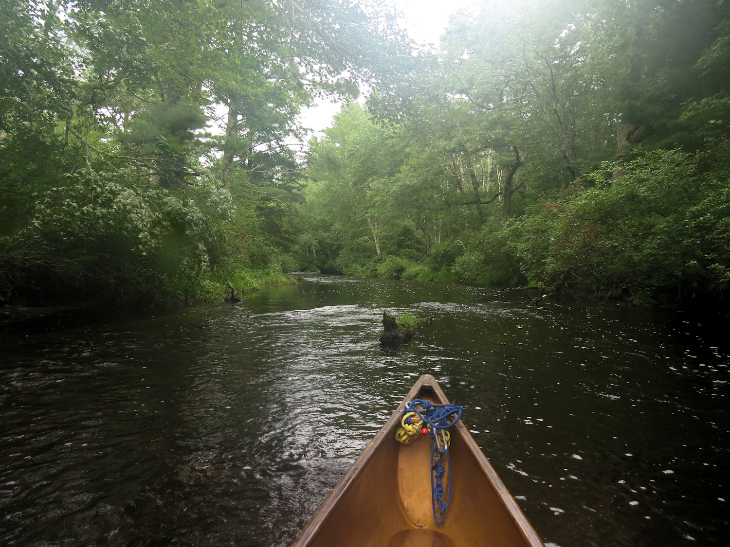
Rhode Island's Wood River has so impressed me on recent trips that I decide to use the day to explore the next section upriver from where I've already been.

As usual, descriptions of this section of the river assume that one is paddling downstream. I put in at the bottom of Wyoming Pond and head upriver. There is a bit of moderate wind, which will disappear once I leave the pond and head into the heavily forested river. While there are some houses along the route, as is usual in these parts, they are well back from the river and often screened by trees and native shrubs growing on the banks. I pick up some light current just as I leave the pond. The river feels isolated, and would feel more so except for distant road noise from the nearby interstate. Anyway, it is not hard to filter out that noise by focusing on what is surrounding me. The only person I see is a homeowner who greets me from his back deck. 45 minutes up, I come to the first fast water. It's a short bouldery drop of less than a foot, but combined with a partial overhanging dead fall. I get pushed back on my first try, beach the canoe and verify that there isn't a worthwhile portage. I think about it for a few minutes and go back at it, coming up the left side in an eddy, ferrying over to the right and hopping out to pull the canoe up in the shallows. The river pools for a short way above, but returns to brief sections of fast and shallow water. It would be an awkward wade as the bottom here has just enough bowling ball sized boulders to make it weird. I get up to where a road skirts the river on the hillside above. This will be a workable landmark to map my location. I turn back where it looks like "all" of the upstream progress will be from wading.
Other than clunking through that first fast drop, the return is easy with enough maneuvering around deadfalls to make it interesting. It mists the entire way out.
With that section using just a bit more than 2 hours, I load up and drive up to the next put-in. This is just above the Barberville Dam and the Wood-Pawcatuck Watershed Association facility. There is public parking and a canoe launch. Checking the map, I was less than a 1000 ft from the dam when I turned back.
Heading upstream, a short stretch of river leads to Frying Pan Pond. It is spectacular, coming out of the forested river into a wide marsh rimmed with tall white pines. The mist goes to a steady rain, steady enough to put on a rain jacket, even though I am already quite wet. The river, which is fairly narrow at this point, meanders through the marsh, and after taking one wrong turn, I end up paddling upstream through the forest. There is a steady 2:1 current in here, with an occasional shallow spot. The bottom is fist size cobbles in pea gravel or course sand. I manage to paddle up through the fast sections with an occasional push with my beater "rock paddle". There are two fishing access spots half way and two thirds of the way to the next put-in. A fisherman at the lowest site is the only person I've seen. I go a couple hundred yards above the top fishing site. At that point, the rain has ceased and it is time to start heading out. While the Wyoming Pond section was good, this one is wilder and with more time I would not at all object to wading my way higher. On the way down, I spot a large doe, that just turns and watches me passing. Another quarter mile down, a small doe or yearling crosses the river about 50 yards ahead of me.
I took very few photos as the rain was heavy enough that I kept the camera sealed in its box.

No comments:
Post a Comment