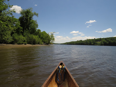
The weather is excellent although I need to go inland to get away from the wind. I put in at Haddam Meadows. Now a state park, the meadows were croplands and pasture going back to the colonial period. About mile long, the meadows are classic low river land that would be revitalized each year with spring flooding of the Connecticut River.
I head upstream, against the current and the northwest wind, staying close to the river-right shore using it as a buffer against a 10 mph wind with some gusts. I've only paddled here once before and that was several years ago - I have pretty much forgotten everything.
 |
| Higganum Creek |
I work against the wind and current up to Higganum Creek, which enters under a decrepit railroad trestle. The creek is sheltered from the wind and makes for good paddling although after a quarter mile, I come up against shallows and a blocking deadfall. I turn back and drift down doing a quick survey of the creek bottom. I find a few pieces of broken ceramic, but nothing significant.
I cross the river aiming for the top of the wetlands. Hoping to find an entrance into the contained marsh, I follow the river-left shore. I only find 2 draining channels and both of them are narrower than the canoe. Once below the marsh, I head out to Haddam Island, follow that down to it's lower point, and then cross over to the broad sandbar that lies off of Haddam Meadows. The water is about 2 feet deep when I am still 200 yards from shore.


No comments:
Post a Comment