Friday, May 31, 2024

Haddam-Higganum Section of the Connecticut

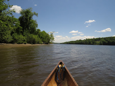
The weather is excellent although I need to go inland to get away from the wind. I put in at Haddam Meadows. Now a state park, the meadows were croplands and pasture going back to the colonial period. About  mile long, the meadows are classic low river land that would be revitalized each year with spring flooding of the Connecticut River.

I head upstream, against the current and the northwest wind, staying close to the river-right shore using it as a buffer against a 10 mph wind with some gusts. I've only paddled here once before and that was several years ago - I have pretty much forgotten everything.

Higganum Creek
The river-right (western) shore is quite nice. The long meadows eventually give way to a forested shore. There is a 2-lane road and a defunct railroad that are too close to the river to leave room for any houses. I must have misread the landscape when I was last here. The far side of the river is clearly a large wetland held behind a treed river bank. 

I work against the wind and current up to Higganum Creek, which enters under a decrepit railroad trestle. The creek is sheltered from the wind and makes for good paddling although after a quarter mile, I come up against shallows and a blocking deadfall. I turn back and drift down doing a quick survey of the creek bottom. I find a few pieces of broken ceramic, but nothing significant.

I cross the river aiming for the top of the wetlands. Hoping to find an entrance into the contained marsh, I follow the river-left shore. I only find 2 draining channels and both of them are narrower than the canoe. Once below the marsh, I head out to Haddam Island, follow that down to it's lower point, and then cross over to the broad sandbar that lies off of Haddam Meadows. The water is about 2 feet deep when I am still 200 yards from shore.

Tuesday, May 28, 2024

Farmington

I start upstream from the new bridge at Old Farms Road. It is the first time that I've put in here. There are several good spots to launch if one isn't too picky. This location is better than the nearby spots with a crushed rock trail leading down to the water.


When the new bridge was being built, an archaeology survey turned up an early Native American encampment dating 12,000-13,000 years old. That was a good find as that was near to when people were first entering the region as the ice age glaciers receded.

The day is mid-70's with a south wind that doesn't matter much as the river is fairly well protected. The sky is partly cloudy with large non-threatening cumulus clouds.

I don't paddle here as often as I once did, and I've forgotten just how pleasant and simple the river is; there are logjams or beaver dams to crawl over, it's just get into the canoe and go. The river has 10-foot high banks on either side with a thin veneer of forest to enclose it all. The veneer, of course, is rather poor habitat for anything other than song birds and it is backed by golf courses, play fields and some remaining farm land.

The river is a little higher than normal but not so much that it makes any difference. The current is a 2:1 (paddle 2 hours upstream, return in 1 hour), which is normal and about as good as it gets. 

The remains of the aqueduct pillar can just be seen back in the forest

It takes me one hour to get to the Farmington Canal Aqueduct ruins. The canal was finished in 1835 and the aqueduct was 270 ft long and 50 ft above the river. It was ready to go just a few years before railroads would make it obsolete. 

I reach the old mill dam ruins in 1-1/2 hours. There is a short 50 yard portage to get around the dam, but that is not in the cards today. I play for a few minutes in the eddies below the dam, and then turn back for an easy downriver return.

Sunday, May 26, 2024

Animal Farm

It's Memorial Day weekend. Rule 1 - start early. Rule 2 - Avoid where the motorboats go.

I put in at the Green Chimneys launch with a plan of paddling up to Patterson and back, a total of 13 twisting miles of prime beaver habitat. I is about 65F, but will rise into the lower 80's. There is a threat of thunderstorms in the afternoon, but right now it is absolutely clear skies and the air is still.

Rule 3 - first one up the river sees the most wildlife. There are a couple of cars in the lot, but they have kayak racks. Kayakers generally don't get very far in the Great Marsh. Great Marsh Rule  #1 - You have to get out of your boat if your going to get anywhere. This is beaver territory, so dams and fallen trees are standard, and kayaks just don't work well for clambering onto beaver dams or over logs.

I start off. Before I get to the first pond, the word is peaceful. It is still and quiet, and the swamp is lush with spring growth. A Great Blue Heron watches me approach. The sunny clear sky casts deep shadows from the surrounding forest. Yellow irises are in bloom all around. I find only one small stand of purple irises.

I pass six people. Three are fishing, three are wandering about just below the forest section. They warn me of a couple Swans as they head out. I paddle through a low spot  in beaver dam and find the Swans soon enough. They have seven Cygnets - quite a good hatch!  The Cob hisses at me while the Pen keeps the Cygnets behind her. I swing as wide as I can and move on.

The forest section is fairly open and although I have to weave around a few deadfalls, there is no need to step out of the canoe. I spot two pairs of Canada Geese with a total of seven Goslings. I also find a hen Wood Duck with 13 Ducklings. Woodies clutch nest - hens will dump their eggs in an established nest leaving that hen to tend all of them. This one has one or two broods that weren't hers.  I ease up and they find a side channel to head up. The hen will feign broken wing and decoy predators (or canoes) away from the ducklings. I try not to get that started whenever possible. I spot two muskrats and one mouse, which was swimming surprisingly fast across the river.

The powerline portage is still required - a large pile of fallen trees block the river. It's just a muddy 30 footer, but it will stop 99% of the people that paddle this far. Then, it's a quarter mile to the only bridge.

The portage
The upper marsh starts with the bridge. After a hundred yards of forest, it opens up into a broad marsh where the only trees are dead grey sticks - a forest that the beaver started drowning out at least 20 years ago. But first, I am greeted by a black bear swimming across the river about 50 yards ahead of me. It looks like it might be 2 years old or so, just old enough that mom isn't with it anymore.


Clean bear
There's no one other than me in this section of the river. I see four snapping turtles, sized from small to almost big. The bullfrogs are twanging away as well. I find a solid beaver dam about a mile below Patterson. Most people won't get past it even though it has to be one of the easiest beaver dams to cross. It is solidly built and easy to get out and stand on. I meet some people on the water between here and Patterson. 

I have a nice talk with a guy at the Patterson put in. He is here working his hunting dog, but he knows his way around canoes. With that, I head back. I find everyone I had met on the water parked at the beaver dam. They ask if there is a way around it, and I shake my head.  I cross over and head on.

At the portage, I surprise a dozen people as I emerge from the weeds. They ask if there is a way around it, and I shake my head. I tell them it is just 30 feet of grassy mud, but I know they won't go any farther. I climb back into my canoe and head off.

I find the Swans inside the forest. I get hissed at twice this time. I pass a few more people on the way out. There's not much wildlife near the river with all the traffic. But it was an exceptional day.


Friday, May 24, 2024

Plover Migration

We started early enough, heading downriver to the marsh before the coming heat of the day. The tide is coming in, but the flood current was still slow. It is sunny with little wind, and already nearing 70F with a prediction of 82F by early afternoon.

S wanted to see some birds, and the Wheeler is the best option right now - lots of bird and little driving.

I am a bit surprised not to see some Yellow Crowned Night Herons as we get to the marsh. We head up Beaver Creek, where I've seen many in the last few trips. Sure enough, we begin finding the YC's. By the time we paddle out we have sighted about 15 of them.

Red Wing Blackbirds are all about. We see some Mallards, but with the tide still low, our sight lines are short. We can't see across the top of the spartina and most of the Ducks are out in the middle of the grass away from the channel. 

Near the refuge launch, we spot the Swans with their 4 Cygnets. The male puts on a bit of a threat show, raising its wings over its back and pumping up a bow wave with powerful kicks of its big feet.

American Golden Plovers


We cross the marsh towards Nell's channel. Now, we spot a good number of Golden Plovers. The first dozen is gathered on a small piece of remaining high ground. As we continue, we keep spotting more, mostly in groups of 15 or 20, but occasionally solos. By the time we get to Nell's channel, I figure it to be about 75 Golden Plover. The Plovers migrate from South America to the Arctic where they nest. While many of them go up through the middle of the continent, we always get some each spring. Their return trip is over the ocean and I can't remember ever seeing any in the fall.

American Golden Plovers

Going up Nell's, we watch an Osprey harrass a couple Egrets and a Night Heron. No doubt, the nearby Osprey nest has recently hatched chicks, and anything that eats meat is being warned off.

Back in the river, we ride the flood current up to our start point.

Thursday, May 23, 2024

Thunder

I put in at Indian Well, one of two possible starts for this section of the Housatonic. Downstream is a the 1870 Shelton Dam, and upstream is the Stevenson Dam, completed in 1919. The reservoir is quite small by modern standards and runs a current which can be quite noticeable during high water although today it is pretty much nonexistent.

It is cloudy, with a very light wind and a temperature around 70F. The weather report has a chance of thunderstorms and there has already been a couple of light sprinkles that did not last long. I head upstream with a plan of going dam to dam, taking in the entire section of the river.

About 30 minutes out, it begins to rain hard enough that I dig out the rain gear that lives in the bottom of my pack. It rarely sees the light of day. After a few minutes, it is raining enough to be called a hard rain. I don't mind and in fact I enjoy rain paddling, up to the point where electricity comes into play. Much of this trip is in between high ridges, but as I approach one of the open areas, I hear a couple of distant thunders. I decide to head back where I have a bit more shelter. The rain increases and there is more thunder, so I land on a small beach. There is 200 feet of forested ridge above me, so I feel reasonably protected. I bail some water out of the canoe and then roll it over, as otherwise, I will have to bail it again when the storm passes. I stand on the beach and watch it rain. It dumps like crazy for about 10 minutes - all that is missing is hail. We get some excellent rolling thunder. Rolling thunder is common here. It will start far off to one side and the rumble will travel across the sky to the other side. It is easy to see where the old folktale of elves bowling in the sky came from.

All in all, it makes for a surprisingly good canoe trip.

I'm onshore for 45 minutes before the thunder moves off. As I continue, the rain stops and the river becomes glassy smooth.

The last mile before the Stevenson Dam can have a stiff current when they spill water out of the next reservoir. I'm curious to see what the river is doing with the recent heavy rain. I pass the shelf without any trouble (this is a shore to shore shallow shelf where the current gets accelerated, enough so that at times it is impassable in an upstream direction). Just as the dam comes into view, there are three horn blasts, no doubt signaling the release of water. Sure enough, one of the gates has been opened and a good dump of water is starting. With that, this is a good point to turn back.


Tuesday, May 21, 2024

A Good Day

I'm putting in at Pilgrim Landing, the easiest start for Lord Cove. D, who lives right across the street, is out mowing his lawn. He's an interesting guy - we've talked many times before, and he publishes a nice magazine about the Connecticut River, "Estuary". And yes, I am a subscriber. We have a good talk, a little about Lacrosse, which he coaches, and a little about the good spring migration in the Wheeler Marsh.

The morning fog has risen to become a low overcast which will not, for very long, hold its own against the sun. It will soon be sunny and about 75F with a moderate wind out of the south. The tide is almost at its peak, so the return trip will have some current behind me. 

It is a good day.

Before I pass the first point, no more than a couple hundred yards, an Osprey and a mature Bald Eagle come into the scene, in full territorial squabble. The Eagle, obviously the aggressor, retreats to a tall evergreen. The defending Osprey makes several noisy swoops to get the message across, and then returns to its nest on nearby Goose Island. Halfway through Goose Bay, I spot a pair of mature Baldies sharing a perch. They split up, but eventually both head up to the next bedrock finger. (The cove has a distinctive series of narrow tapering bedrock ridges that descend off of the hillside into the water, with a few hundred yards between each ridge). When I catch up, they are once again sharing a branch.

 It is a good day.

This marsh was overgrown with phragmites and a few years ago the government came in and eradicated over most of the marsh. Now, there are 2 to 3 foot high cattail spears filling in the whole area, as it should be. Nesting is clearly on. It seems that every time an Osprey flies by, it is being harassed by a Red Wing Blackbird. I spot several Marsh Wrens, doing the pop-up and flutter down while singing dance. They seem to have just arrived as I see no nest building from them.

It is a good day.

I follow the east shore, taking in some of the tiny bays and backwaters that push in against the hillside. In time, I get up to the big Eagle nest that stands almost in the farthest reaches of the cove. I don't see any activity in the nest, but it is still possible that there are eaglets tucked down in the cover. The adults are not in sight. I head back out following the west side of the marsh, again checking out the dead end side channels.  I pass under a very large Bald Eagle, and by the size, it should be the female that belongs to the nest. It really is obvious just how large she is. Every year that I've observed her, she has raised 3 Eaglets to fledge. I spot 3 pairs of Canada Geese with a total of 10 goslings.


The Big Female

It is a good day.

I finish with six Eagle sightings, all matures, and it is probably four individuals.

It was a good day.

Monday, May 20, 2024

What's Up in the Marsh

Like usual, I head down from under the highway bridge. It is peak high tide with cloudy skies, a temperature of 60-ish and a light wind that has no effect other than to cool the skin. 

At the top of the marsh, the Swan is busy adding a level to her nest to keep the eggs out of the water. I head, first, up into Beaver Creek. I have spotted a half dozen Yellow Crowned Night Herons almost right away, and at the next bend, just when I'm thinking I've seen a dozen, one that I am watching flushes and four more that I didn't see take off. Almost all the way in, I find a Black Crowned Night Heron up in a tree. It is my first BC of the spring. I see fewer Black Crowns in general, which I don't think reflects the actual population. The two birds have different feeding and perching habits, and I suspect that my canoe habit dovetails better with the Yellow Crowns than with the Black Crowns. 

Black Crowned Night Heron
I head to the Central Phragmites Patch and while retrieving some junk, I notice that the nearby Swan nest is empty, in fact, I can't actually pick it out from the rest of the marsh. But, the resident Swan comes out from behind a stand of reeds to see what I am up to. I suspect that there are brand new cygnets in there, and I back away.

The third nest, near the Refuge boat launch, is empty as well. The adult pair is about 50 yards away herding four small cygnets, which are probably less than a week old.

Great Egret
Otherwise -
With the high tide, I can scan across the top of the spartina, which is no more than 8 inches tall. There are quite a few Mallards out away from the main channels. It's easy to spot their heads in the grass. They are not in flocks, but in pairs.
Least Terns are back. I spot four during the trip.
I see just 3 Yellow Legs. On my previous trips I have seen flocks of 12-20 at a time. So, it seems that they have headed up into Quebec for nesting.
Over near the bottom of Nell's channel, a Black Bellied Plover flies by. The Willets are around here as well, by the sound of their calls.
There are more Osprey in the area than can be accounted for by the local known nests. Most of them are on the east side, either in the trees or soaring high overhead.

Yellow Crowned Night Heron
Midway through the two hour paddle, the skies clear and the wind shifts, now coming out of the south. So, I have a nice tailwind as I paddle out.

Saturday, May 18, 2024

Lover's Leap

I put in just below the four span truss bridge, the only bridge for ten miles in either direction. The day is overcast, something like 70F, and with a very light wind coming down the river. There is an unusual number of people about in either fishing kayaks or pontoon boats. There is a kayak fishing tournament and the pontoon boats are taking part in river clean-up day. 

I cross the river and follow the river-right shoreline. Just a third of a mile up, I find a white tail deer tucked in along the bank. It's missing some hair on the side and it doesn't flee when I get close, so it might be sick. If it's still there when I return, I'll call it in to the state. Not much farther on, I spot four Canada Geese herding six goslings. The young are probably 10-14 days old. And, a half mile up from them, I find a pair of Geese with 3 goslings that can't be more than a few days old. Otherwise, I spot a Kingfisher here and there and a Great Blue Heron once in awhile. I do flush a second white tail. It takes two leaps up the hill before stopping to see what I am. I pass by and it returns to the midday business of digesting whatever it ate this morning. Deer bed move and feed in the mornings and evenings, and they bed down in midday, focusing their energy and blood circulation on digesting the rather woody material they're eating.

I find a Swan nest on the island just below Lover's Leap.

Lover's Leap is a narrow gorge in a high ridge that the river passes through. Before this section of the river was dammed, there was a ten foot waterfall somewhere in the gorge. This made for a productive fishing spot and the local archaeology shows that Native Americans lived in this locale starting not too long after the Ice Age glaciers retreated. I don't know where the actual sites are, but the terrain would be suitable both below and above the gorge.

I paddle through the gorge and as far as the mouth of the Still River before turning back. Just across from the gorge, I stop and chat with a guy who is trying to keep Geese off of his shoreline grass. He has some fake Owls that don't work - I fill him in on just how good birds are at recognizing other birds. Of course, Canada Geese aren't particularly afraid of Owls or Eagles because tangling with an adult Goose is a good way to break a wing, which is, of course, a fatal injury. I continue on down following the river-left shoreline.

I get a lucky spot, finding an immature Bald Eagle in a tall and wide background of forest. 

I cross the river to check on that first deer, but it has moved off, a bit of a hopeful sign.


Friday, May 17, 2024

Second Choice

I headed to Essex where I could mix some big river and big marsh paddling. But, standing at the water's edge, it was clear that the wind was something double the weather service prediction, and I would have a grueling paddle no matter which direction I headed. I loaded back up and headed off to my windy day paddling spot. (The wind was in fact double and then some - 18mph gusting to almost 30)

After my small detour, I put the canoe into the Mattebasset, in the usual spot. The water was lower than I've seen it in some time, having had several spells of high water this winter. It was more or less at a normal level. I took stock on the idea that I've been in here when the water was a dozen feet higher than it is today. There is little wind.

This is the typical scene in the Mattebesset

The Mattabasset is a placid river passing through bottom land forest, mature swamp, and open freshwater marsh. It's only problem is that it isn't long enough, but that is a common issue with small Connecticut Rivers. There is a small current today, which is about as strong as it ever gets - it's nothing to fret over.

The day is overcast with a filtered sun and a temperature in the low 70's. There's no wind in the forest and very little in the open marsh. It is a pretty fine day for paddling. I spot a few Great Blue Herons, and hear a good number of song birds, which are difficult to locate with the trees leafing out.

About half of the known beaver lodges look abandoned - piles of sticks without the binding mud, but not yet collapsed. The Point Lodge looks like it might be in use, but it looks a bit haggard. The big lodge just above the last bend before the mouth of the river looks solid. But, when I head up the Coginchaug, the Big Lodge looks abandoned having lost its mud and some of its height. The unusually frequent flooding this winter probably convinced the colonies to seek better living locations. Even with the couple of lodges that looked lived in, what I noticed was a lack of the little signs. I don't find any left over peeled branches or fresh gnawing. All of the beaver signs like chewed trees are silt covered. I get up to the power lines on the Coginchaug before finding two small scent mounds.

This is the typical scene in the Coginchaug
 
I turn back and head out when I get to the first log jam on the Coginchaug.

Sunday, May 12, 2024

Chipuxet

We put in at the bottom of Worden Pond, an egg shaped and shallow body of water in the middle of the swamp that is known as western Rhode Island, although I suppose that Rhode Island is so small that most people don't think of it as having a "west". It has been some time since M was out with me in the canoe, so it seemed a good idea to go somewhere she'd never been. 

The day is mostly cloudy with a temperature of about 60F. An afternoon South wind of something under 10mph is predicted.

We follow the east side of the pond for about a mile and half to where the Chipuxet River enters. This is a trick of colonial era thinking, I imagine, as when the same river leaves Worden Pond, it is the Pawcatuck River. Anyway, I have been here before, having come down the Chipuxet and knowing enough then to go out into the lake so that I would be able to recognize the river mouth, all 20 feet of it, amongst a shoreline of low and featureless swamp shrubs if I should approach from the south. I find the entrance right away although we're not d-sure until we've paddled in about 75 yards. 

This lower part of the Chipuxet is very narrow with hardly any straight sections. It is a busy and somewhat slow paddle. We start seeing Great Blue Herons, a lot of Great Blue Herons. We might be flushing some of them, but mostly they are taking off well before we can be seen. Of course, there are constant Red Wing Blackbirds, some Goldfinches and a few Mallards. We also regularly pass a beaver lodge and several fresh scent mounds. The first beaver dam requires both of us to step out. It is only a couple inches high, but it is solidly built. The second dam we manage to get half way over, so that only I need to step out.

When we get up to the first road bridge, I can see that the water is about a foot higher than when I've ben here before. We duck under the bridge and head up the third of a mile to Thirty Acre Pond, which is held back by an excellent beaver dam that is 2-3 ft in height. It has been here for many years.  That is far enough and we turn back, both of us noticing just how much current there is as the canoe glides with moderate speed through the narrow channel.

The Dam at Thirty Acre Pond
The wind has come up while we were in the swamp. It doesn't count for much there, but it dows at Worden Pond.  It is blowing straight out of the south and the shallow pond has a good harsh chop to it. We follow the shoreline fairly close both to get some shelter and to stay in the shallows as the water is still fairly cold. An immature Bald Eagle overflies us. We have a mile and half to go into the wind, which is definitely in the 15 to 20 mph range. It's a good workout.


Thursday, May 9, 2024

The Shipwreck Reach of the Connecticut

I put in at a new spot, a bit of State land in Cromwell.  The river is running faster than I expected and I regret not looking at the gauge this morning (it's at 8.5 ft - 2 to 3 ft above typical). On top of that, there is a stiff wind coming downriver that doesn't feel like the weather report (it was 10mph gusting to 20). The plan is to go upriver to the Rocky Hill Ferry. I decide to beat my head against it instead of retreating to the familiar nearby swamp. 

I hug the shore as much as possible to catch the slowest current and get some protection from the wind. Unfortunately, on this side of the river there are quite a few fishermen and I have to swing out into the main current to avoid their lines. After grinding that out for a half mile, I cut across the river where I won't have to dodge fishing lines.

The first mile takes more than 45 minutes. But, I start finding slack water in the wobbles of a natural shoreline. I can handle the wind, or the current, but not both, at least for very long. 

Fortunately, the wind starts to drop off. I make Gildersleeve Island in an hour and a quarter. The island is not quite 2 miles from my start. Across the channel from the island is a small sterile concrete bridge with a creek flowing out of it. I've seen it before and intended to explore it some day. (This is Carr Brook)This is the day, I guess. 


Carr Brook
The passage under the bridge goes from wide open river to a narrow forested creek. I feel like I've discovered a secret. Fifty feet in, I spot a little head looking at me. White chin hairs - it's a mink. Mink are curious critters and from the relative safety of its burrow entrance, it watches me as much as I watch it.

I continue up the creek a short ways. I spot a male Wood Duck - good terrain for a Woody. It has some "almost" blocking dead fall that I push past. After a few hundred yards, I decide to consult a map when I get home to see if there's enough possibilities here to make numerous log crawls worth the while. 

Back at the river, I continue upstream. The wind has died to almost nothing and the sky has gone from mostly clear to overcast. But, that first hour took the stuffing out of me and the Rocky Hill Ferry isn't going to happen. About halfway to the Ferry, I turn back. It's a very easy paddle back.

Wednesday, May 8, 2024

Camoflauge

I put in for a quick trip through the local big marsh. It is a very high tide, with only the last bit of it coming in. The sky is overcast, a thick humid type of cloud that can become a thunderstorm if the clouds stay put and the air currents go more vertical. It is in the mid 60's with a light wind coming up the river.

33 Sandpipers
I pass a Yellow Crowned Night Heron at the top of the marsh. Then, I head over to the fully flooded Nell's channel. In fact, the entire marsh is well flooded with the only dry spots being the phragmites patches, which don't survive regular periodic flooding. These high tides compress many of the birds that are in the marsh. While Ducks, Geese, and other water birds don't mind, the waders - Herons, Sandpipers, Willets and Yellow Legs, are on high spots waiting for feeding to resume.
Greater Yellow Legs (there is a Lesser Yellow Legs)

Paddling past a long floating mat of last year's phragmites and spartina, I notice a couple Sandpipers. Then, as my eyes are fixed, I realize that there are easily a hundred Sandpipers on this fifty foot long mat. And, that is how it goes whenever I am close to one of these mats. I spot a pair of Yellow Legs, and it becomes six or eight. I spot a Sandpiper, and suddenly ten of them flex their wings. Anything with a speckled pattern on the back practically disappears.

The lower marsh is flooded so that not even any of the spartina breaks the surface. I spot and hear a flock of Brandts over by Milford Point, while heading towards the east shore. Then, I cut down toward the central phragmites patch, where I find the nesting Swans busy raising their nest. Then, over to the east channel and back up the river.

Tuesday, May 7, 2024

The Quasi-semi-every-so-often Shelton Run

I put in under the highway and head upstream. It is a fine day with some wind and temperatures in the low 70's. The tide is still coming in.

The weather and tides have finally met in my comfort zone. Once in awhile, although not very often and definitely not every year, I paddle up this lower section of the Housatonic pretty much as far as one can. I set out with the tidal current pushing me up. The wind is in my face, but at its worst, the two seem to balance each other. Of note, there are two new Osprey nests at the old power station, making three total.

At the unnamed 6th island, a Bald Eagle flies over. It looks to have brand new white tail and head feathering as the underside color of the wings is still patchy.


At Wooster Island, a pair of orange flashes whiz by... Orioles. I don't see them all that often and it is always a treat. They refuse to pose for a photo.  A second mature Bald Eagle flies over.

The wind calms down above Wooster Island. I continue all the way up to O'Sullivan Island, in Derby. This is where the Naugatuck joins the Housatonic. Going up this part of the Naugatuck is a grim, pointless paddle between towering levees, and there is just a quarter mile or so to the Shelton Dam on the Housatonic, so this is a good turn around.


Derby

The return starts easy with a gradually increasing current behind me. Unfortunately, below Wooster Island, I get the predicted wind shift and will have a stiff headwind for the rest of the trip. I pay for the easy outbound leg as the current helps, but doesn't make up for the headwind. It is a game of paddling in as strong a current as possible while hiding from the wind as much as possible on the west shore.
A third Bald Eagle soars high over as I approach Pope's Flat.

It is an 18 mile trip with a steady 6-1/4 hours of paddling.

Monday, May 6, 2024

Bird Check

I put in on the Munketusuck to search for the elusive Little Blue Herons and Glossy Ibises. Actually, they're not that elusive, but I figured out over the last few years that they must have nesting colonies near the Menunketusuck River. Occasionally, I have spotted the Glossy Ibises in the Wheeler Marsh and the East River, during the spring when they are migrating in. They would disappear once nesting began. As to the Little Blue Herons, this is area is the only place that I've seen them. The last couple years, I figured out that tthey were fairly plentiful in this area once their young had left the nest. I can't be sure, but I figure that they might be nesting on nearby Duck Island - about a mile distant. 

It is a calm day. The temperature is already about 60F, the sky overcast but looking like it won't stay that way. The tide peaked about a 1/2 hour before I set out, and it is a higher than average tide. The spartina is just barely awash throughout the marsh. This is a high salt marsh, so it has the short spartina variety, and only floods a few times each month. 

Little Blue Heron
Just before getting to Opera Singer Point, I spot a mature Little Blue Heron and four Snowy Egrets. The trip has paid off.  With the Snowys, I have to see the feet as a first year Little Blue Heron is a lookalike. The Snowy has very obvious bright yellow feet, which is a "for sure" identifier. 


Glossy Ibises

This marsh has the river running through with two branches, one on either side. To make this a worthwhile outing, I always paddle both branches, which takes in the full scope of the marsh. Near the outer end of the west branch, I spot four Glossy Ibises a bit over a hundred yards distant. Now, the trip has really paid off. The Ibises are head down working the mud with their long curved bills - kind of a slow sewing machine motion. There are also some Willets and a couple small flocks of Yellow Legs. 

I head back, finish of the bottom of the river as far as the railroad bridge, then head into the east branch. There is a mature Bald Eagle perched over the abandoned opera singer's house (I think it is now wildlife refuge land, and they will remove it when budget allows, as they have done to a couple nearby cabins). Considering that it is pretty good feeding, there aren't as many birds as normal by the point, which I imagine has something to do with the predator in the tree. Past that though, I spot several more Snowy's, and a few Great Egrets. 

With that, I head back out, pushing against a moderate ebb current until back to the put-in.

Saturday, May 4, 2024

A Clever Ruse

It is a far too nice day to not be out. I put in under the highway bridge It is about 60F with a light wind out of the East and the tide has just started to fall. It is an easy and quick paddle down to the marsh.

I'm greeted at the top of the marsh by a Yellow Crowned Night Heron, my first sighting of this bird this spring. It is clever ruse.

Yellow Legs
The marsh is still very much flooded as the passing high tide was a higher than usual one. The shoreline feeders, like Willets, Yellow Legs and Sandpipers are standing on the small patches of marsh that remain above water. Before I am even fifty yards up the inner channel, I've spotted 30 Yellow Legs, in groups of 6 to 20 individuals. There are also some Willets, but the Yellow Legs are much more numerous. 

The Central Phragmites Patch
I head up the east side, then out into the center of the marsh and paddle up towards the central phragmites patch. I flush a dozen or so Green Wing teal, a few Mallards, and a couple of Black Ducks. There is a Goose Nest well hidden in the phrgamites patch and a Swan nest out in the open on the east edge.

Perhaps Semipalmated Sandpipers
Next, I head along the upriver side of Cat Island. The water has already dropped enough that I can make it all the way around the island. So, I come back out and head up into Beaver Creek, which I haven't visited for a couple weeks.

The clever ruse is revealed right away. 4 Yellow Crowned Night Herons, then 2 more, then 2 more, then a few more. Before I turn and head back out, I've spotted at least 20 of them hiding back here. They will all nest on Charles Island, which is a mile distant.

Yellow Crowned Night Herons

I hug the shore on the way back up river against the ebb current. It's counterintuitive, but the stronger the current is, the longer the eddies and slack water sections are, at least in this part of the river. It goes pretty easy.