Thursday, June 30, 2022

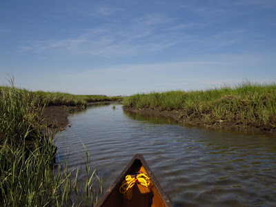
Local Waters in the Other Direction

I put in under the highway bridge again, but this time I head down river for a quick morning trip through the marsh.  The tide is coming in and the river current has reversed, which it does for about 2 miles from the ocean. High tide isn't for three hours, so the current is mild. Otherwise, there is a nice breeze and mostly blue skies with a few small cumulus and some high cirrus.


I head down through Nell's channel and as I pass the sand bar with plenty of depth, it looks like my timing is good.  A Black-Crowned Night Heron flies by. Halfway down the channel, the calls of Osprey increases in number and I pause to look around - two on a nest and eight overhead. Then, I see a Yellow-Crowned Night Heron in the spartina, and soon, a pair of them fly across the marsh in front of me.  
Great Egret (yellow bill, black feet) and two Snowy Egrets (black bill, yellow feet)

Milford Point has a zero bird count, although I bet there's a Piping Plover in the beach gravel.  But heck, you can overlook those little magicians from ten feet away.

Mute Swans

I head across the bottom of the marsh, spotting more turtles than birds.  Then, up along the east edge where I see a couple of Snowy Egrets and a few Great Egrets.  Take the secret inner route, finding that this tide level gives more than enough water to get through the entrance.  At the far end of the inner route, I spot a pair of Swans with a snow white Cygnet.  I've never seen a white Cygnet before - they are usually gray until they are a year old.

I head back up the river riding a current that does not make up for a stiffening head wind.
Tuesday, June 28, 2022

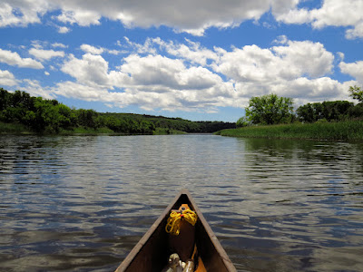
Local Waters

I put in under the highway bridge on the big river, one of my usual spots for a quick trip near the house.  It is a fine day with a half cloud sky, a light breeze and ideal summer temperature.  The tide will be rising for about one more hour.

I head up and across the river heading into the channels between the four nearby marsh islands.  A couple of  Great Egrets circle and scold me from over Carting Island while a Green Heron drops in and poses for me on a deadfall in mid-channel.


I continue up from the islands following the west shore.  I spot a few Osprey, one Bald Eagle, and every so often, a Great Blue Heron.  And, not particularly aiming to get any place, I wander a bit picking some trash.

I stop and stretch my legs on the sandy beach at the dragonfly factory, and continue on to just short of Wooster Island.  From there, I turn back following the east shore.  There is a CH-53 at the dragonfly factory.  It is a very big helicopter.  A little further south, I spot an Osprey tiltrotor coming upriver in hover mode.  I've never seen one flying before.  Considering modern helicopter technology, it looks like a big target.


Sunday, June 26, 2022

Salmon River with A

 A long time friend joined me today.  I've know A since she was 6 years old, and about a year ago found out that she was working on a PhD at a nearby university.  Busy as she has been, summer is here, tests are completed, and it was time to go see some more of Connecticut.

We headed out to the Salmon River.  With today's excellent weather, I knew that all the main rivers would be in control of the Mai Tai Navy.  The shallow cove at the mouth of the Salmon prevents anything larger than a bass boat from entering.  Somewhat unexpectedly, the launch area was filling up with vehicles, but of course, most of those were from motorboats that wouldn't come into the cove.  I'm a bit more used to paddling here on weekdays when I am likely to be the only one around.

A had never canoed before, so as we got going I gave her a quick lesson in basic paddling.  She picked it up right away and I traded out her heavy factory paddle for one of my hand-mades.

We paddled the edge of the cedar swamp that divides the cove from the main river.  There are a couple of large beaver lodges in here and I wanted to show A the dam that they had built, which is unique as it holds back water only after unusually high water events.  Today the water level on the other side of the dam was about 8 inches higher than where we sat.  A Green Heron popped up and flew deeper into the swamp.

We headed up the cove, crossed over to the far side and paddled into the Moodus River.  I point out the grape vines as we go and we pass over two barely submerged beaver dams.  The log jam is still in place, so we head back out.

Then, we cross the top of the cove and head up the Salmon River proper.  There's a few Osprey working the area, but otherwise not too many animals.  There are a lot of kayaks out today, so the wildlife, while still here, has moved back into the recesses until the party ends.

Our turn-around point is the Leesville dam.  There's not much water come over the dam and little current below.  From there we head back down taking a look up into Pine Brook. I'm wondering if the state took out some of the wild rice in here. It seems that there should be more growing by this time of year.

We get a stiff head wind when we get back to the cove.  But, the cooling on a 90 degree day is better than the extra work to paddle against it.

Friday, June 24, 2022

Menunketesuck and Chapman's Mill Pond

S wanted to go canoeing today, so I loaded up the two seater and we headed out.  She hadn't been out in a long while, so it was pretty much my choice and I opted for a place that I hadn't been to before.

We put in on Chapman's Mill Pond.  The pond is part of the Menunketesuck River, and we've paddled the salt marsh portion before.  The pond is immediately upstream of that area and unfortunately separated by a eight foot tall dam with no portage.  If it was a long canoe trip, you'd actually bust a portage through the trees and brush, but for a day trip, it's not worth it as well as not raising the ire of the state conservation department. 

Chapman's Mill Pond
Right away, I comment on how beautiful the pond is.  Although narrow and less than a mile long, it is surrounded by forest and set down in a shallow valley.  Plus, we are the only ones out.  We spot a couple Osprey and a few Egrets, lots of Swallows and some Redwing Blackbirds and a brood of Wood Ducks. We explore a couple of nooks and when we get to the upper end, try to push up the river.  However, the entering river is barely enough for the canoe without the overhanging tree branches and brush.  So, back we go. With such a short trip, we opted for the 1/3 mile motor portage down to the salt marsh section. In fact, without doing both sections, the pond isn't big enough to be worth the drive.

The state is in the process of rebuilding the  Menunketesuck launch (which will have a new name that has nothing to do with where it is, of course).  There used to be room for 2-3 cars, now there are 10 parking spots, garbage cans and pads for picnic tables or some such things.  We head out on a falling tide.

This would be a favorite spot to visit, if it was a bit larger.  But, it is good for a couple hours.  The area is a high spartina marsh, running narrow through a forest and widening out to a half mile at the bottom.  There are several Opsrey near the start, and several more near the lower end.  We spot a mature Bald Eagle half way down and all along a good number of Great and Snowy Egrets.  This has been a good spot to find Little Blue Herons, but none today.

On the way out, just in the last bend or two, we spot a  Glossy Ibis wheeling around and then flying overhead past us, first of the year for either of us.


Thursday, June 23, 2022

Walls and Eagles

I set out from Pond Brook.  The weather was a southeast wind of no more than 10mph and a partly sunny sky with billowy clouds that held no threat of rain.

After getting to the main river, I noticed one of those stone walls that follows the elevation contours not far back from the water. When I first saw one of these, I assumed that it had been built to keep animals out of the river. After reading some, I found that the stone walls dated, for the most part, to the early 1800's. There was a merino sheep "boom" at that time and much of the suitable forests in the area had been clear cut for pasture.  Then, one finds out that the current shoreline dates to 1955, this being a reservoir with the original channel some 50 ft down and about a hundred yards to the east.  So, the wall paralleling the shoreline is somewhat a coincidence. I thought about this as I paddled and a bit of common sense arose.  I could be wrong, but given the choice, I would prefer to build these stone walls on the steep valley sides by tumbling and rolling rocks downhill out of the pasture to the location of the wall.  So, there might be a certain logic to building walls across the slope.  Of course, there are walls heading in all directions. One of the best ways to see this is to fly overhead on a sunny winter day when the leaves are down.  The walls stand out sharply and can be seen to form just about every possible polygonal shape.

After turning the point and heading up the Shephaug a mile or so, I made a wind check.  I had a tailwind here on the west side, so I crossed over to the east side of the river and confirmed that there was a wind shadow.  If the wind should increase, returning along the east shore will be much easier.  Then I paddled back to the "better" side of the river.

I got a "proud sighting" at a somewhat expected spot.  A good quarter mile off and some 300 feet up, I noted a white spot near a dead tree in the forest. That white was just not quite the white I'd expect in a forest. Using the zoom on my camera, I found it to be the head of a Bald Eagle.  I called it a "proud sighting" because I doubt many people would have noticed it.  In fact, I think I would have had a very hard time getting someone with me to see what I was pointing to. I'm sure there is a nest nearby, but I've never seen it.

I continue up to the cascades with little to add other than it is an exceptional day, and no one else is around. Near the cascades I retrieve three fish hooks with either bobbers or lures attached.  I turn back from the cascades.  

There was a beaver lodge and a lot of beaver gnawed trees a quarter mile below the cascades.  That activity seemed to drop off last year.  I paddled up a short inlet to and confirmed that the lodge had collapsed.

About a half mile above the point where the Housatonic and Shephaug meet, I clearly heard a few Bald Eagles calling with that hoarse whistle. It was a familiar sound that I had noted not long ago on the Lieutenant River where I observed feeding time for a pair of Eaglets.  No doubt that the Eagle nest is back in the forest here.

Tuesday, June 21, 2022

Essex to Selden

After a few days of high gusting winds, it was nice to wake up to a calm day.

I headed out to the lower end of the Connecticut River.  There are numerous good places to set out from in this area, it all just depends on what you want to see.  Today, I put in on the North Cove in the town of Essex.  I just felt like adding something a little historic to the trip.  The North Cove once had several shipyards in it building smaller ocean going vessels, as the mouth of the Connecticut River is fairly shallow. During the War of 1812, the British sent a small boat raid up the river and burned 27 ships. I cut across the cove and out into the main river through a small gap in long bar that separates the cove from the river. 

I follow the west shore upriver. Less than half a mile up is the Ely Ferry site.  The ferry dates to the 17th century and, if I remember correct, ran into the early 1900's.  The old landing on the far side is a good start point, but on this side it is only noted by a large swath of large submerged rocks that are otherwise totally out of place.  About this time I pass a young woman paddling a canoe full of gear.  She started in Farmington and is heading down and along the coast to Stratford.  With her are two more women on paddleboards....long trip for paddleboarding, uff da. 

I follow the shore closely, dodging the main current and taking advantage of eddies.  Osprey are numerous and a I spot an immature Bald Eagle, then a mature Eagle.  Being close to shore adds the possibility of animal sightings, and about the time I'm thinking that, I spot a weasel observing me.

Selden Channel

At Chester, I pass Eustasia Island and cross the river to Selden Island and follow that up and into the top end of the Selden Channel.  The channel is as calm and peaceful as I've ever seen it.  Great Blue Herons are owning the banks while Opsrey are keeping the sky.  

I cross the river again when I get back down to Ely's Ferry.  Here I notice that there is a large run of menhaden.  The fish travel in big schools, usually right under the surface and so it is easy to spot where the are as the water surface is choppy where they are.  In addition, they are surfacing and jumping out of the water quite often.  I take this to hint at predators like the striped bass.  Anyway, the Osprey and Herons are feeding well.

Tuesday, June 14, 2022

Farther Up Mill Brook

It's a fine day, sunny with the morning still cool.  I put in on a back channel near the mouth of the Connecticut River.  The tides are perfect for heading up into any of the smaller tributaries - a push from the last of the flood will become a return push from the beginning of the ebb.  Plus, the higher ends of the any of these creek sized rivers will be well flooded.

I head up towards the Lieutenant River.  But first, there is a mile or so of paddling along Great Island.  This is Osprey country and supposedly, one can see thirty Osprey nests from the put-in...if you can't see that many, have no doubt that there are.  Nearing the Watch Islands, I can see eight Osprey, five Great Egrets, a Willet, and a dozen Cormorants, without turning my head.

Red Throated Loon with damaged wing
I spot something that looks like a Loon, which would be two months out of place.  But, it is one of those Cormorants with the light colored breast.  At Watch Island, I spot something else that looks like a Loon, a lot more like a Loon.  It's a Read Throated Loon, and it is definitely two months out of place.  They migrate  through in the spring on their way to very far north.  I paddle closer to see if it might have a fishing lure stuck in it.  When it decides to move away, a flap of the wings show the problem.  It has lost the outer third of its right wing.  Fortunately, it looks fit and energetic and as the injury has to be about 2 months old, it has probably healed.  It won't be breeding and nesting, or migrating, but if a Loon has to be stuck someplace, this is about as good as it gets.  

Willet
I head up the Lieutenant - more Osprey, more Egrets.  Then, through the Boulder Swamp, which doesn't resemble the name right now, the tide covering the dozens of boulders that like to reach out and nudge the daydreaming paddler.   I head up into Mill Brook. I look for, but can't locate the Eagle nest that I'm familiar with.

Mill Brook
The neighbors seem to have dealt with the small beaver population.  No fresh signs at all. Then, under a small bridge, and one easy step over on a well-known deadfall, and paddle up to a brushy deadfall that has blocked me in the past.  This time, I squeeze easily through the branches and enter new-to-me river.  It is a combination of short paddles and short wades, nothing much to complain about.  I finally get up to a brook side house, which is a good landmark.  Turns out that I am just at the bottom of the lower millpond.  When I have a full day, I'll come back.  The map looks like there's a good mile or more of paddling on and above the millpond. (Later - The house is built on the site of the Bradbury Mill.  River-left on this section of the brook and millpond are forest preserve land)

I wade/paddle back to Boulder Swamp.  I locate the Eagle nest, mostly because my arrival coincides with feeding time and I can her the Eaglets squealing.  It looks like there are two Eaglets with a mature that is shredding the kill.  After a few minutes of watching, I head out.  I pick up a good ebb current as I leave the Lieutenant, and it is an easy cruise back to the put-in.

Saturday, June 11, 2022

Boy Scout Day

It's a fine day with a watercolor wash of clouds above.  It is a fine visual metaphor for my canoe trips.  I always feel washed afterward, the edges softened and the complexities melting into one.

Three Snowy's and a Great
I ride the ebb current down to the top of the marsh, which seems to be Egretville today.  Seven Great Egrets and twenty feet further, seven Snowy Egrets.  Three Cormorants, a few Mallards and a pair of distant Osprey finish the momentary count.


I down through one of the internal channels, the tide still being high enough for such tomfoolery.  I'm surprised to find "that" Swan still on the nest.  It seems late for the hatching, and if it is going to happen, it can't be too many days away. I pass a Yellow Crowned Night Heron, and then aim for the tip of Milford Point, as the marsh is well flooded between here and there.  There are no less than a dozen Great Egrets in sight, as they stand out against the lush green spartina, which is only grown - 15 inches at most right now.
That Swan Nest

Two Osprey at the point, but the migratory shore birds of the two weeks ago are gone, at least until fall.  I head counter-clockwise around an out, picking a few items of floating trash as I go.

Then, I head back upriver against a stiff ebb current.  This is the time to hug the shore and take advantage of eddies and slower water.  Nearing the first docks of the shoreline houses, I spot two women on small sit-on boats. They are wearing their PFD's...something I always check for when I get near people.  One flips.  They're out at the edge of the main current, which is moving at 3-4 knots. She's floating, but having a minor struggle.  She gets on her board, but flips again when she runs into the dock raft.  She crawls onto her board-thing as I get there.  Her paddle is missing, I suspect it is under one of the floating dock rafts as it should have come near me.  I tow her over to the shore so she can catch her breath, then I call her friend over, and out of the stiff current.  The paddle finds its way into the open and I go retrieve it.  My new friends are fine, but clearly surprised by the current.  I give them a brief lesson in paddling upriver (and checking tide charts)...hug the shoreline, rest when you get into an eddy, and stay away from the upstream side of the dock floats.  We chat and I assess the skill level, and decide to escort them, without really telling them.  I turn it into a lesson in reading water, pointing out the tell-tales that I'm looking at to spot eddies and faster water.  We talk about birds and I tell them of a couple other good spots to put their boats in.  It all works out.

Wednesday, June 8, 2022

A Less Quick Trip

Today was the day to get a trip in with tomorrow's forecast of wind and rain.  I went inland to fresh water as the tide would be low and I would be locked out of the better local salt marshes.

I put-in at Pond Brook under a beautiful sky of sun and quick moving batches of cumulus clouds.  The temperature is nearing 80, but a fresh gusty breeze takes the heat off of a sunny, warm paddle. I headed out of the brook and upriver into the wind.  It was a pleasant paddle with little surprises other than the almost complete lack of other boats.  After 2 hours, I turned back.  When I took out, I had seen just 2 kayaks and one bass boat.


Tuesday, June 7, 2022

Quick Trip

I put in at Indian Wells, in the section above the lowest dam on the big river.  The sign at the start warns that there is a dam 3 miles  downstream.  That sign always makes me chuckle.  

It is a nice summer day, sunny with slowly increasing clouds.  It is windier than I expected, and I pause to think about it as the wind is running straight up the river.  So, when I set out, I head downstream into the wind.  If worse comes to worse, I'll have a tailwind returning.  However, once in the canoe and in the water, the wind just isn't that bad.  It's gusting more than I thought, but the highest winds I was feeling were the gusts.  I make good time following the west shore.  I'm at the dam in 20 minutes.  That's why the warning sign at the put-in makes me chuckle.  Either I paddle 9 mph into the wind, or the distance to the dam is something more like 1 mile and not three.  

I cross the river and head back up.  The swans at the marsh have two, maybe three cygnets.  I had spotted their nest from the road when driving up this way.  In that same area, enormous carp are thrashing about.  I had spotted the splashing from a few hundred yards.  The water is murky with the mud they've stirred up.

I head up another mile or so, and call it a day.  The wind is building some, and this was intended as a short, quick trip. 

Friday, June 3, 2022

Pawcatuck Part 2

 A couple trips back, I did some exploring on the Pawcatuck River in western Rhode Island. Today, I returned to the Bradford put-in to go farther up the river.  

The day is calm, in the mid 60's and mostly overcast.  It's basically ideal for canoeing.  No one else is at the launch.  I set out upstream, pass a few houses, go under a railroad bridge, and after that it is just forest and marsh up to Burdickville.  This is not just a river running through a strip of forest.  There are fairly expansive forests and marshes on either side of the river with no road access and little, if any, trail access.  I spot two Green Herons and about a half dozen Great Blue Herons. A squirrel swims across the river.  

Squirrel
 

The special sighting is an Owl.  Owls are stealth fliers with soft feather that don't make any noise when they fly.  I only saw it because it flew across the river right in front of me. It perches at the top of a tall snag and I manage to get a couple of photos.  It's a Great Horned Owl.

Great Horned Owl

Oak trees (mostly red oaks, I think) seem to be the most common along the river.  There are groves of pitch pines here and there, and after awhile I start to connect the pines with sandy areas.  Some of the sand banks are 20-30 ft high.  The sand was deposited during the last ice age.  There are some sand quarries in the area.

At Burdickville, I meet three trout fishermen.  They say that the fishing is good.  There is an old mill dam here.  The dam has been breached, but still has to be portaged on river-left.  The portage is an awkward 30 foot stumble up out of an old mill channel.  

There is more current above Burdickville - 2:1 most of the time, with some stretches of slower water.  I pass the mouth of the Wood River.  The Pawcatuck is about half as big from now on.  There is also a lot more dead wood weave around and more current.  Even so, there is only one bank to bank jam, which makes up for it by being a real Jungle Gym to get through.  

Landmarks are few on the river.  2-1/2 hours out, I've only passed two railroad bridges, one road bridge, and one power line.  I finally pass another road bridge.  I continue on another half hour, until the current starts to become a bit more onerous and the amount dead wood in the water is a real nuisance.  I can hear road traffic, so I figure myself to be nearing the Jay Cronen access.  (I check the map when I get out - about a half mile short of Jay Cronen, and the road is paralleling the river about 1/4 mile off through the forest).

The Great Horned Owl, again

It's a good paddle back down, weaving through the deadfalls with a moderate current.  The Jungle Gym is easier in this direction. The awkward portage at the dam is also easier in this direction. The Great Horned Owl flies across the river again, pretty much in the same spot.  I see a third Green Heron and run my total of Great Blue Herons up to about fifteen.  It winds up a 6 hour paddle. 

Wednesday, June 1, 2022

Great Swamp

I put in off of Gage Road.  It's the first time that I've used this spot to access the Great Swamp (the Green Chimney's access is closed on weekdays).  It turns out to be an excellent bank for launching a canoe - gentle slope, just enough room for one canoe, and only a 20 yard carry.  The current is 2:1 with the gauge on the nearby Doansberg Road bridge showing 3-1/2 feet.  Above the bridge it is obvious that the water is high with some of the trees a foot or two deep in water.  The river braids and meanders tightly.  I follow the main current, which takes me off the main river channel once or twice.  I get to Green Chimney's in 20 minutes. A few of the kids are fishing with one of the teacher's supervising... a pretty good spot for some recess.  The current slacks off at this point, as usual.


Odds are, there's no one else in the swamp.  As of the first pond, I've spotted one Redwing Blackbird, four Great Blue Herons, seven Canada Geese, and a pair of Wood Ducks.  At the top of the first pond I find one very aggressive Mute Swan, which has been harassing ten Canada Geese that are scattered about in the outer edges of the pond.  I spot the female Swan out in the pickerel weed and cattails.  She has at least two very small Cygnets with her - it looks like they might be riding on her back, but I can't (and won't) get close enough to confirm that.  It is clear that they have just left the nest.


The beaver dams are submerged in the high water and only one shows - I think it is the third of fourth dam during normal river levels.  It's an easy scoot over without having to step out.

Again, the high water helps out at the midpoint bridge and I pass through the tangle of deadfalls without having to step out.  The upper marsh is particularly beautiful today.  The cattail spears are about 4 ft high and there are some large patches of bumper crop pickerel weed.  The pickerel weed aren't blooming, yet.  It is good bee food when the purple blossoms are out.

With the Gage Road put-in, the round trip to Patterson is probably 15 miles.  I decide to keep going until I can discern Pine Island.  The island is a low forested hill about a 1/2 mile from Patterson. It can't be seen from the swamp until, all of a sudden, it's there.  A little over 2 hours out, I spot the island and turn back.  

In the lowest pond, I spot a Green Heron perched at the very top of a tall snag.