Saturday, July 7, 2018

Perfect Weather

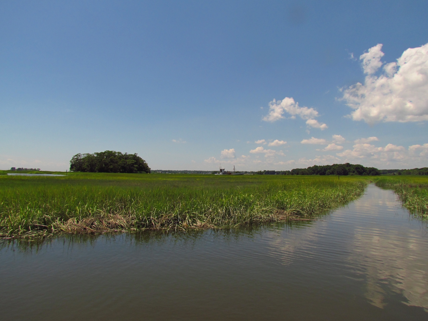
The morning comes cool and sunny and far less humid than it has been for a week.  And while those past days weren't intolerable, they were unpleasant enough to curtail or shorten my time in the unshaded salt marshes.
S and I put in at the end of Neck Road with a gently falling tide and a very pleasant cooling headwind coming out of the north.  It soon becomes obvious that this will be a good day for bird watching. Unseen Willets are calling out in force while adult Osprey watch over their young who are still unable to fly, but active enough to be up and looking around from the nest.  A couple of Roseate Terns are fishing the East River, whirling and swooping, diving from 15 feet high for the catch.  They are remarkably nimble flyers.  With the tide part way down, the mud banks aren't showing, but the tall spartina - spartina alternaflora is dominating the view.  We flush Willets, unseen until we are just a few feet away, from the tall grass.
Just after passing under the stone arch bridge we spot a Yellow Crowned Night Heron.  It is the first one that I've seen here this season.  It is more common near our home where there is a nesting colony on Charles Island.  It stands in the shade and watches us closely until we are headed away.
Yellow Crowned Night Heron

We run out of water just short of the Gravel Flats.  A line of silt clouds in the water track a swimmer...I spot the shell of a snapping turtle just before the stern of the canoe rubs over it.  That does no harm, just makes it move off a bit faster than it intended to do.
Our return is no more or less than our paddle in was...bird sightings a constant, a cool wind behind us mostly, in our faces on a few meanders, the Roseate Terns closer to the sea where we had left them.  It was one of the most pleasant canoe days that I have had in recent memory.

Tuesday, July 3, 2018

Contrasts

It is exceptionally still and the ripples from setting the canoe in the water radiate out and don't fade away until they are more than a hundred yards out.
I head up and round the top of Pope's Flat and follow its west side downriver until crossing the channel over to the other spartina island of which I can never remember the name.  I spot 4 Willets.  I don't remember seeing Willets out here.  The government has been performing phragmites control...eliminating large patched of the dense invasive reed.  Willets nest in grasses where they have long uninterrupted sight lines.  They seem to keep their distance from trees and other vegetation that can hide predators.  Removal of the phragmites so that the native spartina can thrive creates additional nesting territory.  In fact, phragmites only supports 20% of the species that a spartina salt marsh can hold.
It is steamy hot with a thick layer of translucent cloud that acts much like greenhouse glazing.  I shoot some photos of the old coal plant noting in the eyepiece the contrast of the monolithic structure to the low marsh islands with their dark brown banks and green tops. 
Swans at the top of Wheeler Marsh
I turn back at the top of the Wheeler Marsh.  It is low tide and much of the marsh is impassable, even for a canoe.  I also want to beat the sun as it is starting to burn off the clouds.
I spotted 3 Great Blue Herons, 4 Willets, 3 Black Crowned Night Herons.

Monday, July 2, 2018

Hot Day


It is a hot day and although I am not starting particularly early, I should miss the peak temperatures.  The tide is low and rising when I set the canoe into the river.  Two bird researchers launch just before me.  They've been here on my last two trips counting one species or another.  I suspect that they are looking at Seashore Sparrows.  I've been told that there are some others watching Clapper Rails. 

I head up the East a short ways and then veer off into a sinewy natural dead end channel.  It goes quite a ways and I'll have to come back at high tide to see how far I can get.

There is nothing out of the ordinary to report.  Osprey and Willets are doing the appropriate things for this time of summer - watching nests, and the Egrets are feeding - their nests are a long ways off somewhere. 

I pause wherever I find shade to sip from my water bottle.  The edge of Cedar Island works...and each of the bridges. 

I find a shallow pit and a "drag" trail on the mud bank just up from the rockpile in the Big Bends.  I'm not sure what it is but I suspect that it might have been made by a snapping turtle.

Maybe a snapping turtle track?
I turn back when I get to the stone arch bridge.  I could go farther, but the heat makes it less appealing.  The return is more comfortable as the tailwind that had been pacing me is now blowing across my skin.

At the Sneak I find enough water for passage, so I do.  Willets scold me as I near their nest sites in that narrow meander through the middle of Ox Meadow, but I'm gone quick enough and they return to their watch.  An Osprey on one of the conservation easement signs lets me pass within 30 feet....and lets me shoot several photos.

Friday, June 29, 2018

Art Party

I pick my friend JR up at the train station and we head directly out to the East River. 

The tide is high when we get there.  J, a professional fishing guide that I frequently furn into at the launch is there practicing his casting.  As JR and I paddle off up the Neck River I tell her that it's weird that J doesn't know much about birds, but then again, I don't know anything about fish.


JR keeps leaves her camera in my waterproof pack...thinking that she would prefer to soak it all in rather than interrupt the experience with the camera.  We talk about this for a few minutes as I often skip over good photo opportunities because the moment is just too rich to gum up.

As we paddle I teach Salt Marsh 101, with brief lessons about Willets and Ospreys.  Osprey young are showing themselves in the nests.  Their not big or bold enough to be up standing on the edges of the nests, but they are putting their fuzzy heads up high enough to look around.  The Willets are doing their usual thing, warning others as we near and scolding us.  They should have young in their invisible nests.
Oyster boat working the East River
We head up through the Sneak and back into the East River and just keep going passing out of the salt marsh and into the cattails and then into the forest.  We go a bend past Foote Bridge before turning back. 
Old Dams 101, and Introductory Course

I take JR on one short side trip up to the old sawmill dam.  I teach Old Dams 101...Connecticut is good for a full degree in Old Dams, but this one is a good introduction, built in the 1850's, a low efficiency undershot design that could only function seasonally as its water supply is a trickle of a stream that can be easily stepped over without getting ones feet wet.

And we paddle on, talking about art, art projects, and art problems, and catching up on a year that has passed since last seeing each other. It is something that the canoe does exceptionally well.


Wednesday, June 27, 2018

Three Rivers

I put in at the top of the big river, another comes in from the west, and another comes in from the east.  To me it geographically makes no sense...two rivers meet and they both end while a third begins.  It's the meaninglessness of naming natural features.  It's as if people were giving names to rivers before knowing where they went and what they connected to.
Yantic River
I head east up the smaller river.  It is a short trip, less than a half hour, until I reach the falls, a cascade through a narrow rock cleft about 35 or 40 feet high.  Ten feet of old stone diversion dam at the top of the cascade converts it to 45 or 50 feet.  The diversion dam channeled water into an old brick mill on the north bank, which itself has been converted into apartments.  It seems a nice place to live, on the banks of a heavily forested river at the base of a cascade.

I return and pass my put in heading up the other river.  It leaves the town behind soon enough and becomes a fairly broad and calm river cutting through the eastern hardwood forest.  This river is more industrial, or I should say, was more industrial.  Arched brick and stone outflow channels show where water was returned to the river after turning the machinery of silenced mills.  Sometimes, all that remains is the outflow tunnels, the mill buildings gone from the landscape. 

Sparse but large boulders in midstream herald the coming of a shallow and swift rock garden, which is passable by watching and carefully keeping to water that is deep enough for a full paddle stroke.

A very large mill appears...looms...on the left bank.  Four or five stories tall and a couple hundred feet long it is roofless and abandoned.  The wall facing the river has tall glass block windows...more than half the wall is glass block windows.  At the base are six outflow tunnels.  I pass by and continue on up to within a couple hundred yards of the Greenville dam.  It is typical of big river dams in Connecticut.  The state still has over 4000 dams. 
Most are small containment structures or seasonal diversion dams to power some mill that operated only when there was enough water.  Of those 4000 dams, only 4 were designed for hydroelectric power.  The Greenville dam runs a small "modern" generator, but it originally diverted water into a side canal that fed mills along the river...turning their machinery by turning water wheels.  That big glass block walled mill had several water wheels inside running its machines. 

The Greenville Dam
Spanning the river, the Greenville dam looks to be no more than 20 ft. high.  The trade off for electricity versus the ecological impact of stopping fish passage is not there. 

On my way out I stop to explore the bank near the mill.  I collect a check writing machine that fell not to far from where it was used. 
I manage to get about 75 feet up into one of outflow tunnels. 
I could poke around in this area some more....must return.


Friday, June 22, 2018

A Twofer

I start out on a section of the river that I've only barely paddled.  It's at the top of the reservoir and from here it is about seven miles up to the section that I am familiar with.  My last trip here, the reservoir level was down and so there was a strong current at a spot 10 minutes up, where I turned back.  Today there is almost no current and to start with the river is wide and calm.
Typical of the lower section
It seems that few people come through this stretch.  And, as I get farther in that becomes more apparent.  There are some downed trees, most of which I can maneuver around or under, a few that I have to step and drag to cross, but I only find one snag that has been sawn.  The section is all forest with a wide buffer of bottom land shielding the river from development.  I spot a few large Great Blue Herons, which always look record size when they are flying among trees. I turn back after 45 minutes (maybe 2-1/2 miles).   The river is beginning to be more choked with deadfall and I left my saw at the car.  As I paddle out I surprise the roundest fattest beaver that I've ever seen.

I move up to the top of the Great Swamp and put in again.  I've been here many times and the water is well down, the river narrowed to a boat length or less in most places.  But, the going is easy with only a single deadfall to step and drag over. 

Not far into this trip I spot a mother mink and two kits on a log in the river.  Usually, a mink will dart off and then return out of curiosity to observe me.  Not this time.  She grabs one kit by the scruff of the neck and drags it at a run off of the log and into the brush.  The other follows closely.  I did not see them again.

I turn back from a beaver dam that is near the halfway point.  It is a 18 inch drop today.  The water on my last trip in here was high enough that I just coasted over the top of it without touching.


Tree Swallows


Monday, June 18, 2018

Data Collection Day 2

I put in near the sea and head up the Neck River to record man made features.  The Neck and Bailey Creek have corduroy road sticking out of the bank in several places and as it is one to two feet below the spartina surface, it has to be fairly old.  My uneducated guess is in excess of 100 years before present.

Waypoints
 7   Corduroy Road - eroding from bank with some having slumped into the water
waypoint 7
 8   Nine wood posts made of limbs - 3 to 4 inch in diameter
 9   Corduroy Road and 1 square 3x3 inch post.  Section of road is 15 ft long and made of 3" limbs
10  Piling Structure. rotting but large.  This is on river left.  Built of posts and sawn 3x8's
waypoint 10, 8x15x20 ft, about 8 ft tall.

11  Corduroy Road - 4 ft section.  Made of 8 inch wide sawn side slabs (sawmill leftovers) with
      curved side up.
12  Five posts in a drainage cut.  Starting about 20 ft from water and running to water's edge
13  Corduroy Road - 6 ft section made of saplings under 2 inches in diameter
14  Four posts - two are 5 inch dia limbs, two are 2x4 sawn.  This is on river left.
15  Corduroy Road - 2-3 inch limbs
16  Corduroy Road  30 ft section  4 inch diameter or less.  at the Bailey/Neck confluence
waypoint 18

17  More of #16 exposed in cut drainage ditch.  16 to 17 is 3 canoe lengths (45 ft)
18  Sapling corduroy road exposed in cut drainage ditch
19  Upper end of 18
20  Two short posts
21  Corduroy Road  - this extends upriver to the dike/bridge
waypoint 22 - dike/bridge (upriver is to right)

22  Dike/bridge - stone and wood remnants of bridge and or dike that crossed over creek to
      Ox Meadow.  From this point on upriver there are no more man made features.  It is possible
      that this structure prevented fish passage.  Some of the posts found along the river in this area
      show rope or line cuts that suggest that they were used for anchoring nets.  It is interesting that
      there are no "net posts" above the bridge remains.
2 Osprey chicks