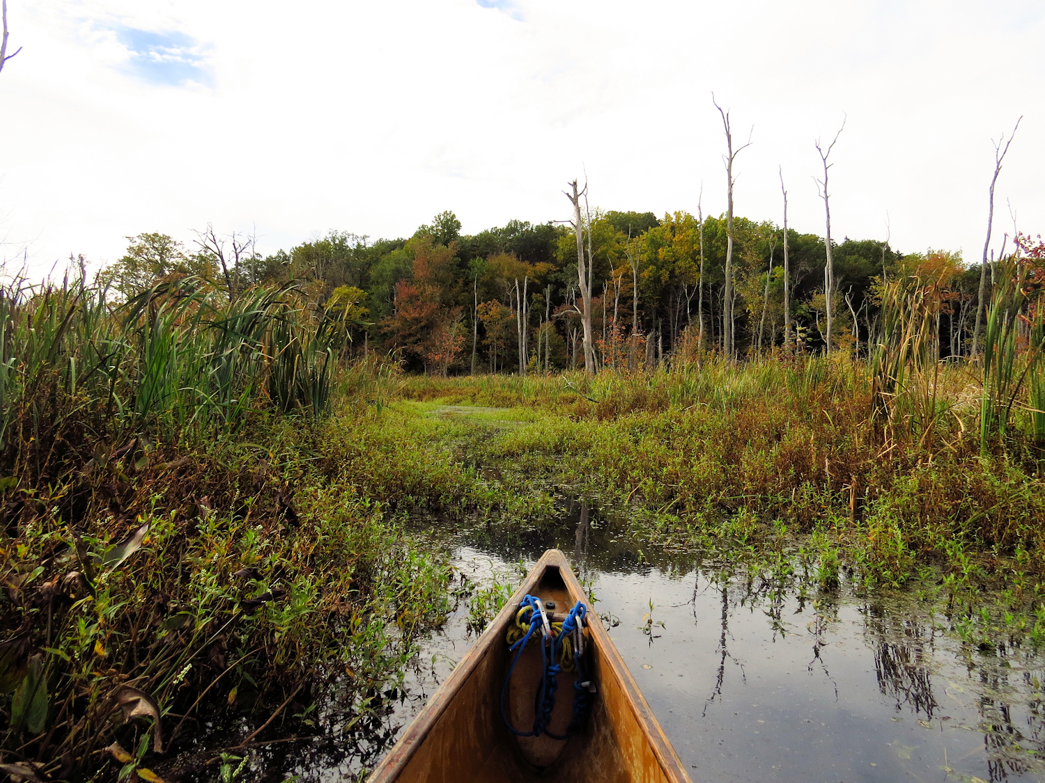
The first seconds. I've probably never mentioned the first few seconds. I set the canoe down in the water, then in goes my backpack, my camera box, and my spare paddle. These aren't the first few seconds. The river bank above the small single lane bridge is shaded, the trees still holding onto most of their leaves. No one else is around.
I step into the canoe, kneeling with my butt on the edge of the seat. A moment of calm comes over me. Whatever I was thinking about, whatever was in the back of my mind behind those thoughts, it disappears. There is no future, there is no past, there is nothing beyond what is in front of me. I suppose this to be what someone who is spiritually inclined might feel when they enter a temple or a cathedral. I hope that everyone can find a place that washes them like this. I don't know how else to describe it.
The tide is coming in. Even some four miles from the sea, the tide has reversed the normal current. It is going to be a very high tide, something near a foot above normal. At the first bend, the tide line can be seen on the shoreline brush, still two feet to go. I pass over the Gravel Flats without any hint that they are below. Two Kingfishers.
The cattails yield at the first bridge. The water below the bridge is brackish. Still three miles from the sea, I would not expect it to be too salty, but it must be just enough that the cattails can't make it. Spot a Harrier, but then it flies up high, not acting like a Harrier, and probably some other medium sized Hawk.
Eight Yellow Legs on the downstream point of the island in the middle of the Big Bends.
An immature Little Blue Heron standing on the junk docks. It is a surprise and seems late for the year. I wonder if it is a Snowy Egret with dirty feet, also a bit late for the year. I check my out of focus photo later - it is definitely a Little Blue Heron.
Below the railroad bridge, I do not need to follow the river or channels. I take the side sneak over to Bailey Creek, flushing sixty Ducks. About ten are Mallards, the rest being Black Ducks. This corner of the marsh is a no hunting zone, being too close to a house and the railroad tracks. Generations of Black Ducks seem to have figured this out. I will spot more Black Ducks as I go through the marsh, but it will be in twos and threes, not dozens.
I leave Bailey Creek, and cut west across the marsh, passing Cedar Island, crossing the East River, and taking an inlet until I leave that, paddling across the spartina flats to the Guilford boat launch. When I pass over submerged pannes, I note that there are dozens of tiny crabs scurrying away fro the shadow of the canoe. I think they are fiddler crabs. I am more used to seeing them on the banks, where they retreat into their burrows.
I get back into the East River at the boat launch. The current is still zippy, easily 3 mph upstream. Soon enough, I leave the river again and head cross country back to Bailey Creek, then through the Sneak, and upriver. The current doesn't go slack until I've passed Clapboard Hill Bridge.