Thursday, July 29, 2021

Night Herons

I put in at the marsh with near perfect timing.  I just needed a head clearing trip, a short loop around the nearest marsh was the idea.  It was windy and the tide was low but coming in, so I started at the rougher wildlife refuge launch.  As I said, my timing was spot on and I avoided an ankle deep mud slog by about 15 minutes and instead just stepped into the canoe with nothing more than ordinary wet feet.

There is a pretty good wind, maybe 15 mph steady, but with the low tide there is plenty of tall spartina to hide behind.  I head around clockwise.  


Within the first quarter mile I have spotted two dozen Night Herons.  Most of them are newly fledged juveniles, a mix of Black Crowned and Yellow Crowned.  To tell the juveniles apart one has to focus on details a bit more than I care to.  The adults are easy.  There are several Great Blue Herons, Great Egrets, Snowy Egrets, one Oyster Catcher and a ton of small Sandpipers.  I imagine that most of the Egrets are dispersed throughout the marsh.  The Night Herons seem to be congregating in one corner and I suppose it is a defensive tactic for the young birds.  
Juvenile Yellow-Crowned Night heron

I find six Osprey close together  at the tip of Milford Point.  They are all adults and with the tide coming in fast they are all probably taking advantage  the resulting good fishing.

I head downwind and with the current through Nell's channel.  The upstream Osprey nest has two young birds perched there with the parental units nearby. At his point in the fledglings development, they are nearly identical to adults, except that they can't fly.  Once they start flying you can still identify the young for about two weeks as they don't fully spread their wings and they tend to goof off.

By the time I'm back to my start point, I've totaled three dozen Night Herons and add a last minute immature Bald Eagle.

Wednesday, July 28, 2021

The Edge of the Forest

I am overdue for a trip on the East River, but today's tides aren't cooperating.  I head inland to bigger water on one of the big rivers, a plan to do more paddling and less wading.

I start well back up in the cove.  There is some wind but it feels good on the skin and will be welcome as the day warms.  The scent of warmed fresh water - that mix of green stuff that rises up from the sum warmed surface.  It's a smell that takes me back a long ways.

Once on the main river, I cross over and follow the shore closely, my line coincides with the reach of the forest.  I learned through all this canoeing that most of the good stuff happens at the edges - where the forest meets the marsh or rivers, where the meadow meets the trees, where a cliff overlooks the landscape, etc.  Those meeting places are where the most diverse animal life will be found.  But, "life is at the edges" works almost everywhere.  It works in art, science, engineering, and culture.  The most interesting place to be is where contrasting things meet.

I follow the forest closely.  Peering uphill into the eastern hardwoods on the chance that I will see something while knowing that something in there will be watching me pass.  I am not so much looking into the forest as I am looking into myself.

Sightings: Several Great Blue Herons, dozens of mallards that are either molting or too young to fly, 3 Bald Eagles - 2 immature, a weasel, a couple Kingfishers.

Friday, July 23, 2021

Exploring

The little creek (Falls Brook) has been on my list for a while.  I'd gone a little ways up before and it showed some promise, it just needed high water.

I put in at the Ely Ferry Road talking briefly with a guy who'd brought his dogs down to the beach.  Just as I got started Admiral Mimosa steamed past in the PT-73 throwing two and half feet of wake my way...summer Friday on the big river.  Fortunately, I only had a half mile of big river before heading back into protected waters.

A tiny cement bridge - more of a culvert from my point of view, took me into a large pond. The next bridge was low enough that I had to lay down in the canoe - my high water timing was accurate.  From there I headed up the creek, a clear channel through a hundred yard wide wetland which in turn was bordered by forest.  It is quite a good paddle.

After a half mile or so, the creek braided a bit although the main channel remained obvious.  A  hundred yards of that and in brushed in.  But I could hear running water, so I pushed through.  The sound was water filtering through a well maintained beaver dam some two feet high. 
First dam

I crossed over the dam into a small pond and found a second dam at the head from where I could see a condemned one lane concrete bridge.  So, I crossed that dam and paddled up to the bridge to see what laid ahead.  The beaver lodge was on the far side of the dam, but unfortunately there wasn't canoeable water in the upstream marsh. All in all, it is a pretty good side trip.


Second dam
Back at the cove with plenty of time left, I headed deeper into the cove for a visit to Eight Mile River.  Normally, there is a current at the Joshuatown Bridge, but the high water had the river backed up, deep and no current.  It was an easy flat water paddle up to the white cabin where the river makes a sharp ninety degree turn.  The water above was fast and shallow as it always is.  With that, I headed back out.

Thursday, July 22, 2021

Beaver, High Water, and Beaver

The Connecticut River was still in a freshet with the Hartford gauge at 12 feet.  It was another day to go explore one of the tributaries as the lower ends of those rivers are backed up with high water.

I put in at the old tavern launch.  The river is well into the trees but with no current.  When the Connecticut, a few miles down river, is high it just backs up the bottom of the Mattabesset.  Last time I paddled these conditions I went upriver, so this time I set out downriver for the Coginchaug.  

Soon enough, curiosity drew the canoe off into the trees and I began looking for shortcuts across the broad meanders.  The forest was about three feet deep in water and I continued through to push into the marsh grasses. There was more than enough water and forcing through the grass was the only work.  After a couple hundred yards I got into some grass that wouldn't yield so easily, so I backtracked to the river.

The first sighting, other than Great Blue Herons, was one of the largest beaver that I've ever seen.  It was huddled a few feet above the bank and I looked at it for more than a few moments wondering if it was a large dog or the back of a deer. 

Then it turned its head to eyeball me.  The head and neck were almost as big around as my thigh and I figure it weighed 30 pounds or more.  With the high water, the lodges are all flooded, so the beaver have been camping in the rough for several days.  I'm unaware of any lodges in this area, so it either has a bank burrow or a lodge farther back from the river. I moved off without leaving it to continue basking. 

A third of a mile downstream is the Tepee Lodge.  Only a foot of it was above water, which gauges the river at five or six feet above normal.

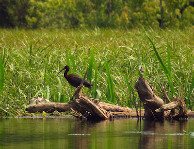
I passed through the large open marsh noting that there is no pickerelweed (which is blooming now) in sight...it's submerged.  Then I headed up the Coginchaug.  High water makes the narrow, forested Coginchaug a treat because you can skirt the blow downs.  I spot one beaver on the way in and it tail slaps me.  A large bank to bank blow down stops me before the usual high point (where the river gets bony, fast and pointless).  I head back out and turn upstream toward my start.  I spot a Glossy Ibis on my way through the big marsh.

At the Tepee Lodge I stop to check and see if it has collapsed or if it is at full height, and it seems intact.  Then I get two tail slaps on the another side of the river, which is also the primary feed zone for this colony. 

One of the Tepee Lodge beaver
It's three beaver, but I spot only two - they are idling in the water keeping an eye on me.  Then, I notice that there is a bank burrow behind them.  That's something new to me.  In my experience, it's really too close to the Tepee Lodge and I wonder if the colony has gotten tired of being flooded out and built a new lodge. 

New bank burrow in Tepee Lodge territory
When I get back to the put-in, I keep going just because there is no reason not to. This is the sixth day in a row of canoeing and even though these are day trips, the rhythm of a longer tour is kicking in.  The high water gets me above the highway bridge without wading.  Then I feel like returning.

Five beaver and a Glossy Ibis...a good day.

Wednesday, July 21, 2021

High Water

I friend up in New Hampshire reported a big storm blew through yesterday.  A more local river gauge for the Connecticut showed it dancing right at flood stage.  That is a lot of water for mid-July.  The current on the big river will be moving pretty fast today, but that high water means that the back channels and tributaries will be high and backed up with water, which is opportunity to explore narrow and shallower small places, if you can get to them.

I put in at Pilgrims Landing and head up into Lord Cove.  The water is definitely high with the tiny beach completely under water as are the first few rocks that like to reach out and bump canoes.  The sky is still hazy from western forest fires, it would be clear blue sky if it wasn't for the murk.  

After crossing Goose Bay I take the first left hand channel, a long big loopy detour.  The phragmites eradication that the government performed a couple years ago is really showing payback.  Of course, the invasive non-native phragmites are gone, but now there is a bumper crop of cattails with the sedges, reeds and wild rice that should also be here.  It is quite lush.  The other thing I notice is the huge number of Marsh Wrens.  I don't actually see more than a couple - they kind of hover up into the air for a second and drift back into the cattails - no, this is an audible count.  They are singing from all directions.  Marsh Wrens can nest in phragmites, but I bet they much prefer cattails as the cattail spears are a favorite in their woven ball nests. Visually, the bird count is Redwing Blackbirds, Great Blue Herons, Cormorants and Osprey, in that order, but the Marsh Wrens outnumber them five hundred to one.

I continue up and around the west side of Coutes Hole and then north.  I try a couple inlets before a long dead end tunnel through the cattails takes me to within fifty yards of the Ely Ferry Road.

Every channel looks the same

On the way out I paddle over to check the Eagle nest.  The young have fledged and the nest is unoccupied.  Then around the next point and over to the little bridge, then follow the east shore out.

Tuesday, July 20, 2021

Little Blue Herons

I left the house without a plan.  I veer off the interstate making a snap decision when I cross over the Menunketusuck.  It's been a long time since I was in there.

It's not a long river, but if you take in the two meandering side channels that feed into the main river, it makes a good day trip.  I start by heading upstream.  A mile up is a dam with a good long pond above it.  The last bit is a nice forested section that almost makes up for the background highway noise.  But my real reason is to see if there is any chance of a portage into the pond.  Unfortunately, the one side where one could portage is fenced off.  That's that.

I head back past the put-in, past an Osprey nest with two healthy chicks, and around the first big bend - that's where the river gets good.  The few houses are left behind and I enter a high salt marsh of spartina patens - "salt hay".  I learned something about Willets here, because there are never any Willets in this first section although everything is right for nesting except that the forest is only about a hundred yards back.  Forests and the trees at the edge of the forest make a Willet's ground nest an easy target.  There are a few Willets in the marsh, but they're down a ways where the marsh is wide open.

The air is hazy, which is holding the temperature down some.  It looks like humidity, but the weather report later says that it is haze from western forest fires.

One of the old shoreline cabins has been removed.  The wildlife refuge has been buying properties on the east side.  There's just one more old house to go.

Great Egret
I turn up into the east side channel.  There are several Great Egrets in the area today.  I spot a couple Snowy Egrets and one Little Blue Heron that is in the middle of a phase change from immature to adult.  It's the first time that I've seen this.  It is half blue-gray, half white. The surprise is that the coloring isn't random but a distinct pattern with white bars on the wings...almost as if it was a different species.  I flush that bird and one of the Snowy Egrets several times as I paddle in and out of the side channel. They are making an effort to stay together.

Adolescent Little Blue Heron shaking its stuff


Two Little Blue Herons

I drop down to the railroad bridge spotting a couple more Great Egrets and an Osprey.  The current under the railroad bridge can really move during full flood or ebb, so this is far enough. 
Mature Little Blue Heron

On the way back out, I get to see the Little Blue Heron in the open on the bank with two Snowys, except the Snowy's are actually immature Little Blue Herons in their white phase.  Snowys and Little Blues are the same size but Snowy Egrets have black bills and bright yellow feet while Young Little Blue Herons have green legs and a bill with a black tip. While I am photographing them, an adult decides to show up. Now, I have four Herons in all the possible age phases.

Adolescent with two first year Little Blue Herons
 I leave them behind and push up through a few more Great Egrets to get back to my put-in.


Monday, July 19, 2021

Science Day

Eventually, I end up at the Salmon River.  I made an effort to get into a middle section of the Hammonasset but the only possible access required rock climbing with a canoe on my shoulders. Then, the main road to the Salmon was being cleared of a landslide from the recent storm.  As they say, opportunity is just a problem in disguise.

Pickerelweed close up
It's quiet and calm...really calm, like abandoned calm.  The Connecticut River is high, freshet is the term used around here. It's about 2 feet above normal, an opportunity to go into the swamps that boarder the cove.


I spot six Osprey.  They are all adults and anything resembling a nest is rather ramshackle.  I windstorm came through about three years ago and blew most of the Opsrey nests out of the trees, a fatal event for the chicks.  The adults built new nests right away but in different locations.  I expected them to enlarge them the next year and to start breeding.  Their efforts were somewhat half-ass.  This year, none of the nests are in any condition to hold eggs.  It's hard to say exactly what's going on other than that storm event had more effect than I would imagine.  
Beaver dam

My first stop is to check on a beaver dam that I spotted not long ago.  This dam is unique in my experience.  All other dams that I've seen are on flowage - they hold back a small creek or river to flood nearby land and form a pond.  This one is in the swamp (true swamps have trees) that forms a long spit separating the Connecticut from the bottom of Salmon Cove.  There is no defined waterway or current.  This dam was built to catch and hold high water events.  It's particularly interesting because they didn't have running water to direct their efforts, they just built a dam - long term thinking, especially if you think about how long this dam has to be to do any good.  I paddle up the obvious beaver swim channel, the top of the dam is just an inch or two above the current high water level. It's an easy crossing into the "pond".  I crunch through some dead brush that looks suspiciously like a winter food stash.  I get about a hundred feet before having to turn back.  Great beaver habitat, poor canoe habitat.  As I paddle back I see the well camouflaged lodge right next to the winter food stash and about 25 feet in from the dam.  I follow the dam south about a hundred feet kind of admiring the muddy manufactured shoreline.  I go back and cross the dam and paddle out through a rich bloom of arrow arum - an large arrow shaped leaf with a purple bottle brush flower...the bumble bees are happy.  Then it occurs to me that the muddy top of that dam was brand new - no plants growing in it.  The beaver raised the dam to match the most recent freshet levels.

Well camouflaged lodge

The mud is the raised top of the dam

I paddle a quarter mile along shore and tuck into the next swim channel.  There is a dam and lodge here as well and I suspect that this section of the dam connects with the previous.  Confirming that has to wait for autumn when the brush dies back.

The science done, I turn up the river.  There is almost no wind.  The clouds are almost dramatic - overcast with lots of different shades of gray, nothing that is too threatening.  I set my goal for the Leesville Dam.  I flush a Great Blue Heron now and then, but even the wildlife is calm.

It's a big word for me, but this is tranquil. 

The water is backed up to the dam and there is just a little current to contend with before eating my lunch and paddling back out.

As I paddle the south shore of the cove, I get surprised by an immature Bald Eagle.  It is 20 feet straight overhead when it leaves its perch...big bird.  There is a second immature on the last stretch to the take out.

Sunday, July 18, 2021

Bird Watching

We started later than usual, timing the trip for a low tide to catch the waders hunting from the exposed silty edges of the marsh.  I expected our start to be near slack tide, but there was still a fast downriver current, which I imagine had to do some with the amount of water coming through the Shelton dam, as we noticed on yesterday's trip.  We arrive at the marsh as fast as I ever have. I figure we were moving at about 6mph. More than the speed, we're surprised that there aren't any other boats in the area.  We joke about Admiral Mimosa and his wayward Mai Tai Navy.

Right away we are spotting Great and Snowy Egrets, Great Blue Herons and Osprey.  The Osprey chicks are standing up in the nests and will be flying soon.  They are close enough to full size that we can only tell the difference by watching their behavior.  

We head up the inside channel of Nell's Island.  It's low tide and a trip around the marsh isn't possible as the innermost channels drain out.  While we're poling through a short stretch of shallows, we retrieve about 200 ft of high strength fishing line that some nice fisherman has abandoned.  We spot a few Night Herons - not as many as the Egrets and GBH's.  The Night Herons might be juveniles but I can't be sure because I haven't been in here recently.  Anyway, they lack some of the vibrant colors that are typical.

We head up to the point and circle around adding a couple dozen more birds to the count, which we're not actually counting.  There are several Terns hunting for fish.

The poling section already has 3 more inches of water and as we head back the current gradually picks up, in our favor.

Wheeler Marsh

Saturday, July 17, 2021

High Water

We start at the Boy Scout put-in.  The portage is shortened by about 10 yards by higher water than I've ever seen.  This is the one "reservoired" section of the river that will run a current.  The two sections above are both larger while the section below is tidewater.  We turn upriver against a 2:1 current.  Our goal is to go up below the dam and play a bit in a short section of rocky class 1 whitewater, but I know the crux will come where there an underwater shelf that accelerates the current.  Besides the faster current at that spot, the shelf runs bank to bank with no eddies to rest in - you have to paddle right through it for about 75 yards.  We keep going because I'm hoping that water will have backed up enough to flood out the shelf... things you can't learn without looking.

In the last eddy below the shelf

A nice long eddy has formed on the river left bank.  This lets us take a breather and coast up to the fast water.  Then, we head out into the current and power paddle.  S thinks we're making headway, but you have to ignore the water and watch the bank.  We are making headway - about 2 inches for every paddle stroke.  I know this isn't going to let up - we'll be past the shelf sometime next week.  So, we veer off and ride the current back.

It's an easy downstream paddle.  The current is a bit faster than a fast walk.  It'll be a short trip as the Admiral Mimosa has ordered the Mai Tai Navy to set sail.  Three pontoon boats and some other flotsam pass by.  We wonder what marketing wizard decided to name a brand of pontoon boats, "Aqua Patio".  That just couldn't have helped sales.


Wednesday, July 14, 2021

Above the Water

Before I can get into the canoe, a large tree limb or tall dead snag crashes down unseen through the forest canopy  a hundred yards to my left. I know then that I have come to the right place at the right time.  I spot two Great Blue Herons tucked into the shade at the water's edge.

Out of the cove and heading down the main river, it is calm with an imperfect reflection of all that is above. The humid cloud fog overcast is reflected on the water.  The rocky shore is doubled to appear as a well built dry stone wall.  I would normally paddle close to shore under the edge of the canopy as if I was a forest creature, but out here I have the distinct feeling of paddling not on the water, but rather some ten or a hundred feet above the surface.  Gliding where no one else can go.

It takes an hour and a half to spot the first other person - a guy putting slowly about in kayak. It will be the only boat I see until I get back to my put-in.

The low water below and the extra runoff coming through the cascades stops me a hundred yards below my usual turn-around.

For the day I count at least 15 Great Blue Herons, 2 immature Bald Eagles, one mature Bald Eagle and a Kingfisher.


Sunday, July 11, 2021

After the Storm

July 9
Yesterday, the remnants of a hurricane twirled through the area dropping five inches of rain in 24 hours. But today the forecast was for light north winds, moderate temperatures and sun.

We put in near the bottom of the big river with a plan to explore some of the tributaries in the area.  M had requested that I take us to someplace with birds and it just happens that right across the channel from the launch is Great Island, which has about 30 Osprey nest platforms.  Great Island is pretty much, Osprey City. At this time of nesting season, the chicks are big enough to poke their heads up about of the nest and look around.  And at any time there are always several adults airborne within sight. Soon the chicks will be standing on the nest in clear sight and eventually starting to work their wings in preparation for first flight.

With a rising tide I steered us up the Blackhall River.  It's a small river with several shallows that keep all but the smallest motorboats out.  We spot a few Willets.  A Great Egret with a couple Snowy Egrets standing close together helps us to spot an adult Little Blue Heron that is mixed in with them. Adult Little Blue Herons are Egret-sized and blueish gray.  The first year Little Blues are white and you have to check bill and leg colors to differentiate them from the Egrets.

We paddle the full length of the Blackhall.  As we go it closes in on us and becomes more intimate, a bit more wilder, a lot less visited.  We push into the end of the marsh at its head until we are in sight of an impassable culvert.  It is the first time that I've seen a noticable current up this high, a product of yesterday's rainfall.  The extra effort to maneuver and push through some brush is driven by a lot of flowering plants - wild rose, pickerel weed and honeysuckle.  The cattails and arrow arum are also doing well.  The stillness of the high cattail marsh is holding the scent of all these flowers.
Unlike much of the country, we've been having a good growing season.  As we head back out we explore a few side channels.  It's a fine day to be poking around.

Back at the big river we turn upstream.  I expected to have a slack tide when we got back to the big river, which would help us make good distance and then, as the tide turns, carry us back to our put-in with the north wind at our back.  Instead we find a pretty stiff current coming at us.  I have to do some figuring on this phenomena, but it can only be the runoff from yesterday.  I check the river gauge later and confirm that upstream the river is running five feet higher than normal.  It's not a flood, but it is a lot of water and it just overpowered the usual reversal of current that the tide produces.   We work our way up to the Watch Rocks by hugging the shore and tucking into eddies.  Then we head into the short Duck River. It looks familiar to M, but I know she hasn't been here before because I've only paddled up here 2 or 3 times myself.  With that, we head back out and ride the current down to the put-in.