Saturday, November 30, 2024

A Chill in the Air

I put in at the Coginchaug site, mostly because it got me off of the highway sooner as all of the holiday travels seemed to be bound and determined to crash into each other, and a few of them have succeeded. My start from home was delayed due to a medium sized Hawk that was trying to flush a squirrel from an evergreen in our back yard. The cats found this especially entertaining, and I did not want to interfere.

The tide is coming in and with that and the recent heavy rain, the river is running at about a normal level. It is under 40F, mostly sunny and with a light cool wind. I came here because the weather prediction is for a gusty afternoon, and the Mattebasset is fairly protected from wind.


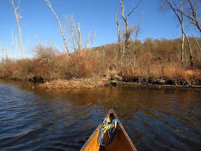
I head down the Cog- and turn up the Matt-.  I am immediately pleased that I decided to canoe today. It is a beautiful day with spectacular light. 
There is a Red Throated Loon in the open marsh. For me, this is a come Spring sighting as they take a break while heading south. This might be the first time that I've seen one in the Fall.

A report on the beaver colonies -
The Big Lodge is clearly abandoned and collapsing.
The bank burrow near the ruins of the Tepee Lodge is in use. 
Point Lodge is the star of the show. It is well maintained with lots of sign all around it. There are several trees partially cut, and a few more that have been felled.
Heading up from there, the last tree gnaw is about a 100 yards away. Then there is a gap of no sign for the next hundred yards, at which point there are numerous scent mounds - about 75 feet apart - maybe 8 or 10 total. The left bank, where the mounds are, is actually a berm between the river and a large open marsh. I suspect that there is a lodge back in that marsh, and these are the colony's territorial mounds.
The bank burrow at the next bend is in use with a few signs nearby.

I continue up another mile past the upper put-in, getting to the sandbar section. I turn back wanting some time to look up the Cognichaug. Spot 2 kayakers on the way down, and Outrigger Guy passes me while I make notes.

I get up to the powerlines on the Cognichaug, passing two new lodges, which although modest, look like they are in use. With that, I head back out.

Wednesday, November 27, 2024

Salt Hay and Mosquito Trenches

I set out on the East River from Foote Bridge. The sun is coming through a high haze of clouds, but it is definitely sunny. The temperature is about 40F and heading to 50F, and there is a moderate wind, supposedly out of the west. The tide has been falling for the last hour and a half and within the first mile, I will start to pick up the ebb current.  I flush six Mallards and six Black Ducks from Pocketknife Corner and fifteen migratory Canada Geese from the Gravel Flats. Just below the Flats, I spot a large bird flying up the river. It's a mature Bald Eagle and before it gets to me it turns away heading out over the East Woods.

Pocketknife Corner

The other day I went down a rabbit hole of aerial photographs of Connecticut, looking over the places that I have canoed to see how the land has been altered. The most interesting photos were the first series, black and whites from 1934. The photo of the East River Marsh was particularly catching. It shows that the marsh was trenched about a much as it could possibly be, sometime before 1934.

The East River to the left, Neck River at the bottom, with Bailey Creek
branching off between the two rivers.

I knew that the marsh had been trenched, but not to that extent. Curious about when this happened, I found a 1912 report from the Connecticut Agricultural Experiment Station on controlling the mosquito plague along the coast. Mosquitos were a big problem at that time and the majority of them hatched in the extensive salt marshes along the coast. (This is particularly interesting because I will paddle all summer long in the area without being bothered by mosquitos one bit). The East Marsh is a high salt marsh - it floods only a couple times each month, with the surface growth being mostly spartina patens - also know as, salt hay, a grass that stands about 8 inches tall. High salt marshes feature numerous shallow ponds, which provide habitat to crustaceans, food for birds, and nurseries for mosquitos. The trenches were, of course, for draining the surface of the marsh. The report also points out that by 1904, half of the states salt marshes had been drained for the purpose of farming spartina for packing, bedding and mulching material, at $7 to $12 per ton, in 1912 pricing. Draining the marsh increased the yield by removing the shallow ponds and by causing the ground to be firmer and easier to move machinery on.  In fact, the Neck River still has remains of corduroy road protruding from the bank, which enabled the farmers to get their hay to the river and loaded on boats. In the above photograph, the corduroy road is on the Neck River where it turns sharply up the image and goes a short way up Bailey Creek to where there is the ruins of a tide gate/bridge. The corduroy road is currently about 3 feet below the surface. In some places, the trenches cut through the corduroy road.  I haven't been able to find out when the trenches were dug, other than before 1934. It is likely that some trenches were originally dug for farming, and other for mosquito control. The mosquito trenches are deeper (24-30 inches) and longer lasting than the farming trenches. Some of the trenches in the photo are, at this time, easy to spot, while others have filled in enough to no longer be obvious.

In the Sneak
It takes an hour to get to the main salt marsh below the railroad bridge. There is still enough water to paddle the Sneak, which starts as a man-made trench and joins a natural tightly meandering channel, into Bailey Creek. But the water is still too high to spot the corduroy road. I follow the creek down to the Neck River, tehn over to the East River, and head back. The wind evens out the remaining ebb current that I have to paddle against.


Monday, November 25, 2024

Very Low Water

I set out from the bottom of Salmon Cove, which is one of my frequent trips. The plan is to check on the beaver lodges and the dam below the mouth of Dibble Creek.

Last night, the temperatures finally dipped to below freezing, but just barely. The only ice I will see today is in the bird bath in our back yard. It is sunny, about 40F by the time I get started, and there is a steady 10mph wind. That wind was supposed to be out of the west, but here it is coming straight down Salmon Cove - more of a north wind. 

New Lodge
150 yards out, I find a new beaver lodge. It has lots of fresh trimmed branches on the pile, and the extended entrance "hallway" that I've been seeing during the drought.   I add an unidentified medium sized Hawk and two mature Bald Eagles to that first 150 yards. The Eagles are perched on Haddam Neck with about a hundred yards between them. The second lodge on this side (river-left) looks abandoned. There are no fresh branches and the mound looks like it is collapsing in spots. Abandoned beaver lodges don't usually last too long.  After a year or so, if one didn't know it had been there, you wouldn't notice.

Bald Eagle pooping
At the top of the cove, I decide to do the side trip into the Moodus before heading upriver. But, I turn back while still in the mouth. Already I am in just 6 inches of water and I figure the tide has just about that much to drop before rising again. The idea of wallowing out of the Moodus some knee deep in mud does not appeal.

I cut across the top of the cove, picking up the deep channel and heading upstream. The low water from the drought and low tide makes this the lowest water level that I have ever seen on the Salmon, by a long shot.  I pull up at the mouth of Pine Brook. The shallows that are above the islands in this area are close to a foot out of the water. I know that I will come to a series of bars not too much farther on. It is time to call it a day and head out. This will be a high tide paddle until we get more rain.

Rock Pile on the outside of the bend

With the tide down, I am forced over to the far left side of the cove. The bottom of the shallow center of the cove is right at water level as far down as Dibble Creek. There, the deep channel swings over to the creek, but the mouth of the little bay where the creek enters is a foot above the water level. But, the low water has exposed a man-made rock pile. It is a fairly neat construction of cobbles and boulders, maybe a canoe length in diameter. I'd guess that it was built to hold a beacon. There is a similar structure just across the cove. I 'm not even able to check on the two huge lodges in Haddam Neck as I cannot get close enough to pick them out of the brush. Well, at least the Eagles are still here.

Wednesday, November 20, 2024

The Usual Route

I put in at the old stage ford, just a few feet above the old one lane bridge, and about four and ahalf miles from the sea. I paddled under the bridge and pulled up to shore, walked the 50 yards to my car and retrieved my saw. The deadfall arch just below the bridge has a new deadfall spanning the gap at the perfect height, about 3/4 of a canoe height above the water. It takes about 30 seconds to cut and drop it into the water so that I can glide over.

It is a sunny and calm day with the temperature almost to 60F. The tide has been coming in for about Two hours, but it is still quite shallow. More than anything, it is very quiet.


Reaching the Gravel Flats, I spot three white tail deer exiting on the right bank. I'm guessing that they probably waded the river. One of them gives me one last look from the top of the bank before casually leaping out of view.

By the time I get to Clapboard Hill Bridge, I have flushed about 30 Black Ducks. Just below that bridge I catch a glimpse of a large flying bird. My guess is an immature Bald Eagle, but it could be a Great Blue Heron - I just didn't get to see enough of its flight.

There is enough to get through the Sneak, so I can paddle my usual route down Bailey Creek and returning on the East River. I spot a Harrier working over the salt marsh between the two waterways.

A small shoreboard at the lowest Big Bend catches my eye. It's a Killdeer bathing with its mate about 10 feet away.

The low angled light at my back is making the trip back somewhat spectacular. At the top of the Gravel Flats I meet a guy in a canoe (as opposed to a canoeist). He's paddling solo from the rear seat, so the bow is pointed at the sky. This makes a canoe slow and tippy, but it all goes with the lack of a life jacket and general cluelessness about cold water paddling. I've never gotten anything but the stink-eye when talking to strangers about basic canoe safety, so I let it go. 


Thursday, November 14, 2024

A Rare Naugatuck Trip


After a week of showing and driving artwork around, I finally have time to put the canoe in the water. I put in from O' Sullivan's Island, which lies at the confluence of the Naugatuck and Housatonic Rivers. The tide is unusually high, and while it is an hour past down where I paddle more often, this far up the river, with the lag of some 10 miles, the river height is probably peaking. In fact, O' Sullivan's is just barely awash in many places that would normally be a foot and a half above the water at high tide.

Witness the new glow in the dark drysuit.


It is 40F and the water is in the upper 50's. Today marks the first day of winter paddling - it is the first day for me to put on my drysuit, which is brand new after trading in my old suit after 11years and some 400-500 days of use.  In Connecticut, I can paddle most of the winter and I am in a drysuit from November until sometime in April.
The brush pile hides a beaver bank burrow

I head up the Naugatuck. I've only gone up the Naugatuck a coupe times before. The right side of the river is a 30 ft tall boulder levy that was built after a huge 1955 flood. It isn't much to look at. About a mile up, the river has a short section of shallow fast water that stopped me in the past, and with the ugly levy, working around it wasn't worth the effort. Today, the tide has flooded the fast water out, and the upstream paddle is easy. Just short of 2 miles up, the river goes shallow. I spot some beaver gnawings, but no place that would work for a lodge or bank burrow. Then, I cross over to the far side looking for a deep channel, but there isn't one. At any normal high tide, this would be a gravel bar with the river trickling through. There is about 300 yards of this before reaching a bank to bank ledge, some 2 feet high. But, there is a bank burrow on a small island just below the ledge. There is at least another mile of river above the ledge until reaching a dam, but without doing some reconnaissance, I can't justify the portage. Also, in a half hour, I would have to portage the 300 yards of gravel. Time to retreat. 

I get back to my put-in and continue up the Housatonic. I spot a few Great Blue Herons and my first Bufflehead of the season. I go up as far as the island below the Shelton Dam, and return via the other side of the river.


Thursday, November 7, 2024

Observations

I start out from the put-in off of Route 3, the paving job that was being done in the lot having been completed, finally. The water is the lowest that I have ever seen, even considering that the tide is out. It has been a long time since we've had a good rainy spell, and all of the rivers show it, but especially the smaller ones like the Mattabesset.  

I suppose that most people might avoid this spot with the low water. But, I know that I will get to observe riverbanks that are seldom exposed as well as getting a good look at the bottom of the river in places that are usually too deep for a view.


I wanted to make another check on the beaver colonies in this river. Last years three floods encouraged some of the colonies to move out. The first lodge, coming downriver, is before the bend above the goat farm. At first look, it doesn't look used, but then I spot a fresh stripped branch in the pile that covers the entry tunnel. Below the bend, I spot a couple scent mounds and a couple of recently gnawed trees. 

As I continue, I note several old entrance tunnels in the bank, the lodges long gone. 

The Point Lodge is occupied. While the lodge doesn't show a lot of recent work, there is a fresh brush pile over the entrance tunnel and a couple of recently gnawed trees nearby.

Across from the Tepee Lodge site, the exposed bottom is covered with quite a few bricks. I've never seen the water low enough to expose the bricks. Bricks often have dates or a manufacturer's name, so I pick one up. It is not a clay brick, but a shaped stone cobble. While there is an old quarry a couple miles away, I have no idea as to why these were be deposited here, or how they got here.

The bank burrow below the former Tepee Lodge is more obvious. With the low water, the beaver have built brush piles that cover the exposed entry tunnel. In this case, the pile extends 8 or 10 feet out from the normal bank. There is a good deal of fresh green branches on the pile, which shows that the lodge is in use. 

I head up into the Cognichaug. The Big Lodge looks abandoned and as if it is slowly collapsing. The last flood topped this lodge by at least 5 feet, and the lodge itself was about 6 feet tall. There is no sign of activity, no peels, no gnaws or new cuts anywhere nearby.

I have some wind to work against on the way back, but that is one of the reasons I came here today. This river is well sheltered from the wind in most places.

Sunday, November 3, 2024

Nells Island Maze

M was long overdue for a trip, and by the time she arrived, the unexpected early morning wind had died down. We went to put in at the Refuge launch, but there was an sketchy idiot with a stalled truck...wait for it...parked at the water's edge of the rather steep and rutted dirt launch. He needed a battery jump, which I could not help with, and given the whole picture, I decided to put in upriver rather than run the risk of returning to find my car without a battery.  

The day was most excellent with clear skies, a very little wind, and temperature in the mid 50's. We headed downstream from beneath the high bridge on the last hour or so of flooding tide.

With the high water, it was time to show M the interior maze of Nell's Island. This time, we headed in on the most upstream entrance, which I had not before used. In about 200 yards, we came to a log jam that I remember, although from the other side. We took our time and pushed the floaters out of the way and eased over the main log with just enough water that we didn't rub. Then, M spotted a critter to our right, and we backed up to confirm it as a opossum hunched on some drift wood staying dry.  It definitely looked interested in staying dry, so we moved on. We managed our way up and out through the main entrance channel with just a couple of wrong turns. Tidal marshes fill from the outside in, as a sponge set it in water. Nell's Island does the same with a couple main flood/drain channels and a maze of others that don't fill/drain with much of a current.

We crossed the marsh to the east zigzagging through spartina islands and channels. Spotted a couple dozen Black Ducks, one Teal, a dozen or so Canada Geese. The Geese were migratory, being that they spooked from quite a distance. Then in and out of Beaver Brook, where we spotted some more Ducks and a couple of active Kingfishers.