Tuesday, July 30, 2024

A Reliable River

The humidity hits me the second I step out the door. For a couple days, we have very pleasant summer weather, but this morning feels like the day will become a cooker. I set out for the East River, one of the best day trip rivers in close range. 

I put in at the old stage ford. The tide is dropping, but there is still a good depth. If the weather report holds true, I'll paddle down river on the ebb tide and return against a lessening current with the wind at my back. There is no one around other than a dog walker that happens by just as I set out. The humidity is no longer any bother, it is exceptionally still and peaceful.

I duck the branches of a fallen tree and the show starts. After the first bend is the first Great Blue Heron. There will be five more before I get to the Clapboard Hill Road bridge. I spot a couple of Osprey and an unidentified Hawk crosses in front of me. Right now, most of the birds are perched, possibly waiting for the tide to expose more of the silty shoreline.

Exiting the last of the Big Bends, a juvenile Night Heron crosses the river. This is a less than normal sighting and I wonder where it came from. They are common near my house because there is a very productive rookery on nearby Charles Island. There are a good many Great Egrets and Snowy Egrets.


The water is already too low to make a pass through the Sneak, so I stay to the main river. I've walked out of the Sneak before, and it is no fun. Although the spartina is easy walking, it is a gut buster to get up the soft muddy silt bank. I go all the way to the Sound. There is an Oyster Catcher feeding there. Otherwise, a couple dozen Gulls, including one of the black-headed Gulls, although there are three different species that it could be.

I head back against the current with a light wind behind me. The wind does little other than take some of the heat, and it is getting on toward the predicted 85F.

The activity is all up in the forested section above Clapboard Hill Road. There are several Osprey in the air along with three Hawks. The Egrets are down at the water's edge stabbing at food. I clear the Gravel Flats without having to wade, but just barely. When I turn the last bend, I find a whitetail fawn wading in the river and looking back at me. After sizing me up, it runs a short stretch up river, crosses at a shallow spot and heads off into the trees. Meanwhile, a pair of Kingfishers make several dives after tiny fingerling fish that are schooling amongst the boulders and deadfall trees.

Saturday, July 27, 2024

Clear Water

I set out from the Eagle Scout launch on what I call Housatonic 2, the second reach above the sea. It is a nice day and I expect the water to be busy. This stretch is an old reservoir, the dam holding it back dating to 1878, which I suppose it is a fairly large dam for that era. Although it is over 600 ft long, it only holds back about 25 feet of water. Anyway, this stretch is only 5 miles long and mostly less than 500 feet across.

The obligatory Great Blue Heron photo

The first thing I notice is how clear the water is. Today, the bottom is clearly seen some 6 or 8 ft down, and if there is something of contrast, I can see farther. This is much different than the upstream reservoir, commonly referred to as Lake Zoar. A more modern dam holds back 60 feet of water in a much larger reservoir. I don't paddle there at this time of year as it is prone to nasty algae blooms and the water can be rather gross... definitely not clear. 

Being a small reservoir, Housatonic 2 has a small but constant current. In fact, if the dam keepers are trying to stabilize the reservoirs during heavy rains or runoff, it is work to head upstream from where I put in. In normal conditions, I would guess that a unit of water entering from upstream might pass through to the tidal water within a week. That current mixes waters from different depths, flushes the system, and keeps the water oxygenated. And, that keeps the water clear.  Lake Zoar, on the other hand, is stagnant. I've never perceived any current except at the very top of the reach. Blooms get started, the oxygen gets depleted, and the lake turns into skunk water, until winter comes.

I head up toward the Stevenson Dam. There are a few jet skiers out jet skiing, but there aren't any water skiers out water skiing even though the conditions are ideal. I spend about 20 minutes messing about in the easy whitewater about a 1/4 mile below the dam, getting in some practice catching eddies and ferrying back and forth in fast water. Then, I head back down.

Friday, July 26, 2024

Wood River Trip 3

I checked my records and M was clearly overdue for a canoe trip. 

Overnight the humidity dropped and the day came sunny with a nice breeze out of the northwest. We put in just above the Alton Dam for a trip upstream on the Wood River. This was my third time here, but the first time that I've brought anyone with me. This section of the Wood, from the dam to about as far upstream as I've paddled (2-1/2 hours worth) is quite beautiful and varied. Starting upstream from a pond edged with trees and a variety of New England marsh plants, it narrows to swamp and forested stream. Then, there is a short portage, another pond, more swamp and more forest.

In the upstream direction, there are some route finding tricks. In most rivers, these backwater dead end channels are devoid of current. But, this is true swamp, and the river flows through the shrubs and trees. Even though this was my third time here, I managed to wrong turn us into every wrong turn that I made on earlier trips. 

M spotted a few deer, which eluded me other than their tracks which were all over a nearby sandbar that we had to wade. We saw a few Osprey, a few Kingfisher, and one almost mature Bald Eagle. White pond lilies were in abundance as was the pickerel weed flowers, yellow pond lilies, and magnolia. We didn't see anyone above the Alton Pond other than a couple of lost fishermen in ridiculously large bass boat (they were stuck in the mud), and two people fishing at the Woodville dam portage.

We turned back a little short of the logjam portage that I crossed on my last trip. Next time I need to remember to bring my saw as I could have cleared a couple of spots easily.

Thursday, July 25, 2024

Shephaug

A hen Wood Duck with two Ducklings
 
I put in on Pond Brook. The day is overcast and humid, but the temperature is about 80F, so it is overall fairly comfortable. There is no wind, the water is glassy, and the slightest touch of the paddle on the canoe echoes back from the wooded hillsides. There are some large schools of minnow-sized fish and with the smooth water, I can spot them fifty yards or more away.

I head down and around the point and up into the Shephaug arm, a route that I am more likely than any to do when I start from Pond Brook. Distant trees have a gray wash - the result of the moisture in the air. I pass a couple of Great Blue Herons and go a full hour before seeing any other people. I reach the Shephaug cascades without seeing any other boats.

While taking a break, a motorboat comes into the last bend before the cascades. I've never seen anyone do this before. It is a good place to destroy a boat propeller due to a scattering of boulders that lie just below the surface. Anyway, he's just fishing and I follow him out from a good distance, and then pass him to leave him fishing for whatever he is fishing for. A light wind has developed. It is hardly worth mentioning except that it feels good on such a humid day.

I spot a mature Bald Eagle across from the private marina/park. While I'm checking a photo that I'd just taken, I hear a Bald Eagle call from a moving bird and look up to see where that Eagle is headed. But instead, I see a very young Eagle fly past. It's call is a hoarse whistle, much more raspy than normal. It is probably the fledgling of the mature Eagle. I know there is a nest back in the trees. I don't believe it is visible from the water, but I have heard the young Eagles squealing for dinner on past trips. The mature Eagle stays perched while the noisy youngster disappears into the forest.


Friday, July 12, 2024

Full White Bird Mix

I put in on the Menunketusuck River at the usual spot, a half mile below Chapman Pond and a couple miles above the sea. The tide is just starting to come in. There is a thick overcast and it begins to mist as soon as I settle in the canoe. It will mist and sprinkle almost the entire time that I am out. It is much more comfortable than living in the heat and humidity that would come with any sun.

An Osprey is perched at the first bend, and I flush a Green Heron at the second, which flies up and disappears into the tree tops. It is calm and still, and I do not expect to see anyone else.

The marsh is narrow in this upper section, 50-70 yards of spartina on either side of the river until it comes up against a hardwood forest. Near Opera Singer Point the marsh spreads out. A lot of birds prefer this area, probably both because of the distance to the trees and the better feeding due to the many small channels and pannes.

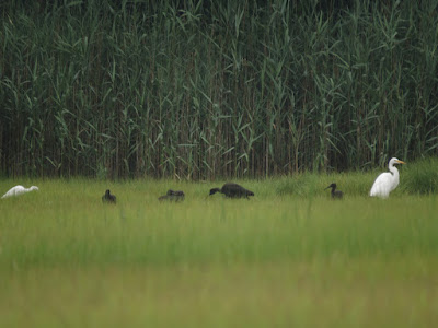
As I turn one of the bends, I find thirty some white birds on either side of the river. A few are Great Egrets - noticeably larger with a bright yellow bill, several are Snowy Egrets, identified by the yellow feet and black bill, and the others, perhaps half of them, are young Little Blue Herons - the size of Snowy Egrets, but with greenish legs and feet and without a pure black bill. One of the theories as to why young Little Blues are white is that they can mix with Egrets, a safety in numbers thing. There is one morphing Little Blue as well - its feathers patchy white and blue as it becomes an adult. 
Left to right - Little Blue Heron, Little Blue Heron, Snowy Egret, Great Egret

If someone told me that they wanted to see a Glossy Ibis or a Little Blue Heron, this is where I would send them. I don't know if it is real, but it seems to me that the population of Little Blues and Glossy Ibises has been increasing in this marsh. 

Little Blue Heron morphing to adult
In the tree above the abandoned opera singer's house is a mature Bald Eagle. I'll bet that 4 out of every 5 times I paddle here, there is an Eagle on that perch. The white birds are just far enough away that they would see and have time to evade the Eagle.

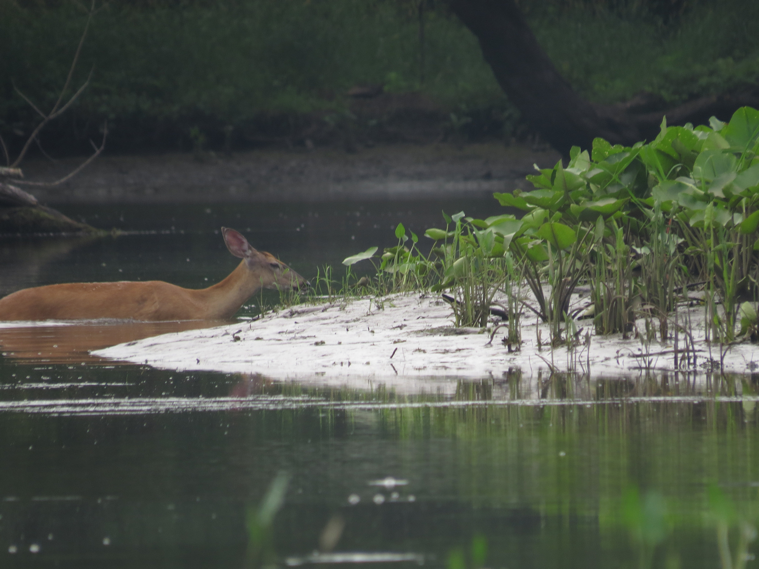
The tide is right for returning through the railroad underpass, so I head down to the Post Road bridge. There are four young and one mature Little Blues up in a some trees, and a couple of Great Egrets along the river. I spot a fox loping along the river near the Post Road, but it is raining too hard to pull out the camera.

On the way back, three Glossy Ibises fly past, one seems to be being chased by a mature Little Blue Heron. 

With a few more inches of tide, I can now scan across the broad spartina flats. I find four more Glossy Ibises on river left feeding in a panne with a few Egrets.

Thursday, July 11, 2024

A Fresh Wind

The day might become to warm to put the effort into going to one of my more distant rivers. It seems that being off the water by noon is a good plan. At least the humidity is down from yesterday's gas chamber conditions.

I put in under the highway bridge. Two Yellow Crowned Night Herons are immediately downstream. I usually don't see them until I get to the marsh, but it is no big deal.


There is a stiff south wind, 10 to 15mph, coming straight up the river. I might complain if it was 60F, but it is not, and after yesterday, it feels great, even if it is a bit of work to paddle into. The tide is all the way out and the top of the spartina is well over my head, so my view will be somewhat enclosed. I head down Nell's Channel, one of the few choices that I have with the tide out. I spot four old bottles as I make my way. Unfortunately, all of them are out of the sediment layers and just laying on shoreline silt. I collect three of them just because they are interesting. One has a molded divider inside. It reminds me of a yogurt container where you mix your own fruit into the yogurt. It might be a baby food jar. The second might be a dairy container - half pint with an old milk bottle lip. It is embossed with lots of identifiable details. The third is a Singer Sewing Machine oil bottle with the cork pushed inside. It is cracked from freezing. There are bubbles in the glass, so it's probably over a hundred years old.

Short Billed Dowitchers
There are a couple flocks - maybe 20 birds each - of Short-Billed Dowitchers, which would already be migrating south. They're about the same size as a Yellow Legs, without the yellow legs, and with a much longer bill. There are also quite a few turtles. I get spy hopped continually while writing my notes.

It takes a full hour to get to the bottom of Nell's Channel - close to twice the time it normally takes. I head back the way I came.

Tuesday, July 9, 2024

On a Contour Line

It is going to be a hot day and I don't feel like driving over to Rhode Island where I have been exploring some rivers that are new to me. I pick my place for the shade that I will get, at least during some of the trip. I put in on Pond Brook, back in the quiet sheltered cove that it has become. I'll head out and turn down river.

Before I reach the confluence with the Shephaug, I have spotted at least six Great Blue Herons. They seem to be preferring this spot just below Pond Brook. I spot a good number of fingerlings in the shallows along here. 

I take only one photo. I have taken this shot, or something like it, dozens and dozens of times. It is not because it is a particularly good setup. It is simple put, where I like to paddle. It is the edge - the boundary between open water and the forest, the line between light and shade. It is where the birds feed, where the animals come to get a drink, where the little fish thrive in the shallows.


I head downriver finding more shade than I expected. I tuck under the trees and follow the shoreline closely. It is not a natural shoreline. No matter how hard I look, I will not find evidence of an ancient fishing camp or even an old cabin. This shoreline is a contour line, one of those faint green lines on a topographic map that denotes constant elevation. The original river is some 70 feet down, with the old fishing camp, the cabin, the old trails and roads. There is a trail paralleling the shore for a short while, but it came after the dam. There is even an old stone wall that runs along the shore, but this is by chance as soon enough, it slips into the water. The shoreline is mostly cobbles and boulders, but it is not river rock. It might be the same geology as the river rock below, but this is glacial drift with the soil that held it for so long having been washed away. The glacier rounded it off and smoothed off the rough edges, but it hasn't been water polished and tumbled with sand like the stones in the old river bed. No one ever made a point of walking this shoreline until perhaps, the geologists, foresters and surveyors connected with the dam building came along. I think that I will plot my route on an old topo map when I get home.

I paddle down to the dam, losing the shade as the shoreline bends around. I cross above the dam and find more shade for my paddle back, crossing back over when the shade disappears.


Sunday, July 7, 2024

Low Tide Mattabesset

The river runs through freshwater tidal marsh and swamp, and the tide is all the way out. With the extra gradient, there is a current at the put-in that is rarely seen. I get an almost early start. The day will be humid with temperatures in the upper 80's, but it looks like the overcast will hold and there will be little wind if any.

Even with the nearby highway, the river is peaceful. No one else is around and it looks like I am the only one that has put-in, so far. The call of a Woodpecker comes over my right shoulder - probably a Flicker. A hundred yards in, I pass a Great Blue Heron and take the obligatory photo. This is good Heron terrain and I will see fifteen or twenty during the trip. 

Near the Point Beaver Lodge, I spot a Green Heron. It will be the only one today, and it will be in this same area when I return. The lodge looks like it might be in use although I can say exactly. We had three flood events last year that topped every known lodge in this section of the river. There is a noticeable lack of beaver sign - no cuts or peels, no scent mounds, no leftover feed sticks floating in the water. Each of the floods lasted about 2 weeks, and I suspect that the colonies moved on. Farther down the main river at Salmon Cove, the beaver responded to the high water by adding height to their lodges, but they were dealing with 5 feet. of water, not the 15 feet that the Mattabesset was getting.


There's a heavy growth of a plant that I don't recognize. I pause to take a look and realize that it is yellow pond lily fully exposed by the low tide. I did not know that the stalks were stiff enough to stand. I spot only a couple of white pond lilies today. The white lily is a floater and it may be that it doesn't do well in the tidal zone.

Yellow Pond Lilies

A muskrat crosses the river in front of me. 


As I round the point near where the Coginchaug enters, there is a young Bald Eagle. Its feathers are mottled - probably a 2 year old just moving toward the white tail and head coloring of an adult. It stays pretty calm and lets me take several photos. As I turn away, there is a whitetail doe swimming the river.

I head up the Coginchaug. It is running a bit more shallow and faster than the Mattabesset. The beaver lodges look abandoned and there is no sign. There are a lot of Kingfishers. In fact, by the time I come out, the Kingfishers will have outnumbered the Great Blue Herons by a good amount. Besides fish, they may be feeding on some bugs, there is a healthy horsefly and green head fly population. The other day, I saw a Kingfisher snatch a cicada out of midair, so it can be done. 


I manage to get to the first big log jam. I wasn't sure that would happen with the low water. Anyway, this is the turn-around point, as it is also the point of useless-to-continue being that there are more logjams and only a couple hundred yards of canoeable river above this.

I pass the Green Heron pretty much where I last saw it.


Saturday, July 6, 2024

Storm Trash

Morning brings a pair of thunderstorms that dump three quarters of an inch of rain. Afterwards, although the sky is a thick overcast and more rain is possible, the weatherman's radar shows that thunder is over for the time being. 

I put in from O'Sullivan's Island near the upper end of the tidal section of the big river. Here, the river is somewhat enclosed in a deep enough valley to give me some protection just in case the weatherman's radar missed something. The tip of O'Sullivan's is also the confluence of the Housatonic and Naugatuck Rivers.


As I paddle downriver, it is impossible to ignore the amount of floating plastic trash. The last time I saw this was also just after a storm that flushed the rivers. And, just like the first time, all of the plastic is coming out of the Naugatuck. The Housatonic is clear and not one single floater is visible, but the Naugatuck has dozens and dozens of trash items in near view. Note that this does seem to be a high water/storm related phenomena, so somewhere, trash is getting flushed.

The two rivers are quite different. The Housatonic doesn't pass through any large cities and I suppose that most of it's surroundings are either forest or farmland. The Naugatuck runs through a deep and rather scenic valley. And, it runs through series of old milltowns and one large and somewhat dilapidated city. It also has a major state highway sharing the bottom of the valley. I can paddle the majority of the Housatonic, but the Naugatuck is a different matter. The Naugatuck is shallow, fast, rocky. It's one of those rivers that when it is safe to paddle, it's too shallow to, and when it's full of water, it's a torrent. And. that is without considering that it just doesn't have many places to access it.

I would not be surprised if something like 90 percent of the plastic debris in this lowest section of the Housatonic comes directly out of the Naugatuck.

I paddle down to Wooster Island - an hour out, and return. I fill up the bow of my canoe with trash. It would have not, at all, been difficult to fill the entire canoe up to the gunwhales.

Friday, July 5, 2024

Into the Wilds of Nell's Island

It is the day after Independence Day. It should be busy on the water, but it is not. It's 10 o'clock and my car is the only one at the launch. The river is glassy smooth under a thick and humid overcast, The tide is an hour short of high. There's no wind.

I put in and enjoy the quiet paddle of the mile down to the marsh. With no motorboat traffic to be seen, I stay in the main river. Aerial photos of the marsh show a channel that zigzags through Nell's Island and I have wondered if it has enough water in it to get through. High tide is the time to explore.

Great Egret
Osprey are quite active at the top of the marsh, and as I edge along Nell's, Willets come out to scold me and warn everything in the marsh of my presence. The first channel I get to is about 30 feet across. It winds into the island but peters out after 300 yards. I return to the river and continue down finding a second channel in a couple hundred yards. This channel is at least twice as wide as the first and looks more likely. I expected to find a channel to follow with maybe with a few short dead ends. But, a hundred yards in it just blows up. I get up on my knees and can see that there are good open channels all around. It looks like a shattered pane of glass. One thing is for sure, this is where most of the Willets are nesting. I flush at least fifty while in here. As the channel dies out, I look around and find channels heading off in all directions. I paddle through a narrow bit of spartina and pick up a new trail, repeat, repeat...  I come out into Nell's Channel pretty close to where I expected, but not in the channel that I expected to. This is worth coming to in the future.
The wilds of Nell's Island

I spend the rest of the time connecting some of my favorite inner marsh routes. A few people are getting started from the marsh launch, but they are paddling the perimeter, as almost everyone that comes here does.


With the high tide, my eye is just a few inches above the tips of the spartina. the heads of Yellow Crowned Night Herons are distributed all through the green expanse. Great Egrets are also out there. I saw a couple of Snowy Egrets in the middle of Nell's Island. And at the central phragmites patch, two Black Crowned Night Herons. Twice I hear the scratchy scolding of what might be a Clapper Rail - once on Nell's and once at the central phragmites patch. If it was a rail, it acted like a Rail and stayed hidden. I've only seen them a couple times.

Willet
I head out and up the river. Even now, boats are just beginning to appear. The fireworks parties must have been ferocious last night.

Tuesday, July 2, 2024

Wood River, Trip 2

 This might only be my second time in this river. It does not take long for me to wonder why that is. 

I start at Alton Pond, just above the dam and about a 1/2 mile from the confluence with the Pawcatuck. It is an ideal day for canoeing, sunny and with temperatures in the upper 70's and a light wind out of the north. A wide and clear main channel runs through the shallow pond, a big S leading to the river. It is the start of wild flower season in the marsh. Pickerel weed started blooming a week or so ago and now it is all over. It will bloom for a long time as the plants don't all "pop" at the same time. The marsh bees are quite happy about this, working the blossoms as they would with a lavender plant. White and yellow water lilies are also in bloom as are several of the marsh shrubs.

Pickerel weed
After reaching the top of the pond, the forest gradually begins to dominate, overhanging and closing in. But except for a few short passages,the channel is plenty wide and always deep enough. I flush, and will continue to flush, a Great Blue Heron or Osprey every so often. In this terrain, I rarely see them before they take wing. I spot a muskrat swimming a good bunch of swamp grass to its nest. 

The portage at Woodville Dam comes after about 45 minutes of easy upstream paddling. As I finish the portage, I meet a guy putting a kayak in. He puts in at a different spot than I've been using. Aha! not only will this shorten the portage, but I won't have to climb over a metal road barrier anymore.

There is a short pond above the Woodville Dam. The river closes up quickly when you leave the pond. There is a short stretch here where the current runs through the shrubs and it is easy to get side tracked into a small channel with a running current that will close up into impassable brush. One wrong turn and I get back into the river. From here on up, this is a small river running through the forest.  I surprise a whitetail fawn that was resting on a small island. It leaps into the river and swims the narrow channel to make its escape.

Wrong turn

I don't remember much about this section. I don't even remember why or where I turned back on that first trip. Sometimes, increasing current makes the decision, and other times it is log jams that I just don't want to deal with anymore, knowing of course, that I have to re peat them on the way out. Well, the first logjam jogs my memory. It was a double - two logs where I stepped from one to the other while lifting the canoe over. This time I can end run it as someone has trimmed some of the upper branches of the offending tree. The current never builds to anything particularly bad. It is a 2:1 current at worst. I do a 30 foot portage around a second log jam and continue up to a messier tangle. 

The turn around logjam
At this point, I can here the interstate well enough to make out individual vehicles. I sour grape it and decide that if I wrestled over this log jam, I would be returning to it in pretty short order, and I am getting close to being 3 hours out as it is. Time to head back.