Monday, April 29, 2024

Time Travel - Wheeler Marsh

I put in under the highway bridge for a low tide trip through the marsh. Bird migration is at peak these days along the east coast and the Wheeler is a particularly good place to see a variety of birds as they come to stay, or come to feed before continuing north. It is already 75F by mid-morning and when I put in, the tide is a 1/2 hour past low and there is a light breeze coming upriver. I thought it might feel hot, but the 50F water is keeping it pretty comfortable.  

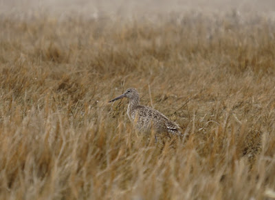
Right away, when I get to the top of the marsh, I start hearing and seeing Willets. When I was here four days ago, I didn't sight any. There are quite a few as I head down Nell's channel, although I can't see many of them. With the low tide, I am four feet below the top of the banks. One of the reasons to come here at low tide is because some of the shore birds will be feeding on the exposed silt shoreline.

I have been collecting old bottles from the cut banks in this marsh as a method of determining a rate of build up of the marsh soil. I've, so far, figured that it takes about 50 years for 1 foot of soil to build up. While I am paddling along the exposed bank, I reflect on the idea that my location is about 200 years ago.

Near the bottom of Nell's channel, just before it bends right into the main river, I spot a brown glass screw top beer bottle in the bank. It is 8 inches below the surface, and I carefully collect it. This is Wheeler Specimen 8.

Specimen 8 in situ

I take the inner exit for Nell's channel. At some low tides, this channel runs out of water, but today I have 8 inches to a foot of water. This route takes me right to Milford Point, where I find a good 200 Brants. Brants winter here, although not in these numbers. They are migrating north. I let the wind drift me past them, and only stir a couple dozen, and they only fly a hundred yards. Quite a bit different than how Canada Geese would respond. I find three Oystercatchers near the halfway point as I head over to the east edge.

Oystercatcher

I spot a small duck decoy up against a mound of spartina. When the canoe is about 3 feet from the decoy, it flushes, but settle down about 20 feet away.  Surprise me, or what.  It's not readily familiar to me so I have to look it up when I get home. (it is a male Ruddy Duck in winter colors. It is not migrating north, but west instead. They winter here, but we are at the northern wintering limit and I have only seen a few)

Ruddy Duck - male in winter colors

On the east side of the marsh, I find a large number of Yellow Legs. I've been seeing them in ones and twos most of the way through the marsh, but over here, they are constant sight.

Brants
At the top of the marsh, near the mouth of Beaver Creek, I spot another bottle. It is 22 inches below the surface with the old embossed federal law notification. -Wheeler Specimen 9.

Specimen 9

 I head out and upriver, spotting a small flock of ten Least Sandpipers just before leaving the marsh.


Friday, April 26, 2024

The Willet Count Increases

I returned to the East River, this time with S in tow. She hasn't been canoeing in several months and she was eager to visit the East River. We put in at the old stage crossing. It is sunny with temperatures heading to about 60F. There is a light upriver breeze and the tide will peak in about an hour and a half.

The forest section has less large birds than on my trip 6 days ago, when I saw 2 Eagles and several Osprey. However, we spot an immature Bald Eagle in the trees a few hundred yards up from the Clapboard Hill Road bridge. We find our first Osprey in a tree just downstream of that bridge.


The sneakier side channel off of the Sneak
In the middle of the Big Bends, we spot several Yellow Legs. There are a couple of large pannes in this area that the birds like to feed from. 

Below the Post Road bridge, we start spotting Willets. This is a signal that more Willets have come in during the last few days. On the 20th, my first Willet sighting was about a mile downriver. Below the railroad bridge, we head into the Sneak, then take the smaller sneakier channel to the upper end of Bailey Creek. We spot quite a few Willets. They seem to be in pairs, and they are definitely more perky than the ones I saw the other day. As we join back into Bailey Creek, we find another bunch of Yellow Legs, again feeding in a small panne.

Willet

We head down the creek and up the Sneak. S hasn't paddled recently, and this is long enough for her. The Willet count is probably five times what I saw just 6 days ago. The behavior is different as well. Some of them are engaging in territorial pre-mating activity - chasing and dogfights. The aerial dogfights are particularly fun to watch as the Willets are large enough to see at a distance as well as being fast and maneuverable. 

In the Big Bends, we spot eight Great Egrets and two Snowy Egrets all feeding from a panne on the inside of the uppermost bend. 

The rest of the trip is easy with the wind at our back. It has been an excellent trip during a spectacular day.

Thursday, April 25, 2024

Migration

I head over to my local salt marsh at the mouth of the Housatonic River. I put in under the highwya bridge, as usual, and head downriver. The tide is almost high, so the current is almost not there. The day is sunny with temperatures around 50F and a chilly 10mph wind supposedly out of the east, more or less coming upriver.

Pass three Osprey on the way down. At the top of the marsh, I flush several Yellow Legs and a couple ducks. I spot a mature Bald Eagle about a half mile away, over by Cat Island. The white tail, dark body and wing flap make it an easy ID, even at that distance. There's a couple Great Egrets over there as well, another easy call.

I head down my usual inner channel. I flush quite a few Yellow Legs, mostly in small groups of 6 to 15. It is a common bird here, but this is more than I usually see. They nest in Canada, so it is safe to assume they are migrating. 

Yellow Legs

With the high tide, the bottom of the marsh is fully flooded. When the wind in out of my ears, I can hear Brandt calls. As I paddle across the marsh, I spot a large flock of Brandts over by Milford Point. It might be a hundred birds, but it's tough to see them all at this distance. 

Because of the wind, and the high tide, I decide to head up through the center of the marsh. I start flushing ducks, and they quickly outnumber anything else that I've seen. It is a mix of Black Ducks and Mallards, with large numbers of small ducks. I never get close enough to ID the little ducks, but I suspect that they are Teal based on the coloring and size. I probably see a 150 of them, total. Some teal might nest here, but mostly they are going into Canada or the uupper midwest I spot two Swan nests - one not far from the refuge launch and the other near the central phragmites patch.

I cut across and go round the back of Cat Island. There is a new Canada Goose nest near the island's tip. I push a Swan out of the channel on the upstream side, but even better, that whole sunny and sheltered side of the island is loaded with singing Red Wing Blackbirds. With that, I head back upriver.

Tuesday, April 23, 2024

The Land of Not Knowing

Five minutes upriver, I pass under a railroad bridge. At this point, the nearest road veers away taking with it any vehicle noise. Fifteen minutes upriver, I pass three or four houses, built on what little high non-state land there is in this section of the Pawtucket. The river immediately turns sharply north, and I pass by a beaver lodge that still has a good stash of winter food in front of it. For the next hour, there are no signs of people other than a couple trails that come from who knows where.

It is a fine day - all sun with temperature heading from an overnight 39F to about 60F. There is some wind out of the south, but it doesn't reach the river in any steady fashion. The water is high, maybe two feet above normal and there is some current to work against. Much of the Pawtucket passes through the Great Swamp, and although different parts of the swamp currently have different names, I'll bet that originally, it was all known as the "Great Swamp".

Beaver Lodge on the right, food stash in center

The river is bounded by lowland forest, swamp (wetlands with trees), and a bit of higher land, which is probably ancient seashore sand dunes. Most of the trees are hardwoods, except for the sandy areas, where groves of sugar pines dominate. Sugar pines do well in sandy soil. Thick brush lines the river almost everywhere. With the water high, the swamps are flooded with a few inches of water. In these conditions, I'm not expecting to see too many large birds. Great Blue Herons for example, will be back away from the rive in the flooded puddles fishing for frogs and other little critters. I do spot a couple Herons, and that is just what they were doing. Big birds aside, there is a nonstop chorus of mostly unseen songbirds. 

Note the gnawed tree. The brush pile next to it covers the vent hold of a beaver's bank burrow

With the current, I suspected that I might not be able to reach the Burdickville portage.  Burdickville has a few houses, a road bridge crossing the river, and the remains of an old mill. In this case, the remains are a broken dam, a mill race, and a cast iron turbine that sits at the head of the race. However, the extra flow has created some long eddies which make it easier than usual to get up to the portage, which is in the bottom of the mill race. It's a very short portage - maybe 20 feet, but it is awkward climbing out of the channel with a canoe.

From here on up, the river will gradually narrow, and the current will gradually increase. I plan to turn at the confluence of the Wood River, but I can't remember how far that is. Just as the current really becomes onerous, I spot familiar terrain marking the entrance of the Wood River. I know well enough that the going will only get tougher beyond this, so I turn back after a short break.
All along I've been thinking about the contrast between my last trip, on the upper Housatonic, and this one. Through a camera's eye, the two rivers might not appear to be significantly different. That section of the Housatonic was new terrain to me, yet I found it predictable and rather boring. Here, I'm on water that is familiar, yet it never seems predictable. Up close, there are differences, of course. The Housatonic passed through forests and old pasture lands. The Pawcatuck is immersed in a great swamp with limited building sites and no real farmland. Emotionally, this river is one where anything can happen while that river had had its mystery removed.  Here there is the possibility of being surprised or being awed, there is always a reason to keep going. This is the type of land where our greatest legends and fairy tales come from. This is the land of not knowing.

The current whips me along and Burdickville shows up in short order. I portage the dam. It is runnable at this flow, but not a good idea when paddling alone. It is an easy quick trip out.


Sunday, April 21, 2024

Sled Dogs on the Housatonic

I wanted to see some new water, so I headed to the NW corner of the state to check out an upper section of the Housatonic River. It is cloudy with temperatures in the lower 50's and there is a light wind that seems to come downriver, most of the time.

The put in is just above Great Falls, which is, at least now, a hybrid waterfall/dam with a height of 50 feet. In 1833, an iron works factory was founded here, taking advantage of iron deposits in the area. It operated to about 1870.

I head upriver. There is a 2:1 current today, and I gather that the water is a little higher than in summer, but it is well down within the banks. The river is about 150 feet wide, and the first 45 minutes of paddling is a long bend to the left followed by a long bend to the right. The river is still 150 feet wide. 

The river is bounded by swamp and marsh, and pasture land, and it is located in a wide valley. If I was on a multi-day trip, this would be a good enough section of river.

So, here's where the sled dogs come in. A key trait of a good sled dog is curiosity. In fact, young sled dogs are trained on winding trails and roads, where they are motivated by wanting to find out what is around the next bend. People that have used dogs to cross large ice caps, such as traveling to the South Pole, send one of the teammates well out in front. The dogs, which would otherwise become bored, keep pushing on to find out what that dark moving object is. 

By 45 minutes up the river, I begin to think that I can predict everything that I will see today. Finally, the river makes a sharp bend. Here, I find a muskrat, a Kingfisher, a couple Wood Ducks and a few Red Wing Blackbirds. Then the river returns to what it had been. With a 2:1 current, I set a turn around time of 2 hours, unless the river changes. That will give me a 3 hour round trip. The river is still 150 feet wide - no islands, no braids, no marshy inlets. I know what is around the next bend.

At two hours, I reach the first bridge. I round the center pillar and head back. I put my camera away because there's nothing more to photograph. I think about what was missing on this trip - there is no element of surprise, no chance of being awestruck, it's not small enough to be intimate, there's nothing to explore, and it's far short of anything spiritual. It's just a good workout.


Saturday, April 20, 2024

Returning to the East River

I started from Bear House Hill Road. I don't know the origin of that excellent name, but I imagine it to be an old name. What I do know is that this is the original wagon crossing of the East River. At high tide, the water here is not much more than 3 or 4 feet deep with the river being about 30 feet wide with firm banks on either side. Downstream of this point all the way to the Sound, the river runs through a wide marsh. Nowadays, there are a few bridges lower down, but all of them required enough earth moving that they had to wait for the industrial revolution. For me, canoeing has always been tied to a healthy interest in history. As a Boy Scout, some of my first trips were crossing Many Point Lake and paddling into the Little Ottertail River. We actually were paddling into a less swampy man-made channel of that river that dated to logging days in that area. The bottom of the river, in places, was covered with waterlogged trees that sank before reaching the mill. Here on the east coast, I tend to find old dams, fords, and mill sites.

The tide is high and just beginning to fall. The temperature is in the 50's with a light mist that stops as soon as I get started, and there is a light wind of no account coming up the river.

Before I can get to the first bend in the river, I have spotted a Great Blue Heron and an Osprey, and by the sound of it, the small cedar swamp on the left is filled to capacity with Red Wing Blackbirds. 

There are several Osprey up in the air looking for fish. To save time, I'll just say that all of the known Osprey nesting sites in this river system are occupied, 'nuf sed. 

When I get down below the railroad bridge, I paddle through the Sneak and into Bailey Creek, then down and into the Neck River. A couple bends down the Neck I spot my first Willets. It takes a few moments for my eyes to adjust to spotting them - if they keep there wings folded, they blend in with the marsh surprisingly well. This is the time for them to be returning to the marsh for nesting, and I've noticed in the past that they seem to fill the marsh from the ocean side going inland - kind of like filling a glass of water. By the time I reach the confluence of the Neck and East Rivers, the tide has dropped about a foot. And, as I head back up the East, I begin seeing more shorebirds as they come to the newly exposed silt banks to feed. I end up with about a dozen Willet sightings. 

I spot a Snowy Egret, my first of the spring, just above the Post Road Bridge.

Back up at the Big Bends, a flock of 20-some Yellow Legs cross in front of me to fee on the right bank.

 Just below the Clapboard Hill Road bridge (another excellent old name) I spot a mature Bald Eagle. There are a half dozen Osprey circling above, and it may be that the Eagle is waiting for a steal. It flies upriver.

As I get near the old burial ground*, I spot an immature Eagle, and a hundred yards upriver, the mature one. With that, it's just one more mile to go.


*There is an old burial ground on the right side of the river. It contains the leader and an unknown number of militiamen from Guilford that, around 1760, went north to fight in the French-Indian War and returned infected with smallpox.

Wednesday, April 17, 2024

Hamburg Cove with All the Fixin's

I put in at Ely's Ferry on the Connecticut River. It is sunny with a light wind and temperatures near 60F. The river is running high, as it has been for several days, although in this area it is less obvious as there are plenty of tributaries and marsh areas to absorb the extra flow. But, there is still a zippy current out away from the shoreline. 

I head upriver following the shore closely. It's about 3/4 of a mile to the entrance to Hamburg Cove, and it is a particularly beautiful stretch of shoreline, with a sandy shore and steep forested hillsides with no houses in sight. 

The cove is a good and well protected harbor not far from Long Island Sound. In summer, parts of it are a big boat parking lot. In the off season, it is quiet and seeing another boat, of any sort, is rare. It is a pleasant but rather ordinary paddle, unless one takes in all of the side trips. I head in and follow the shoreline with no hurry to be anywhere. Osprey are out and about, for sure.

Eight Mile River is my first side trip. With the big river running high, I suspected that the Eight Mile would have some extra depth, and it does. One enters the river under the beautiful Joshuatown Road Bridge at the far end of the cove. The Eight Mile is narrow and shallow, a mix of gravel bars and boulders with a downed tree thrown in for good measure. 

The boulders and gravel bars are well submerged today and I have full width of the river to work with. There is a 3:1 current, but grabbing eddies makes it an easy upriver paddle. About 3/4 of a mile up is the normal turn around point. At the first bend, I spot a pair of Osprey sharing a tree, plus a couple of Great Blue Herons. Checking old maps showed that the current main channel, which is a steep, fast, straight and narrow toboggan run, was not the original route.
The old channel of the Eight Mile River
There is a longer oxbow that usually is dry. Today, it has a good flow of water. I head up that direction until I would have to wade the canoe past some fast water. I beach the canoe and walk up. The river is shallow and fast, an easy wade. But, about 200 yards up it becomes log jam city. This is far enough.

I head back down cutting past the marina. One of the marina guys wished he was in my spot, and I compliment him on his office space, outdoors on the pier.  The next stop is a couple of marshy ponds, the mouth of Falls Creek. The entrance is a duck under a low bridge, followed by an even lower bridge that requires laying down in the canoe. There's a pair of Swans, a pair of Geese, an Osprey, and a Mallard that comes in for a landing with its wings set tips low. There are some big patches of new cattails coming up. They are only 8 inches high with none of the usual dead growth from winter. I figure this is due to the winter ice moving around and shearing off the old growth. There is old growth closer to shore where the ice was fastened to shore. I turn back at the lower beaver dam, which has been breached since I was last here. 

I head back to the cove. On the way out, I take a short turn around a small inlet just inside the cove, then into the big river and follow the shore back to Ely's Ferry.

Tuesday, April 16, 2024

Along the Edge

It is a very nice day with temperatures 10 degrees above normal, clear skies, and a light wind. But, I change my original plans, which involved a bit of a drive, due to a prediction of gusty weather in the afternoon. 

I head up the Housatonic and put in on Pond Brook, a quiet wooded tributary to the big river. From there, I head out and downriver, rounding the point that puts me into the Shephaug River. 

Female Common Mergansers
This area is all reservoir, and so wildlife spotting is a bit off when compared to a natural waterway. The water was raised almost 70 years ago, and even after that amount of time, the shoreline is unnatural. The current shore is situated on a steep forested hillside and the bottom drops off quickly within a few feet of the shore until one gets into the upper end of the reservoir where the water level is closer to its original depth. Following the shoreline is to paddle the boundary between two ecological patches - one being the forest and the other being deep open water. While it is a beautiful paddle, particularly on the river-right shore, which is almost all protected land, there is a certain sterility to it all without any meadows, shallows, or marshes, which all together would sustain a much more diverse mix of wildlife.

The wind stays mild throughout the trip, except for a couple of small patches where the wind is quite a bit stronger. These locales are windy both when I am heading up and on the return, which probably is due to the the lay of the valley hillsides.
Just below the Shephaug cascades

I go as far as the cascades and turn back. I usually see at least one Eagle, but that didn't happen today. I saw a couple Wood Ducks, a half dozen Mergansers and a few Kingfishers. The Woodies are comfortable in the forest edge, and the Mergansers like water deep enough to dive and fish, and likewise Kingfishers just need some open water to spot prey. It was Vultures that dominated the day, mostly because they were perfectly happy to stay up high soaring on wind currents. I thought about how, if you wanted to be a bird because you liked to fly, the Vulture would be a good choice... if it weren't for the rather putrid diet that came with it.

Wednesday, April 10, 2024

Selden and Whalebone Cove

I put in underneath Gillette Castle, a grotto-ish mansion built atop a bluff by the actor who originated the typical image of Sherlock Holmes - the deerstalker cap and pipe. The castle and grounds are well worth a visit for anyone in the area.  There is a moderate wind coming mostly upriver, the temperature is about 60F, the water is high.

I head down following the shore. A pair of Osprey have returned to their nest on one of the navigation markers and they are busy repairing their nest. There is a second pair is at their nest just inside Whalebone Cove, maybe 100 yards away. Their nest is in a snag and it looks ready to go.

Halfway down to Selden Island I spot a mature Bald Eagle, which heads off across the river.

I head down the Selden Channel. It was a creek once upon a time. A flood in the 1850's busted through and created the upper entrance. A quarter mile in is a large bay, which I figure was a pond in 1850, and the channel leading down river would have been Selden Creek, which is what most people still call it. Continuing on, I spot a few more Osprey. One pair is building a new nest in a bald topped snag (no branches to help support the structure). I go down as far as the Elf Forest, a dead end side trip that is overlooked by most other people, because it doesn't go anywhere. But, everyplace you go goes somewhere. I flush a half dozen Black Ducks in there and a Great Egret flies over and settles not too far away.

Elf Forest

I head out and into another channel closer to the island. There is an extensive marsh running the length of the island and in high water it is sometimes possible to make your way in the "back alley", but not today. So. it's back to the main channel.  

Beaver scent mound in the Elf Forest

While passing a set of cliffs, there is a loud splash in the brush next to the water. Only one thing that could be, and I look down and spot a submerged beaver swimming under the canoe. It doesn't take long before it surfaces and gives me a tail slap. Then it comes up on the other side of me.  I spot a second smaller beaver. They seem a little perturbed, so I head off after a couple minutes.


Four Common Mergansers - two males and two females, as a group, and staying together when they flush, near the top of the channel.

New nest
On the way back, I go into Whalebone Cove. The cove is actually a large marsh. Not only that, but it is a somewhat new marsh, being only 300-400 years old. Ocean levels were still rising - a tail end of the ice age. In yesterday's post, I wrote about early habitation in Connecticut. The oldest site that I know of dates to 12,000-13,000 years ago. This means that people were moving into the area as the gice age glaciers were retreating. It can be hard to keep track of the numbers, but Long Island is the terminal moraine of the ice sheet that covered New England - the gravels and boulders that the glacier pushed ahead it piled up to become Long Island. For quite some time, Long Island Sound was a fresh water glacial lake, until ocean levels rose enough to breach the land separating the two bodies of water. And of course, the earliest of the habitations can be expected to be under water. It doesn't take too much imagination to turn back time and see the marsh as a meadow or bottomland forest.


Entrance to Whalebone Cove

With that, I head back out and finish the trip.


Tuesday, April 9, 2024

Venture Smith and the Dibble Creek Site

It is an exceptional day with light wind and temperatures rising up to near 70F. Recently, I found a book that has provided a lot of new details about prehistoric and historic Native American habitations - "Connecticut's Indigenous Peoples",  by Lucianne Lavin. Of course, the coastal areas were a horn-of-plenty for the first peoples, but it can be difficult to see the details through 400 years of European development. It is no surprise to me that I have been paddling near village and hunting camp sites in most of the places I visit.

I put in at the bottom of Salmon Cove, where it meets the Connecticut River. The water is high, but more or less in the "normal" range. As I get ready, I spot an Osprey.

Red Throated Loon
I make my way up the river-right bank stopping first at the Big Lodge, which is in good shape and always impressive being 7 feet tall and 20 feet in diameter. Then, a couple hundred yards up to the Duplex Lodge, which is just a bit smaller than the previous. There are new earthworks at the Duplex Lodge, with a second dam having been built between the lodge and the original dam. It also looks like a third dam is being built heading back into the swamp. From there, I head toward Dibble Creek. There are a pair of Red-throated Loons fishing the bend in the cove. Another Osprey flies by, with dinner in its talons.
Beaver Dam below Dibble Creek

In the corner of the cove is a swampy bay. This is where Dibble Creek enters the cove. The creek drains a swampy valley that can be seen on maps, and the creek itself is so short that it doesn't seem to rate a name on the USGS topo maps. Today, with the high water and lack of summer vegetation, I can get back to where the creek tumbles down out of the higher swamp. On the way in, I pass over a well established beaver dam that is about a 150 feet long. It has been in place long enough to have a healthy growth of saplings, most of which have been cut off by beaver.  The Dibble Creek site is dated about 2000 to 4000 years old and is believed to be used for hunting and processing game. A cache of broad blade spear points was found there and the wear on the blades showed that they had been used as knives instead of spears. Use of archery began about 2000 years ago, so the site was mostly in use by people who used spears and atlatls to hunt. The actual site is a couple hundred yards up the creek and inside a government no trespassing zone. There once was a nuclear power plant nearby and spent fuel rods are stored in the area - I expect that trespassers are rather quickly met by an armed guard.

Dibble Creek drops out of the cleft right of center
From there, I head up close to the shore. The other site of interest that I've learned about is the Venture Smith farm site. It is, as well, inside the no trespassing zone, being up at the top of the hillside. Venture Smith was captured in Africa and sold into slavery in 1737, when he was about 7 years old. He managed to purchase his freedom when he was about 35 years-old and then through farming, whaling, fishing and wood cutting, managed to purchase the freedom of his wife and children. In 1774, he moved to Haddam and a couple years later bought his farm site next to Salmon Cove. He ended up with 134 acres. An archaeological dig revealed 9 buildings (3 of which were houses, and one which was a blacksmith shop), and about 20 boats. One of his sons was a Revolutionary War Veteran and the other a War of 1812 Veteran. Venture died in 1805 and is buried nearby in the First Church Cemetery in East Haddam.

From the water, you can see that there is still a clearing up there. Remains of his wharf are supposed to still be visible. The only sign of a wharf that I can find is what I call "coyote point" (I once spotted a coyote there). It is clearly a man-made stone work and with the leaves off, I can see an old road cut leading up the side of the hill in the direction of the farm site.

Venture Smith's farm was on the top of the hill
From there, I head up the river to the Leesville Dam. Then return following the river-left shore, working my way over to the Moodus River. Where the Moodus meets the cove was also another village site, although I don't know much about it. I suspect it would have been on the Moodus river-left side because of the gentler lay of the land.  With the high water, I make it all the way up to Johnsonville, then turn round and head back out.

After loading the canoe on the car, I drive to the cemetery to see Venture Smith's grave site.