Sunday, April 18, 2021

Lover's Leap

 Of all things, today seemed a day for solitude, such as I can find it.  The weather report was good, especially for the wind if I just headed inland away from the coast.


I set out from near the steel truss bridge and headed upstream.  This section of the big river is especially quiet, something that might surprise someone on their first trip.  From the steel truss bridge up to the next bridge is about 6-1/2 miles and there are no major roads anywhere in the valley.  There are some scattered houses and a few tiny developments of monetarily well supplied people, but most of the houses are well back from the river and behind a thin screen of trees.  And there are several stretches in this section where there is nothing but forest on both sides.  When i stop my splashing about, it is very quiet.

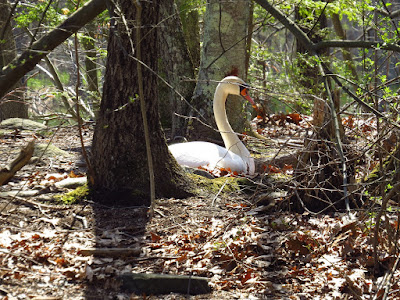
I don't see too much wildlife today.   The count is a half dozen Great Blue Herons, some Vultures, Geese, a Pileated Woodpecker and a pair of Swans.  With the calm air, I catch the rapping of Woodpeckers back in the forest.

There are others on the water today, but every one of them are fishermen, mostly in bass boats.  Bass boats are low high powered things that race from fishing hole to fishing hole.  At first, it hits you as a pretty obnoxious vessel.  But in short time I figured out that if I had to share water with a motorboat, I prefer it to be a bass boat.  First off, they're only in earshot for about 10 seconds when they pass.  Second, they throw little more than a 3 inch high wake.  Lastly, they are parked about 55 minutes of every hour.   They make much better neighbors than water skiers or jet skis.  

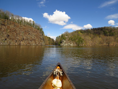
Anyway, I make steady paddling of it up to Lover's Leap, a narrow gap where the river runs through high cliffs.  I turn back and make steady paddling of it to my put in.

.

Tuesday, April 13, 2021

First Snowy Egret

I put in at the harbor to make my not so often expedition to one of the town's four rivers. It is just short of high tide with a light wind and partly sunny day of near 60 degrees.  This trip has to be timed with the tides.  Gulf Pond is scratchy at low tide and three of the bridges are impassable at very high tides.  The railroad bridge is a nasty wade at low tide with a current that can be much to strong to beat if one is paddling against the tide.  Once past the railroad bridge, I have about two hours to mess around before having to leave.

At the mouth of the harbor I turn left into Gulf Pond.  The last of the flood current zooms me under the first bridge.  It occurred to me that if this shallow pond was dredged, it would have made a good harbor.  , I imagine the wonders of commerce made it so that Milford had a large enough harbor as is and the cities of Bridgeport and New Haven took the brunt of shoreline abuse. The pond is nearly cut in two by a road that is mostly causeway.  The lower section is mostly open water with the upper half containing mush more marsh land on either side.  The wildlife seems to know this.

Third Bridge

I duck under the third bridge, which takes me into a tiny pond where I pick up the stiff current that runs up through the narrow railroad bridge and shoots me into the Indian River.  The railroad bridges are older than many of the road bridges and their placement and sometimes foundations are usually pre-1900.  Unfortunately, little thought was given to natural water movement (other than as a problem) or the need to preserve such flows.  I know several tidal bays that have been almost cutoff from the tides.  It's my guess that the next section, the Indian River, was once part of Gulf Pond, at least as far up as Interstate 95.

Canada Goose Nest

This upper section is probably the best for wildlife.  Foot access is difficult and it necks down to an actual river.  Today, I find some Ducks and Geese and my first sighting of a Canada Goose Nest this year.  I've seen Bitterns in here, which are the only Bitterns I've ever seen.  Just for that, the trip is worthwhile.

I manage to get all the way up to the fish ladder.  A nasty tree blockage that fell three years ago has rotted enough that I got by without difficulty.  On the return, I have to lay down in the canoe to clear the uppermost bridge.  Not sure why they didn't spend an extra hundred dollars to raise these bridges one foot, but that's how it is.

Saturday, April 10, 2021

Into the Gray Sticks

 I set out from the top to paddle down into the gray sticks, my own name for a part of the Great Swamp where beaver have flooded out a large area of forest.  Recently, I've seen these dead tree swamps referred to as "ghost forests".  Not being superstitious and being somewhat more ecology minded, I'm not a fan of the ghost idea.  That word implies far too much that just isn't so.  

I chat briefly with a woman at the put in and help her carry her kayak to the water.  But, I am first in and first away, which has great advantage in seeing wildlife as no one else is here, and with the lower put-in still closed, there is little chance of anyone else being in the next seven miles of river.

Wood Ducks

 The ghost idea is proven false in short order.  I don't pass a minute without being insight of or in earshot of a Redwing Blackbird.  I spot a Pileated Woodpecker not 50 yards into the paddle and I flush over a hundred Wood Ducks during the paddle outward.  A friend of mine once told me, "when trees die, they become condominiums."  

Red Bellied Woodpecker
 

In a series of three bends, and these bends are quite closely spaced in the upper section, I spot a muskrat, a dozen Wood Ducks, a Red Bellied Woodpecker, four turtles, some Swallows, several Grackles and ten Canada Geese.  Not too ghostly.

I have not been here for a about a year and a half, and I find a beaver lodge that has been built and abandoned while I was away.  But, I also find another new lodge that is clearly occupied with some left over winter food still in storage and the pleasant odor of castoreum, the territorial marker of beaver.  The river is pretty clear of obstructions.  I slide over two small beaver dams and have to drag around one downed tree that is far too large for my hand saw.

Abandoned beaver lodge

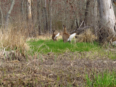
I spot a pair of White Tail Deer.  The doe hasn't seen me, so I sit and drift and observe.  Her yearling spotted me, but didn't know what to do and just went back to browsing.  Finally, the doe notices something and stares at me.  Deer vision tells her that something is there, but as long as I don't move she'll have trouble figuring out what it is.  I slowly get off a few photos and finally drift close enough that it is time for them to put their flags up and retreat into the trees.


It has warmed up and the peepers (frogs) are doing what you'd expect peepers to do.

I turn back at the old highway bridge that is about 50 yards upstream of the current bridge.  It's the only road crossing in this section and I was able to scan the river as I drove over on my way up.  Unfortunately, it is prone to a lot of blow down, and the beaver have built a dam across the underpass of the old unused bridge.  It looks to be a good deal of log crossing - about a half hour of effort I reckon to get into open water again, and it's just too nice today to go through that.

It is an easy and pleasant return with little to add other than I sawed off a larger deadfall having noticed that someone had cut 3/4 through with a chainsaw.  I imagine, looking at the way it was being cut, that the chainsaw binded in the kerf bad enough to force the user to surrender. 

Thursday, April 8, 2021

In the Wheeler

 Perfect spring weather arrived for a second day in a row.  I thought about heading up into the Indian River, but instead put in under the bridge over the big river and paddled down into the marsh near its mouth.  It was warm and sunny.  The wind was lightly blowing up the river with the tide just starting to fall.  

In the river still above the marsh I saw a flock of Red Breasted Mergansers.


The marsh was well flooded and a rather unusual view.  This is a low salt marsh with the taller variety of spartina.  Low salt marshes flood on a daily basis.  In the green season, the flood marsh still has the tall spartina grasses creating a form of topography.  But nothing is yet growing and winter snow and ice has crushed the grasses to a stubble.  For the next half hour or so I can paddle almost anywhere I want, but soon I will have to stick to the channels.

Yesterday, I wrote about naming features so that I can keep track of my observations.  This marsh has escaped that only because the features disappear and reappear with the level of the water.  Many times I have come in here planning to follow a route that I used before only to completely miss any remembered landmarks and having to start fresh.

Oyster Catchers

There is a good scattering of Brandts and Ducks.  It appears that almost all of the resident Osprey are in place with pairs at or near each of the nests.  Closer to the bottom of the marsh I spot two pairs of Swans and quite a few Brandts in three flocks.  A repeated nasal whistle alerts me to a pair of Oyster Catchers speeding across in front of the canoe.  I find more Oyster Catchers working over shell fish on higher patches of spartina.  I spot a pair of Northern Shovelers.  It has been some time since I've seen one, long enough that I have to consult my bird book (I was too far away to see the obvious shovel bill).

Northern Shovelers

I circle the marsh and head back upriver.  The ebb tide is running strong but I have a nice gentle wind at my back.


Wednesday, April 7, 2021

Place Names

I set out from the sea heading up the Neck and through the Sneak.  The high tide passed an hour or so ago but the current is still light.  It is a beautiful spring day - warm, mostly sunny and with a light wind coming down the river.

The Osprey count looks to be about 40 percent.  Some of the nests have pairs busy refurbishing their abode with new sticks.  Some of the nest boxes are bare showing that the mated couple hasn't returned.  Great Egrets are back and in the winter-stomped spartina I can spot a half dozen at good distance with no trouble at all.

The view from Bailey Creek (it's real name)
Nearing the Big Bends but still 300 yards below, I spot several large dark birds at the edge of the first bend.  They move too quick to be Canada Geese and they are entirely in the wrong place to be Wild Turkeys.  I get the binoculars and find that they are, in fact, a half dozen white tail deer and that they aren't on the shoreline but instead, another 300 yards back wading where the marsh and forest meet.  Above the bends I find a half dozen Yellow Legs working over the stomped spartina.

Deer disappearing
Lately, I've been thinking about place names in natural settings.  Before I wade into this, one of my all time favorite names is Ice Crackin.  It is a lake that was on our summer Boy Scout canoe trips.  It's not Lake Ice Crackin or Ice Crackin Lake, it's just Ice Crackin.  It's delicious in that you almost have to "belong" to get it.  

Yellow Legs

Back to the East River -  The Big Bends, the Sneak, the Gravel Flats and Pocket Knife Corner are names in this river that pretty much only I can attach to a particular feature.  I created them to keep track of my observations as my world is much more micro than the government map world.  They seem appropriate to me, definitely more appropriate than many of the official honorific names that the government bestows on places.  Denali becoming Mt. McKinley because President McKinley looked favorably on mining is an example of poor naming.  Of course, it has since officially reverted to Denali as it should be.  Out west in Union Bay where I started this whole canoe journal thing, I named a good number of features to keep my observations orderly.  There was Number 1 Island, Number 2 Island, Broken Island, Birch Island, the Lunch Counter, West Lodge, Hidden Lodge, and Keg Island.  I changed names on some others, Foster Island became the Burial Island as it had been a Native American burial site.  The Ship Canal, which had been a portage route with a Duwamish name that translated into "crossing over place" became the Crossing Under Place.  And that leads to how places become known by names.  Google, in it's massive and somewhat sloppy effort to map the world with satellite images, adopted the names, Number 2 Island, Broken Island and Birch Island, even though I informed them not to do that.  In time, Broken Island made its way into a Masters Degree dissertation and then into Wikipedia.  I suspect it is permanent.  Number 1 Island was left out, which makes Number 2 Island look silly.  Broken Island was named because at high water a 3 ft wide channel develops cutting the island in half.  Birch Island simply had 3 small paper birches growing on it.  Keg Island is where I retrieved a beer keg while cleaning the marsh, and the Lunch Counter was a favorite spot for Bald Eagles to eat Coots.

Approaching Pocket Knife Corner

I paddle up to and just passed the Stagecoach Crossing, which is know as Bear House Hill Road, which is a fine enough name as well.  I return from there riding the ebb current and catching a tail wind for much of the way