Friday, December 31, 2021

Fog

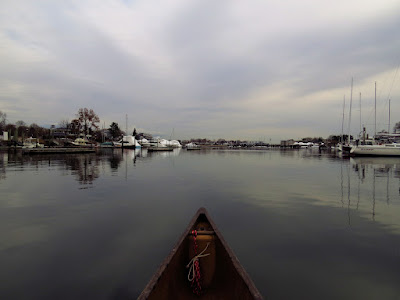
I do the 200 yard portage from the house down to the sound and put in at the base of the neighborhood's seawall.  It is foggy and calm with the temperature in the mid 40's.  High tide passed about an hour ago and only the big seven foot boulder shows above the surface. 

I head towards the town's harbor, which is about an hour away by canoe or by foot.  The visibility is about a 1/4 mile or less.  The in-the-house plan of circling Charles Island is put away as it is a mile off shore and at this tide level I might not be able to follow the submerged tombolo (a  type of sand bar).  Still, these are the best conditions for paddling the town shoreline because if sky is clear the trip dissolves into a tour of waterfront houses that are mostly built in the wrong places.

The mouth of Milford Harbor

There is a very low swell - maybe only an inch or so.  I would not notice it except that with nothing for the eyes to focus on, the other senses kick in.  The swell is probably the almost dead wake of a boat that passed by a half hour ago and two or three miles off shore.  Nearing Pond Point, I hear the industrial motor of an oyster boat somewhere well out in the fog.  As I round the point the motor is closer and behind me.  The clatter of oysters being dropped on steel signals that the boat is in its allotment.

At Welch's Point, the visibility drops to a hundred yards.  I'm seeing a fair number of Red Breasted Mergansers and Brandts.  I hear some other birds flying away, but they're able to see my shadowy figure before I can see them.

Oops.  I was using my paddle as a coffee table while writing my notes, and when I grabbed my paddle to push me away from the shoreline oysters, my cup went into the water.  Fortunately, the water is only two feet deep and I can reach in and retrieve it.  Anyway, I cornered a Common Loon as I drifted into the mouth of the harbor - not intentionally, of course.  Loons just like a huge safety buffer.  This one flies off instead of the more usual submerged swimming evasion.  The takeoff run is seven or eight canoe lengths - over a hundred feet.  That is why Loons cannot take off from dry land.

Common Loon of of Pond Point

Charles Island is just poking through the fog when I start heading home.  I find a Loon near Pond Point and a second one near the west end of Morningside.  I'm pretty sure that these spots have some tidal current - most of the Loons that I see here seem to be taking advantage of tidal currents.

Long Tail Drake

I can hear the Long Tail Ducks calling from the fog when I take out and start the portage up the hill.

Tuesday, December 28, 2021

A Quiet Winter Day

I put in on the big river being thankful for a reasonably warm day with just a light wind out of the west.  The clouds peel back just as I set out and the sun feels good after a few days of light cold rain and gray overcast.

When I get down to the top of the marsh, I head in along the shoreline channel that circles it all.  The tip of Cat Island is the point of no return.  I still have six inches of depth, but it is about a half mile until I get back to predictably deeper water.  If I keep going and have to turn back, I probably can't get out until the tide comes in - that would be a chilly four hour long sit as the mud in here is rather bottomless.  

I head up the inner channel of Nell's Island.  It's quiet and calm with no birds to note until I get to the bottom of the channel.  At good distance I spot a smallish Hawk.  Watching it skim the spartina, I ID it as a Harrier.  
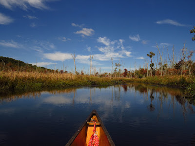
I cross the main river to the west side and follow it back up river.  

It was a nice paddle with not too much to note.  I saw 3 Common Loons, a few Mallards, a few Buffleheads, some Black Ducks,  four Mergansers, and at least a hundred Gulls.  That's a quiet day in the Wheeler.

Tuesday, December 14, 2021

Checking on the Housing

It's been a bit over two months since I put in here and it seemed like a good time to return and check on how the inhabitant's housing.  The summer seemed hard on the beaver in this area.  We had some high water in the Connecticut River that lasted unusually long.  The term in these parts is, "freshet", which is simply a minor flood event.  As the Connecticut is 450 miles long with the source in Quebec, major rain events can send a good pulse of water our way.  A good six feet of river level increase isn't unusual at all. When that happens, the tributaries like the Mattabesset back up and become well flooded but without any real current. Back in July, we had a freshet that lasted about two weeks.  The water in the Mattabesset was higher than I'd ever seen with the forest bottoms flooded enough that I paddled through it without risk of hitting bottom with the blade of my paddle.  As I paddled the area I found the beaver out of their lodges, which were, of course, completely flooded.  My marker lodge, a perfect six-foot tall cone that I call the Tepee Lodge, was submerged except for the top twelve inches.  

Red-Breasted  Woodpecker

I put in behind where the old tavern once stood.  The water was high, but not unusually so.  The day was sunny and nearing 50 degrees with a light north wind - good paddling weather for December.  I soon passed a guy speeding upriver in an outrigger canoe.  

The first beaver sign came at the first big bend.  Quite a few trees showed gnawing about the bases.  In short order, I spotted a small bank burrow.  Besides the common conical lodges, beaver will also build bank burrows by tunneling into the bank.  The entrance is below water and doesn't show, but they build a loose branch pile over the lodge's vent hole.  It looks quite like someone dumped some tree trimmings.  Bank burrows sometimes become conical burrows when beaver drag branches to the water, a process that might eventually excavate a small canal. 

Tepee colony's temporary summer bank burrow

The replacement Tepee Lodge
I found the Tepee Lodge in a state of collapse, a two foot high circular pile of branches.  I had wondered if the beaver colony would repair it, and of course, they did not.  But, three canoe-lengths upstream was a brand new lodge almost identical in shape and size and showing the winter fortification of recently packed mud.  Right across the river was a bank burrow with the entrance clearly exposed about 2-feet above the water level.  This was built during the long freshet of this summer, but with the water returning to normal and the entrance open to predators, it was no longer safe to use, hence the new lodge.


New Tepee Lodge to the left with the old lodge to the right

In the open marsh, I spotted a mature Bald Eagle, two medium sized Hawks, a Red-Tailed Hawk, a Harrier, and several large muskrat lodges.  Woodpeckers outnumber any other birds in the forested sections.

I had one last lodge to check on up in the Coginchaug River.  As I rounded the first bend I met another guy out paddling.  He lives in the area and we traded some observations for a good fifteen minutes. 

The Coginchaug Big Lodge

This summer I found a large lodge being built just short of the railroad bridge over the Coginchaug.  Today, it was a full six-feet tall and about twenty feet in diameter.  Like the new Tepee Lodge, this lodge had been well packed with winter mud and a trail of beaver tracks up onto the lodge showed that they were still working.  In the water next to the lodge was the beginning of a winter food supply.  In cold climates that might ice over, beaver stick branches into the mud near the lodge.  Then, if the ice is froze over, they can feed by retrieving that submerged winter stash without having to venture on the ice where they are easy prey.


Friday, December 10, 2021

The Edge of Winter

It is a gray day, but a calm gray day.  I set out downriver with the low tide an hour past.  The flood current is insignificant.  I pass a Great Blue Heron, push a small flock of Mallards along, and see six Common Loons.  The Loons are all well out in mid channel and well spaced out, but at canoe eye level, the silhouette is unmistakable.

Nell's Channel
I enter the marsh at Nell's Channel, the only open way in at low tide.  The built world disappears for most of that distance behind the salt marsh horizon - three feet of mud bank topped with three feet of golden cord grass.  A pair of Harriers fly by with one trailing the other by about a hundred yards.  I wonder if it is a hunting tactic - the second bird arriving just as prey thinks it is safe to move.  I pass by three Dunlin feeding on exposed silt and at the end of the channel is a lone Gadwall.
Dunlin

Gadwall
At the bottom of  Nell's Channel, I turn into the marsh.  The water has come up just enough to make passage although I run myself into a large dead end.  I'm a bit surprised about that as I know this end of the marsh well and it just isn't that difficult to find the route.  Another Harrier comes by, this time much closer, but still too quick for a photograph.

It has been cloudy and gray up to this point.  Then, one of the best two minutes of canoeing arrives.  The low winter sun burns through the clouds, in a second the night chilled marsh becomes warm and the cord grass begins to glow.  There's nothing I can do but set my paddle down and watch.


Tuesday, November 30, 2021

Don't Do Something Stupid

 It is only 35 degrees when I put in, but the wind is barely registering - decent winter paddling if you don't do something stupid.

The harbor is quiet with the oyster boats already out in the sound and no one else around except for a couple marina workers hauling out yachts.  As a result, the harbor is active with wildlife - ten Great Blue Herons, forty Buffleheads, a dozen Mallards and two Common Loons before I get to open water.  There is skim ice in the calmest areas of the harbor.  

I decided that today was a good day to make my annual pilgrimage to Charles Island - the Mt. Rainier of Milford.  Less than a mile off shore, one can walk to it at low tide on a bar called a tombolo.  A tombolo bar is created by waves wrapping around an island.  If you time the tide correctly, you can walk out, circle the island, and walk back without getting your feet wet.  Time it wrong and you get to sit on the island waiting for the next low tide.  Every couple of years someone drowns out there, either trying to wade back across the tombolo and getting carried off by the tide or flipping a canoe or kayak with their PFD securely stuffed in the bottom of the boat where it is absolutely of no use.

Charles Island with the tombolo leading out

At the mouth of the harbor, I turn right and follow the shore in calm water.  Although I'm 150 yards from the beach, I'm in 2 to 3 feet of water most of the time - if you flip a canoe in freezing water, it is nice if you can just stand up and get back in the boat, or walk to dry land.  Winter paddling is all about having a plan B... and a plan C and D.  On this route, if necessary, I can actually walk/tow the canoe from any point back to the harbor as long as I don't get blown away from shore. So, I follow the shore over to the tombolo, then I'll follow the tombolo out to the island, circle the island and return the way I came.  

With the dropping tide the shore birds are feeding all along the newly exposed sections of the bar.  It is mostly a mix of Sandpipers, Gulls, and Brandts.  I do a short lift over the bar and into the windward water.  The wind has come up and there is a good chop developing on that side.  I keep moving as the conditions are changing and by the time I've rounded the little island there is a good wind in my face getting back to the bar.  The calm water is gone, but the bar reduces the waves to "not much".  But, it is a big angle crab along the bar as I paddle back to the shore.  Then it is an almost casual drift with the wind back to the harbor.  It was definitely time to not be on big water.

Sunday, November 21, 2021

Elwood P. Dowd

 Calm air, autumn sun, and a perfectly timed tide put me into my favorite small river, again.

I pass two kayakers as I head into the Neck River.  The first says, "Glorious day," his way of saying something when he doesn't know what to say.  His buddy tells me in a perfect New Jersey accent to watch out for the alligator.  I'm not worried as the alligator only eats peoples senses of humor.  As much as I put down the "glorious day" comment, it dominates my thoughts for the next half hour.

From the Neck, I head up Bailey Creek and into the Sneak, my usual route when the tide permits.  It is a glorious day and I think back to try to remember a day when I was outdoors that wasn't glorious.  This is an Elwood P. Dowd (look him up) moment... "nice day"... "they always are."  I can't think of day outdoors that wasn't at some point, glorious.  Freezing cold, rain, wind, or a night at 12,000 ft under a boulder in a snowstorm without a sleeping bag...scary, but glorious and unforgettable.  I finally figure out that this is just a ordinary day.

The light is perfect today, low and filtered.  Good photos are easy, but watercolors are what is needed to get the full effect.  The spartina is gold, the water near smooth, and half of the trees still hold onto rust colored leaves.  I flush a dozen Black Ducks as I get up through the Sneak and spot another thirty flying farther off - well out of scare distance. 

I keep going when I get to the little bridge at Bear House Hill Road.  The next half mile only works at high tide and often requires some brush bashing or limbo dancing.  A Hawk trades stares with me for awhile.  I turn at the next bridge knowing that it is just wading above that.

I see a guy paddling a small motorboat with an oar.  He beaches it at the little bridge and inspects his propeller.  He is about 400 yards higher up than he should be and I imagine that he hit one of the large boulders that dance just below the surface.  Eventually, he catches up with me.  His boat sounds like a distant B-17 bomber, a deep thrumming, which might be due to a bent prop.

I get surprised by a Great Blue Heron as I return down Bailey Creek.  The feeding must be good as I am well within a Heron's scare distance before I see it. 

Saturday, November 20, 2021

In the Big River

 I set out at high tide with a slack current.  It was calm and sunny with temperatures in the forties.  The water surface was old glass.

I managed to find the passage between Carting and Peacock Island, having missed it the last few times.  

Between Peacock and Carting Islands

It doesn't look like much on the downstream end, but it opens up into clear twenty five foot wide channel. By the time I've reached the top of the islands, I've flushed about forty Black Ducks with a few Mallards mixed in.  I also saw a few Kingfishers and in one of the tributary streams, a half dozen Common Mergansers, and a Hawk that I am too lazy to look up in the bird book - I'm not really a birdwatcher.

I'm impressed that the autumn colors have lasted so long.  We didn't get the exploding crayon box colors this year, but seem to have traded it for a long lasting show.

I turn back at the unnamed island just above the dragonfly factory.  The current is still slack and I don't sense any flow until I get back to Fowler Island.  A light headwind starts up, but as the current increases it more than balances the effect. 

Wednesday, November 17, 2021

Drysuit Day

After several days of mucking about in the art world, I needed and had time for a short trip.  The morning was calm, mostly sunny, and the temperature just below freezing as I loaded up.  Guessing that the water temperature has finally dropped below 60F, it was a good day to get used to wearing the drysuit.  As I paddle all year, if the ice allows, I invested in a drysuit several years ago.  The suit is a waterproof "onesy" with built in socks, rubber gaskets at the neck and wrists and waterproof zippers. Should I fall out of the canoe, my functional swim time is greatly increased.  So far, my only test of the drysuit has been slipping on ice while finishing a portage and landing in shallow water with the canoe on top of me.  Since I did such a good job saving the canoe, I just shook myself off and paddled away.

I put in at my town's little harbor.  Well protected and narrow, the harbor hosts a variety of motor yachts, sailboats and smaller fishing vessels.  At this time of year, I expect no one else other than working fishing boats.

I pass two small schools of menhaden in the harbor. There are three Common Loons at the mouth of the harbor.  The wintering Loons make use of the tidal currents to fish. They have already lost the beautiful feather patterns that they have in summer.  There are a dozen Buffleheads feeding in the shallows.

I turn up into Gulf Pond, where I find another dozen Buffleheads and then a flock of Canada Geese about halfway up through the first section.   Add a couple of Great Blue Herons and a few Widgeons for good measure before ducking under the second bridge.

There are another fifteen Buffleheads in the upper pond.  I duck under the third bridge and ride the last of the tide through the railroad bridge, by far the oldest of thW. e bridges with a stone foundation.  This is the Indian river and I continue up to the highway bridge noting the increase in trash and wondering if anyone has ever studied highways to see their effects as trash vectors.  

I head back with not much else to add other than it is a fine day.  Heading through the harbor, I end up talking with the master of the Victor Loosanoff.  This is one of those unexpected long chats that are surprisingly common here in the northeast and it turns an ordinary canoe trip into an excellent canoe trip. This talk is far better than most as B has extensive knowledge of what NOAA researchers are doing.  He also has experience as ships engineer on the restored whaler, Charles W. Morgan, the only remaining wooden whaling ship.  The Charles W. Morgan is part of the nearby Mystic Seaport Museum.  Anyway, we discuss, oysters, dams, whales, climate change, and ship restorations - you know, the usual stuff.  After about 30 or 40 minutes, we both have to get on with what we're suppose to be doing.

Thursday, November 11, 2021

Long Time No See

I put in near low tide on a favorite river.  I suppose, as much as a river can be a friend, this is one.  I found this short tidal river sometime during the first year after moving to this area, and I've paddled it more than any other one body of water since.  Salt marsh, fresh marsh, and forest, high tides and low, with all the variety of birds and plants that go along with that. It is a place that never ceases to give.

Dunlin
Just as I get settled in the canoe, I spot a Yellow Legs on the far bank, some 50 yards away.  The Yellow Legs would have gone unnoticed but for the low autumn sun that made it sparkle against the brown silt bank.  Halfway up to the first bend, I spot a Pied Billed Grebe. At the bend is a Hawk, but I never get a good enough look at it for an identification.  After the next bend, I'm watching a pair of Yellow Legs when two Dunlin pop up from around a hummock.  There will be Yellow Legs and Dunlin every so often from here up through the Big Bends.

Beebe comes motoring down the river on his little green barge.  He has a small marina of two to three dozen boats up above the RR bridge, which guarantees that it will be a small marina as only runabouts can clear that low bridge, and even they can't get under at high tide.  We are familiar with each other and he tells me that he's going to Clinton to haul out moorings.  "Long drive in that boat," I say., although I suppose he'll get to Clinton in 30-45 minutes.  His barge is less than 10x25 ft, a chartreuse metal box with an outboard motor and a light duty crane and winch.  A few years back, I figure out that he knew me, at least by sight, when he commented on my paddling technique.  That stepped him up in my estimation as it showed to me that he was quite aware of his landscape, having taken notice of my once-in-awhile trips on the river.  I'm pretty sure he runs his marina and dock/mooring business because the office is so spectacular.  People that are connected that deeply to their surroundings stand out when you meet them.

I pass a Great Blue Heron at the RR bridge.  It is less than 2 canoe lengths off and typifies how docile and calm the birds in the marsh are today.

Just past Beebe's marina I tuck into an old blow out channel.  Until recently, it had some big culvert sections in it - big as in 4 ft. diameter.  Someone has hauled the wreckage out and I paddle up to a damaged tide gate.  It is a cement dam with a 2x2 ft hole where the gate should be. Behind is a low marsh bordered by buildings that are too damn near sea level. Now that I see the dam, I suspect that hurricane Sandy or Irene might have blown out the culvert.  Seawalls and dams are designed to hold water on one side.  When the water gets behind them it can tear things apart in no time. 

Above the Big Bends I spot three Killdeer feeding on the exposed silt. Just before the stone arch bridge I meet up with a male Hooded Merganser, who deftly dives and evades me before I can take a photo.

The wind is coming up.  I turn at the Duck Hole Farms.  The river is getting low and it is nice to have a full paddle blade of depth when you have to go against the wind.

Thursday, October 28, 2021

The Art Lab

High water, really high water.
A powerful Nor'easter came through earlier this week and apparently dumped a lot of rain up here.  I've never seen the water this high, even in the spring.  Fortunately, high water in this area increases the normal current from a 1/4 mph to a 1/2 mph.  It also floods the beaver dams and dead-falls eliminating the usual canoe gymnastic routines.

Because of the high water I start upstream, which unfortunately is tree blocked at normal water levels.  I get up about a half-mile without any trouble being able to end-run the tree blockages.  This stretch would be well worth some log clearing, it's a nice area.  However, I came here for a project, so I decide to head down to familiar terrain.  


I have an artwork in mind and needed some site specific photographs.  The flooding eliminates the possibility of putting my camera tripod on dry land as the flooding extends well out beyond the normal river channel.  I can still shoot from the canoe.  The light is excellent and many of the trees managed to keep their leaves while the storm blew through.

The beaver dams are more than a foot below the surface with just a line of ripples to tip one off on where they are.  I futz about with the camera for an hour or so, until my patience for such things disappears.  Then I just head downstream on a truly pleasant cruise.

I turn back at the old highway 22 bridge.  The new dead-falls are easy to end-run, but the bridge itself has no more than 18 inches of room under it.  That is a flood level of about 2-1/2 to 3-feet above normal levels.

There are very few birds today, a couple Woodpeckers, a Common Merganser (that one is kind of unusual in this river), one Great Blue Heron weaving through the trees, and four Ducks.  Considering that the flooding has added a thousand acres of water surface, there's no reason to expect a lot of birds right in the river channel.

I don't know if the photographs will work, but a vague idea of what my artwork has become, maybe, a good idea.  It was time well spent.

Saturday, October 23, 2021

Last of the Late Starts

I tinkered the morning away thinking about where to go and whether or not I should wait for the tide to come in.  Finally, I loaded up and headed inland to fresh water away from the tides.  The day was partly cloudy with a light wind out of the north and temperatures that would not top 60F.  

I put in on the small cove.  A dozen cars with roof racks telegraphed the presence of the "dreaded" kayak club.  Somewhere out there was an aimless fleet of chattering dippers.  Hopefully, they had a good long head start on me.

Many of the trees are changing color - perhaps half have changed.  It is a hardwood forest and the color shift is vibrant.  I head straight out across the main river, down to the point and up the Shephaug.  I follow the shore closely noting many old beaver cuts.  In fact, I don't spot any fresh cuts - all the stumps are well aged.  I spook a Great Blue Heron every once in awhile, but otherwise there are few birds.  But the colors in the trees are excellent.

For the first time, I go ashore where the old railroad bed emerges from the reservoir.  Up until 1940 there was a railroad connecting the coast with Litchfield.  It ran down the cove where I started, crossed the Housatonic, and then weaved its way along the Shephaug.  It must have been a beautiful train trip.  The rail bed is pretty obvious.  It looks like the best farm road in the world - old farm roads are common in the forests, but this one is as smooth as a new bicycle trail due to the well made bed where the rails once were and, since it wasn't a road, it has rarely if ever, seen wheeled vehicles like wagons or cars.  There are no ruts or potholes or elevation changes other than the very slight uphill grade along the river.

Old rail bed
I return to my canoe and head up to the stone culvert that let a small creek pass under the rails. A few of the kayak clubbers pass by.  The water is a foot or so higher than normal - obvious to me when I see the culvert entrance.

The kayak club has successfully scattered themselves all over, which defeats the safety in numbers idea that seems to be the reason for most people to paddle in a club.  Second to last, is a furiously paddling guy in an expensive canoe.  Last is a spherical guy in a red jacket paddling a kayak that is blaring music which sounds to me like a bad cover of 1980's U2 stuff.  I don't get this at all - you'd think the club would've have drowned that goofball by now.  

I mess around with the culvert for ten or fifteen minutes.  There's enough water on the far end to turn the canoe before paddling out.  

I don't pass the tail end of the kayak herd until the confluence with the Housatonic. I give everyone a once over to see if they're okay. The furiously paddling guy in the expensive canoe must be the leader and seems rather competent.  He is hanging with two people on paddleboards who are tired and slow, but still chattering away.  Everyone else in the club has ditched them...nice bunch.  

I take out at 4pm.  That's getting too late for this time of year.


Wednesday, October 20, 2021

Break Time

Last week was pretty windy and I hiked instead of canoeing.  Then, I managed to get bit by a Lyme tick, so a day of visiting the doctor and picking up my 3-week dose of antibiotics, and some more wind, kept me out of the canoe for awhile. 

I headed out to a little group of islands in the Housatonic.  The tide had been quite high but was more than an hour into ebbing, so the current under the highway and rail bridges was damn near whistling.  I eddy hopped the bridge abutments upstream and then ferried across the hasty current.  The islands, Long, Peacock, Carting, and Pope's Flat - on old maps a few of the islands are called "flats".  They are all low salt marsh islands, covered mostly with spartina, especially now that the government has eradicated the invasive non-native phragmites that had taken hold.  These islands are very rarely flooded, which is the condition where phragmites can out-compete spartina.

Anyway, this area was one of the first that I canoed in simply because it was right there.  Today, there are a few Great Blue Herons and some Ducks - it's pretty quiet.  

I run a figure-8 up and through the islands and then ride a stiff current back. It felt good to be in the canoe.

Tuesday, October 12, 2021

Beaver Dam Hopscotch

I put in at the top, which is the only option since the pandemic.  The lower put-in for this section of the river is on private school land and they closed off access for safety reasons.  This inconvenience for myself is a benefit for the swamp as a great amount of re-wilding has been going on with the big drop in casual visitors.  In fact, due to a big log jam at the midpoint, I haven't been in the lower three miles for almost two years and I doubt that hardly anyone else has either.

The water is high as in something normal for May, but not October.  

As soon as I'm in the water, I hear voices up ahead.  Just 150 yards in is a brand new beaver dam, and three guys in rec kayaks wrestling with crossing it.  This explains the high water.  I cruise up to the dam, hop out onto it, slide the canoe over, and hop back in.  Kayaks are poorly suited for beaver country.  It's just too difficult to get up onto a beaver dam from the Barcalounger.  The second new dam appears just 50 yards later.  The third is a hundred yards more, but it's an easy slide over.  The first log crawl comes less than 600 yards from the put-in.  The swamp's people filter is set on extra-high.

A well maintained lodge
 

After that, the route opens up, as usual, and it is spectacular, as usual.  Many of the swamp tree leaves are turning orange and yellow although it seems that much of the color is from vines wrapped around dead snags. The forests on the distant sides of the valley are still quite green. Cattail spears are turning tan and most of the cattails have burst open. Most of the lower shrubs are still green.  I flush a Great Blue Heron every once in awhile, but otherwise it is a bird quiet day.

About a mile in, I come to another log crossing.  

The fourth or fifth beaver dam
 

After that, it is easy open paddling down to the bridge at the midpoint.  This area has been a mess of downed trees for a couple years and today it is worse.  Two large trees have come down upstream of the old bridge.  In part to make the trip last a bit longer, I pull out my bow saw and cut a gap 20 feet into the new deadfalls.  I can't tell how much weight is on the next cut, so I back out  That cut should be done when there is someone else around, just in case.  Hopefully, the new saw cuts will encourage someone else to clear a bit more.

The return is an easy cruise, perhaps somewhat more spectacular with the sun behind me.  I find the three guys at the third beaver dam... wrestling.  I wait out of sight.  They're having enough fun all by themselves given the use of flowery language.  Once they're clear of the gap in the dam, I speed up through it, exchange pleasantries, and move on.  They're having a good day, making more work out of it than necessary, but still having fun.  They should finish the last 400 yards... in about 2 more hours.

Friday, October 1, 2021

Spirits and Demons

This was the first morning that our house's furnace turned on.  It's the best season of the year.

I put in just down from the four span truss bridge.  It's the only bridge over this part of the river for many miles in either direction.  I suppose it keeps the riff-raff away.

I headed upstream.  The weather service predicted light variable winds.  They were variable right in my face and they weren't exactly what I call light.  It didn't seem like I would make my objective, which was about six miles upstream.  But, just as it started to build to grimness, I would find myself in some little dimple of shoreline and the wind would die...  just long enough for me to think it wasn't so bad.  This repeats several times.


It is a beautiful autumn day with dense puffs of cumulus clouds in a sharp blue sky. I spook a few Great Blue Herons, getting close enough that I don't see them until they fly.  There are also some Mallards and Common Mergansers, but this is not a river for great bird watching.  This is a river for losing oneself in the paddling.  It's a march of distance, perhaps peering up into the forest, but mostly it is steady motion that lets thoughts drift in, bounce around, and maybe melt away, or not.
Lovers' Leap

I showed some friends a sculpture that I had made of a Huldre.  The Huldre is the female of the hidden people in Norway.  She lures men away; she is the folklore explanation for someone that has gone into the forest and never returned.  She looks nothing like my own forest spirits, but it is the best I could do for the uninitiated in such things.  My own forest spirits are voices only. I am well aware that the spirits are inside me and not "out there."  It's just that it takes some real time in a forest to have that stuff surface - I can count on one hand with fingers to spare the number of times it has happened.  Anyway, I spend the next hour thinking about spirits (good) and demons (bad).  My demons are "out there."  In fact they're real people that I once worked with, so to speak.  It occurs to me that the reason they are demons, to others as well as myself no doubt, is because they have no spirit.  I think about the demons and realize that they are all surface and no interior.  When I think about who they were, I notice that they spent all their efforts on how they appeared to others.  They would've have been terrified of spirits. They were good at making other people miserable.

The wind dies off as I get farther upstream.  I hope that this is a lay-of-the-land effect and not a change in the weather.  I turn at the mouth of Lover's Leap.  The wind gradually picks up as I head down.  I have to look at the map and study the hills to figure out how they can make that much difference.

Tuesday, September 28, 2021

Short Day

It was already raining when I set out from the Eagle Scout launch.  I planned on a short trip up to the class 1 rapids below the dam - just a bit of practice eddy hopping and playing with currents.  The rain was light, but the clouds quite dark.  There was one rumble of thunder as I started, but it was "over there" - outside of the valley.  I paddled about 10 minutes upstream.  There was an excellent X-shaped bolt of lightning up ahead.  I counted the seconds - less than a mile away.  And, I turned around and called it a day.

Monday, September 27, 2021

Statistics

I put in under the big bridge.  It's a nice day, a bit windy, but cool and mostly sunny.  Low tide has just passed, but it was not a particularly low low tide and even now I should be able to get through most of the marsh.  In any case, this is the time to get stuck in the mud as all one has to do is sit and wait for the water to rise.

I paddle down river and take a counter-clockwise route around the marsh.  There are quite a few Great Egrets, which gets me to thinking.  I spend most of the trip thinking about how ornithologists statistically account for the "spotability" of different birds.  

I have good enough vision and some people that paddle with me think that I am eagle-eyed.  But, what is really going on is that I am visually tuned in to spotting stuff in the outdoors - it's nothing more than practice and use of the senses.  I recognize certain shapes or telltale movements just because I've seen them so often.  One day, pointing out a far off Osprey to my mother in-law, she asked, "how do you know that that is an Osprey?"  I replied, "because that is what an Osprey looks like."

Back to Great Egrets, I figure that I can spot a Great Egret at about 600 yards.  They're bright white and mostly stand vertical - it's easy.  A Great Blue Heron, I probably spot those at about 300 yards.  But, there is a big difference.  If and Egret is standing still and in the open at less than, say 300 yards, I'm going to always spot it - always.  But, some Great Blue Herons, which are better camouflaged, aren't spotted until I'm 30 or 40 yards away.  The idea here, is that if you are out spotting birds, you are going to spot most of the Great Egrets, but a lower percentage of Great Blue Herons.  


Juvenile Night Heron

Then we get into the problem of hard to spot birds.  Egrets and Herons are pretty easy to spot if they are standing still, but some birds, like Willets and Sandpipers are much more difficult to spot unless they move.  A moving Willet is easy at nearly a hundred yards, but if it decides to stand I might get within 10 yards before it scares and gives itself away.  Then there's the Piping Plover.  Those little magicians with their feathers that match sand, shells and pebbles are invisible from ten feet away if they don't move - and they're not an easy spot when they run (which is one of the reason they are threatened - their nests get run over by beach walkers and loose dogs).  
Black Bellied Plover

And to make it more complicated, it occurred to me that if someone was counting birds from the Audubon Center near the marsh, their bird count of Night Herons just went up by a factor of five because of me because I flushed a lot more of them than were visible. The juvenile Night Herons were feeding in the lower corner of the marsh, as usual and they would have been unseen until they took flight.

Bad photo of a Harrier - but it is a photo of a Harrier

Anyway, I get to Milford Point, then head up Nell's channel where I get to watch a Harrier do its thing, take a diagonal back to the lower corner, and turn up the east edge of the marsh.  I find the secret passage the we found on our last trip in here - it is harder to find from this direction - just point the canoe into a minimal gap in the spartina and hope it's the right minimal gap.  I'm especially fond of "secret garden" passages - narrow little pointless dead end openings that actually open up into something big and grand.  This one opens up into a long diagonal route across the marsh that no one would suspect exists.

Saturday, September 25, 2021

Half Day

I set out again from North Cove in Essex.  This time, I headed straight out through narrow gap in the barrier bar to the big river.  It is an exceptionally fine day, clear sky, calm air, and mid 70's.  The big boats will be out today, but not until after brunch.

As I turn upriver along the near shore, a Coopers Hawk flies by and perches in a tree, apparently to hang out with his six Crow buddies.  Another quarter mile along I find an immature Bald Eagle.

When I get even to the bottom of Selden Island, I cut across the river and head up the channel.  It's nice and quiet with nothing else to report except that I find a tidewater beaver dam.  Similar to the dam in Salmon Cove, there is no stream flow to be backed up by this dam. This section of the river is still tidal and the dam seems to catch and hold high tide water.  There's about a half foot differential in water heights and one very well used drag.  I spot several Kingfishers - the minnow hunting seems to be good.

Tidewater beaver dam

At the top the channel I turn and follow the island until even with Eustasia Island where I cross over to the west side.  I return following the west shore. The last hour is a rough ride as the Mai Tai Navy has set sail; a bunch of A-type personalities trying to beat each other to the nearest dockside bar.