Wednesday, August 28, 2019

Wild Ricing

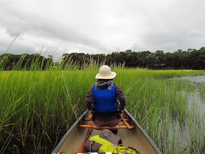
My first plan for the day was to go play in the easy rapids on a section of the Housatonic.  But last night it occurred to me that the wild rice was out and so I asked M if she would rather go out to the Connecticut River and check out the crop.

We put in at Pilgrim Landing, the normal start for a trip up into Lords Cove.  Parts of the cove are undergoing restoration - removal of invasive non-native plants and the changes are becoming more obvious.  The cove is on my list as a place to return to regularly to track on how the restoration is affecting things.
 It is calm with a a bit of very fine mist in the air.  Because of that we go out and head up the main channel until we can re-enter the cove via Goose Bay.  With the tide still up we can cross the shallow bay directly.  Already there are many more Egrets than normal.  Autumn can bring out Egrets and Herons in large numbers as they bulk up and prepare for migrations.

Taking the longer side channel up to Coultes Hole, a weird circular "pond" feature in the marsh that defies logic, we flush a couple dozen Great Egrets, several Great Blue Herons, and watch a dozen or so Common Terns actively fishing...all in the same 100 yard section.   The first Osprey show up on the bend by the old camp, with several more Egrets perched up in the trees.  From there we head back to the Eagle nest, which is  unoccupied at this moment.  But, we flush more Egrets and a Green Heron along the way.  I figure we're at about 35 Egret sightings, so far.

We come out of that section of cove and head over to the wooden bridge.  There's a large number of small dead fish - a fish kill of undetermined reason although this section of water might be prone to a toxic algae bloom as it doesn't get full exchanges of water.  Aside from that, there is quite a bit of wild rice and we take 15 minutes to collect a few cupfuls, so that we can go home and see if we can figure out how to process it.

Wild Rice
We begin working our way out and soon it begins to sprinkle.  Then it begins to rain lightly.  Then, it begins to rain heavily.  But, we flush a large Bald Eagle as we work our way along the forested shoreline.

Monday, August 26, 2019

Kikamuit

August 26
We visited friends in Rhode Island over the weekend.  Our plans to canoe on Saturday were interrupted by our enthusiasm to visit and talk for hours on end having not seen each other in quite some time.
Sunday came up with weather that was every bit as perfect as Saturday, except for more wind.  Our first put in was too exposed with a long windy crossing to get into the calmer water on the far shore.  So, we diverted to the Kikamuit River.  While the wind was still strong, it was a head wind and the crossing over to the other side of the river where the good stuff was would be reasonably short.

We explored a fine little spartina marsh cove before heading farther up the river during which the wind died down some.  Then we headed upriver until it was time to return and go visit D's art studio.


Saturday, August 17, 2019

Return Performance

I headed back to the same stretch of the Housatonic that I was in two days ago.  It occurred to me that S had never been up there.
We set out from the Boy Scout landing.  Even though it was a weekend, the traffic would be light in the morning due to the partly cloudy weather.  It doesn't take too long to get up into areas where the motorboats can't speed along, so they don't go there.

Today the leftmost gate on the dam was open.
S thought the trip to be good, especially as the river gets better the farther up you go, and it doesn't take a huge or long effort to get there.

The water was down a couple inches, something you might not notice except for subtle changes in the rock garden.  I introduced S to eddy hopping going up through the rock garden as far as the portage. There were no Eagles around today although S thought the nest to be a good one.  Then we dropped back down through the rock garden, eddied out and picked our way back up through it one more time using a slightly different route before heading out.  S thought it a good class in reading water and using the river current to do the work.


Thursday, August 15, 2019

Rock Gardening

My last trip here was with M in late spring when the water was cold and running high.  When we exited the little brook where the Boy Scout launch is hidden, I was surprised by the amount of current in a section of the reservoir which is usually lake-like.  We headed upstream against a stiff current but could get no further than the Shelf, a bank to bank shallows where there is always a current.  On that day it was moving at least twice as fast as we could paddle.  We admire it and then cut out into it and took the ride back.

A carp parallels me for ten yards.  It is down deep in the cooler water and I am surprised at how clear the view is.  By this time of the summer I expect most water to be much cloudier with silt and algae type things.  It's only a guess, but I think I'm able to see about 10 feet down.
The first section of paddling is a shoreline of trash docks and houses built too close to the river.  The west bank is mostly 2-3 room cabins with sun porches that are almost as large as the main structure.  These were probably working class get aways from not long after WWII.  The east bank is 1960's-1980's houses - middle class, modest, and architecturally dull considering the waterfront that they sit on. They are year around houses with easy road access.  The trash docks are slapped together floats of plastic 55 gallon drums and beat up wood.  They function, but they look like hell.

All that matters little other than as an observation.  The action of paddling, the view of seeing the paddle sweep past my eyes brings me to where I am supposed to be.
The river necks down in two steps. With each narrowing, the river becomes more scenic and less developed.  Between the two narrowings is the Shelf, which today is an easy paddle against a light current.  At this point the west bank becomes state forest and the east bank has the last few houses, all of which were designed with more thought as to the surroundings.

With a bend in the river comes the last narrowing.  As I get to that I can see the large Stevenson Dam.  There is a portage around the dam, but before I get to it I have to paddle through a section of fast water and rock garden.  The main flow is much to fast to bull one's way through.  Instead, I eddy hop upriver...paddle up slow water and eddies on the left, then spurt into an eddy behind a large boulder, then squeeze up a short chute between two more boulders, pause and then ferry (angle the canoe to the current so that the current does the work) across river to another jumble of boulders, then a short hard couple of strokes up another chute into open water.  It's especially enjoyable as it is 90% finesse and 10% effort if you read the water correctly.  I've been up here once before during high water and the river is a totally different animal - a 200 yard long section of standing waves, each about 2 ft high.  I stayed out of that stuff.
Two Bald Eagles fly over - a fledgling and an adult.  There's a small flock of Canada Geese and a dozen or so Mallards and a pair of Common Mergansers in this last section before the dam.  The Eagle nest is high on the west side not too many yards below the portage.

I stop for a short rest at the portage, which is not insignificant.  It's about a 1/3 mile long and 75 ft up and then 25 ft down.  Not today.

Saturday, August 10, 2019

Canoeing With Artists

August 9
We put in about 2:30 on low water with a rising tide.  For me, it was a rare afternoon start.  The day was warm but the air was pleasantly dry and a cooling breeze was coming off the sea and it would be far more of a comfort than a hindrance. 

The water was too low to pass through the sneak, so we headed straight up the East River.  Osprey, all of the young now flying, were active.  Most any other birds were out of view due to the low level of the water.


F had some good canoeing experience behind him and after not more than a half dozen strokes I told him to put the store bought paddle away and use the hand carved paddle that I brought for him.  He recognized it as one of the paddles I had exhibited in a show that he curated earlier this year. 

I talked my usual lessons on the different types of spartina, high marsh versus low marsh, bird behaviors...things like what Willets are like during nesting, which is not at all like the quietness that they are currently showing. 
Egrets in the trees at the Gravel Flats
The birds started to put on a show as we got near the forest.  Great Blue Herons, Snowy and Great Egrets and Green Heron sightings became frequent.  We saw at least  a half dozen individual Green Herons and as they did not seem particularly shy, we had a chance to see them over and over again.

Snowy Egret in the Gravel Flats
We made it almost to the Foote Bridge where the water ran thin, the upper river still catching up with the tide flood. 

On the way back we diverted into the side channel where the ruins of the Parmalee Sawmill dam stand.  I also pointed out the approximate location of the smallpox graveyard, which is up in the forest on the opposite side of the river.

By this time the sun was getting lower and the marsh was taking on the beautiful golden tint that comes with autumn.  

In the Big Bends we stopped and talked with Dave, who was docking his small skiff.  He's been clearing deadfalls up above the Foote Bridge, an area that is a bit of limbo and tangle to canoe through.  We traded a few river tidbits...but mostly just finding out that we both knew the same secrets.

The Sneak was well flooded by the time we got back to it so we cut through into Bailey Creek.  F liked that stretch of narrow meanders.  The tide was also high enough that we could now scan across the broad high marsh and see just how many birds, mostly Egrets and Great Blue Herons, were around.  The final bird note of interest was that the Laughing Gulls have returned.  The black headed gull is a late summer and autumn visitor to this marsh.  There were at least a couple dozen along the lower part of the Neck River, where I am used to seeing them.

Tuesday, August 6, 2019

Upper Scantic River

It's been two years since my last trip in here and that trip, with my friend M, was a bit of a grind due to a drought and the fact that someone busted open a low beaver dam that kept a shallow area of swamp flooded.  We did more than a fair share of clambering over and limboing under logs.

Well, 2 years has passed.

The old textile mill ruins that was at the end of the mill pond has been hauled away.  It's a shame that the reason for the mill pond is not. at least, a visible marker.  Just a few months before my first trip here three local kids snuck in during the night and dropped a lit cigarette in that old building, and it burned down leaving just a brick shell.

I set out early with the air still in a morning cool.  The sky is heavy overcast, the pond is smooth and there is no one else around.  About 2/3 up the pond I turn left and continue up the river.  It is still fairly wide and I paddle long easy curves around deadfalls in the water.  The banks are fully leafed out and brushy right down to the river's edge.  I flush a Great Blue Heron, then a second one.  The river bends and closes in.  I paddle quietly because on my first trip here I surprised a Great Horned Owl on one of the bends.  But no luck this time.

The current can't be felt although it can be seen, the water grasses all leaning in one direction in full agreement.

I keep an eye out for beaver sign.  There was a healthy population once, but I see no fresh signs at all.  The old dam at the bottom of the beaver pond, the one that had been broken, is not visible.  Usually, old dams remain as woven branch structures, even when fully submerged.  I expect the beaver pond to be shallow, but it is not.  Apparently, the increased flow through the swamp has deepened the channels more than making up for the lower water level.  I find this counter-intuitive and add it to the knowledge base.

The first log drag
The first log drag comes in the beaver swamp, right where it has always been.  It is an easy drag with one end of the blocking log resting on a shallow sand bar that gives good footing.

After leaving the swamp I enter the full meanders of a river that is no more than 1-1/2 canoe lengths wide.  The second and third log drags are fairly easy because the logs are wide enough to tap dance on.  Then comes a ramshackle beaver dam, another easy drag.  It is, unfortunately, the only beaver sign that I see, no new gnawings or leftover peels. 
The fourth log jam
The fourth log drag is - a drag.  Large double logs three feet out of the water with a couple more logs at water level to block the preferred limbo.  On my best day here I didn't get another mile up the river from this point.  I have to repeat everything I cross on the way out and this bugger just isn't worth doing twice.  I turn back.
The former beaver pond


Saturday, August 3, 2019

East River, Very High Tide

It's a late start for a warm day, but the timing is for the very high tide and not for the weather.   I put in at Foote Bridge, an old stage crossing before earthworks combined with bridges allowed for more convenient crossings closer to the sea.  The tidal current is running upstream but at a minor rate.  This high up the river what is mostly happening is that the river is filling.

I've been asked to show the paddle of the day.  It's more a paddle of the year.  This one is Western Red Cedar painted as a basketry fragment.  The inner bark of the wrc was/is an outstanding basketry material for Northwest Coastal First Nations People.  The wood also had dozens of uses making it the most important trees of that region.

It is quiet and calm with a partly cloudy sky and humid air.  I don't spot any birds until I get down to the Gravel Flats where I site two Green Herons, a Kingfisher and an Osprey.

I run into B again halfway between the Big Bends and the Post Road.  We have a 20 minute chat canoe to canoe, more Sigurd Olson and stuff like that.  I pass on the title of an excellent Jack Turner book, The Abstract Wild.  I reread it several times a year, always coming out of it with some new thoughts on wild and spiritual places.  I finally have to move off though as I have a tide to beat.
Six of Twelve

The Long Cut
I take the Long Cut from the East River over to Bailey Creek.  I spot a half dozen Osprey on the small island (something a foot higher than the spartina) that has about a dozen stunted trees growing on it.   They flush from quite a distance and there are actually twelve, probably all juvenile Osprey from the over-reaction.  A Great Egret stays firmly perched in the same trees as if amused by all of the hubbub.

I work my way against the flood current down Bailey Crk and the Neck River.  My paddling seems a bit clumsy today.  Only when I turn the point and head back up the East River do I realize how fast the flood is moving.  There's nothing clumsy about my paddling.


I pass B once more near the Duck Hole Farms, handing him the title and author of the book I mentioned written on a page from my note book.  I'm in "the zone" at this point, so I don't stop to talk.  I am also thinking about drinking something cold.