Tuesday, March 29, 2011

Slow Dawn

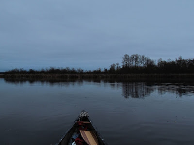
Today's dawn comes slowly to the marsh. Heavy clouds will prevent the sun from showing, even at the horizon where there often is an orange glow for at least a few minutes.


I spot a heron against the cattails, it's back turned to me, an unusual stance and perhaps one brought about by the safety of early morning darkness. I flush a snipe from the north end of the east marsh, a goose bobs it's head, a warning to me as I pass by it's mate. I note that even in the gray calm of this morning, the dead cattails still glow in warm tones, looking warmer than I would actually find them.

I head north, up the west islands, grabbing a big block of foam as I pass through broken island, passing the west lodge, and paddling up Ravenna Creek. It is only a very few days each year that I can make it up this creek. It is choked by wood with downed trees laying bank to bank. If the water is too high, I can't get under what I need to get under, and if it is too low, I can't get over or around what lays in the water. Even here, because it is a bit of a ditch, there are things to see. I pass a flicker nest, some ducks, and all along the creek are beaver trails and gnawings.

False Pixie Cup - from the east marsh beaver forest

Morning has arrived bringing a south wind with it. I head back south and not yet ready to end, I go east to Potlatch Point, just to see if I can make it down the big lake. The tall waving poplars hint that it might not go, but I make the trip anyway, just to see if there is a wind shadow for me to paddle in. But, the big lake is whitecaps, and I can't use the wind shadow, I can't paddle 10 ft from shore or wade the bank like I could in a remote lake. Not here where a long dock is required to keep pace with the Jones'.

Saturday, March 26, 2011

Calm, rain, wind, birds

It is a calm and gray day and I arrive at the wet end of the Harrison portage without a thought on my mind. I suppose that I do not need to have a thought on my mind.

western grebe

I paddle north, noting that the long necked western grebes have returned to the fresh water, a sign that they will soon migrate to their nesting grounds. I pass quite a few goldeneyes and some Canada geese, not stopping until I reach Wolf Bay, a former Native American village site now occupied by a private park for the wealthy neighbors (It's no longer a bay for that matter). There is no one here, unless you count the two bald eagles perched in a tree above me - I do. They may be the north nest pair, or they may be from somewhere else. The north nest is not far by land from here.

goldeneyes

Past Wolf Bay, the shore of ridiculous scenes of wealth gives way to a wooded shelf below steep bluffs. A few houses are tucked in here, but when the lake was lowered in 1916, I figure that this shelf wasn't large enough to build on. It is well treed and pleasant. I stop and retrieve a 55 gallon drum. It has fluid in it and I can't take it with, so I roll and shuffle it to a somewhat secure spot under the landowner's dock. Maybe they will do the correct thing.

At Sand Point I stop for lunch, and continue north, which turns out well. I find a ringnecked pheasant at the waters edge and many swallows, which I did not expect at all. When I come back, I find an immature bald eagle in a tree, and a large flock of scaups that have flown in behind me.


It is raining now and a south wind has started. I have almost 3 miles to go to get back to Union Bay, so I just put my head down and paddle steady, a game of making as much distance as possible should the weather get worse. It does rain and rain, but rain is not wind and wind is always more of a problem. Today is a long paddle, maybe a dozen miles with a couple miles of portage and it seems that thoughts come in the inverse of the distance. I just watch the sweep of my hand past my face with each stroke.

I circle up through the north end of Union Bay. Of note, there are many common mergansers about in groups of 5 or 6. It's not a big surprise since I saw a flock of 69 a couple weeks earlier on a dawn paddle.

I'm hungry and I finish at the east end of the ancient portage, because the portage home from here takes me right past a grocery store. More portages should have grocery stores.

Wednesday, March 23, 2011

Level Ground

I meant to start early but, I didn't, reading the world news instead, war, earthquake and greed. More greed than one could imagine could exist. It threatens to spin me into the abyss, and so it is time to go, because the canoe always returns to level ground.


As I head out northwesterly across the dead lake, I think of my spiral metaphor for life. The idea that one can spiral in, or one can spiral out. The broken people that one meets in later life are often the spiraling in variety. The world is against them as they spiral into a dark place. They spin off friends, they soon cannot be reached. It is a place of hate and fear. Spiraling out, on the other hand, is a constant exploration of life. One picks up friends like a magnet, friends who are also spiraling out. The world expands, the wonders never cease. It can be a scary place to go, but it is, in the long run, always a rewarding trip.


I'm heading to the salt water today. A trip planned, as much as I ever plan, through the locks and around the peninsula. I pass under two drawbridges and the wind begins to blow from the west. It is enough wind that out on the open water of the Salish Sea, I would be put to hard work, and maybe too hard.

the black one is the Speedwell, a ship of age

And so I turn around, because there is always something for me to explore back where I came from. Always something to learn in the smallest of places. The weather service predicted east winds (the reason I headed to the salt water) arrive as I cross the north end of the dead lake. Portage Bay, a body of calm in almost any wind, is not. The crossing under place is worse. It takes at least 20 minutes for me to force my way through that concrete canal while people walking on the shore easily outpace me.

birches of the beaver forest

It seems that the weather is blowing me homeward. Weather has a
good sense of timing, for when I get out of the canoe, in the south lagoon, I find the ground as level as could be.

Saturday, March 19, 2011

Curmudgeon

I'm sitting at home trying to find a reason to put the canoe in the water and looking at journal entries from the past few days when something I wrote goes visual. My wife approves enough that she adds to the whole idea with her own two cents.

At the big lake, at the east end of the downhill Harrison portage, I find the lake calm and sunny. A pair of shoes and a bag left on the beach are just signs of the swimmer that I see a quarter mile north. We talk when he arrives...but it is not a completely coherent chat. I am a ways ahead of him, which is to be expected as he just got done swimming a half mile in 44 degree water. He leaves and I go, heading north.

A slow moving motorboat comes my way, a fisherman, and I ask, "seen any reindeer?" There's no answer except a laugh for such nonsense and it doesn't matter, so fine a day it is.

Along the shore of the big lake are the typical mixed flocks of ducks - some goldeneyes, some buffleheads, and maybe a common merganser or two. The goldeneyes fly off first and the mergansers last, as is also typical.

I pass potlatch point, the big lodge, find a dead beaver floating in the middle of the east marsh, find a few too many people for so early in the season and head out towards the west islands. I see someone standing on the north shore a half mile away, where I often see one of my bird watching friends perched. So, I head that way, but don't get there in time.

The wind has come up. I drift the north channel with my camera in hand. A kingfisher accommodates me...by spinning its head backwards.


Then I head over near the west lodge for the purpose of the trip. I measure, photograph and sketch the details of the beaver felled alders. Seemed like I had it all thought out when I was at home....don't know what I'm doing....but, I just do it.


Some geocachers come by (dad and two boys). I've met the dad before and I remember that he is a nice guy, but we are so out of context that neither of us can put it together. But, like most geocachers, they have no idea where they are or what is going on around them. Still, a quality time for them. I point out the beaver workings...which couldn't be more obvious if they had neon lights on them. They don't find the box. I don't think it is here anymore, as I would've tripped over it sometime in the last month or so. Dad's way overestimating the accuracy of that gadget anyway. I must look like a dinosaur standing there with my compass (but I know exactly where I am and what is around me).

I take out at Portage Bay. Going up the hill a guy comments about my portage. I don't quite catch what he says, except that he says, "portaaaage"... like a French Canadian might. That stuff always scratches me a bit...like a fake Oxford accent...not sure who that is supposed to impress...I mean, I'm portaging (pord-idging) a very well used canoe up a 400 foot high hill...not like I'm drinking high tea or watching the footman wax the Rolls-Royce. So, I reply, "if yer not pordidging, yer not cnooing", my standard reply when someone doesn't reach the bar of proper canoe talk.

Friday, March 18, 2011

Dawn

I wake early, wide awake, and with calm air outside the house. I grab my gear and make a fast portage to the south lagoon, setting in just as the sun begins to leave the horizon behind, rising up into layered clouds that filter warm tones in swirls and broad bands.


I have forgotten how magnificent the marsh is at dawn. Blackbirds are trilling, geese honking and ducks are just coming out of their night beds. It is as if the entire planet is waking up, as if a dormant garden burst forth all of its blooms at an instant. It is the beginning of the world.

In the east marsh, it seems that the floating cattail island has rearranged itself. I can't quite say for sure, but it appears farther north and the opening of the sometimes calved off south island is wider. It just looks different...maybe it is the dawn.

As I reach the main bay I spot a flock of 69 common mergansers, 52 males and 17 females. I have seen them flock together, but usually just before they migrate off later in the spring...maybe it is the dawn.

I get out in the NE lagoon to walk the new trail out to the road where I can get a closer look at the north eagle nest. As I walk the soft ground, a silent hummingbird stops me in my tracks for a moment before allowing me to continue. It's a wonderful trail. The eagle nest is smaller (and closer) than I ever thought.


When I return I am reminded of what some of the trail restoration volunteers said about this place (Yesler Swamp, to them), that it is a patch of nature hidden down below the road level, out of sight from the hustle, a surprise for anyone that cares to walk down and take a look. I remember how the volunteers that I took out in my canoe were so happy to see their project from the water and I realize that I have never seen their project from the land. It's very good...and it is not the dawn.

As I return, I find a sheen of oil in the NE lagoon. It smells like home heating oil, something I've run across here before after heavy rainstorms. I find a larger and heavier, but odorless sheen in the west islands south of the mouth of Ravenna Creek.

Wednesday, March 16, 2011

Out with Z

Me and Z do the portage down to the south lagoon on a windy but, so far, dry day. Two days of blowing rain have kept me out of the canoe, the rain not bothering me so much as the wind did, although that rain was heavy enough that I would have been bailing the canoe a time or two.


It is quite windy, so I keep us in the protected spots. Out on the main bay, which isn't prone to large waves, a bit of white is breaking off of the crests, a sign that in open water the wind is 20 to 25mph, a wind that is more than enjoyable in a canoe. We stay in the calm, paddling up the east channel of the burial island, where I point out a dozen beaver scent mounds, some still fresh with castoreum. We spot one of the south nest eagles while heading over to visit the big lodge...identifying ducks as we go...hooded merganser, bufflehead, wood duck, widgeon...

As we cross the north side of the burial island, a large flock of ducks takes flight out in the bay. I tell Z to look for an eagle, but neither of us see one. Maybe it is just spring.

We cross the ship lane northward, herding a flock of coots as we go and I point out a few common mergansers, a cormorant, and some geese at the first of the west islands, standing about where they may put their nests in a few weeks. At the west lodge, we nose into the shoreline to look at the textbook beaver tree cutting that has been going on this winter. They have taken down 5 medium-large alders and it looks like they have studied a naturalists drawing to figure out how to do it correctly.

In the north channel, we see that the trapper has not been tending his live traps. In fact, I doubt that he has been here in 10 days and his live traps are 1/2 submerged. This is not good.

We can't continue past the shelter of #1 island due to the wind, so we return the way we came.

We do a bit more exploring in the south lagoon, visiting the secret garden since the water level is up, and workbench lodge, where the workbench is living up to the name being covered in fresh trimmed branches. We spot a kingfisher - a treat for Z as she is from the midwest and hasn't seen one before.

On the portage home, we stop to watch a couple of steller's jays, another new bird to Z.

Friday, March 11, 2011

The Fall of the Osprey Tree

On the Casa del Taco Portage - When I have my head in a book, is is most often a factual journey for me, whether the book is fact or fiction. It is with my face in a map that my imagination runs. I look at the lines, the geographic code (that many never figure out) and imagine the appearance, the comings and goings, where the game crosses a creek or where I might pitch a tent.

The NE Lagoon (aka Yesler Swamp)

As I portage northward toward the bay, I reach a place where I can look down from some 350 feet and see, a mile distant, the cattail islands in the NW corner. #1 Island merges with the north shore, its north channel obscured by cattails and rushes, but #2 stands out, a ring of clear water around it. From here I can see the oddly angled shape of its shorelines, which I recently surveyed and then put down in ink. I can see the brushy alders and willows in the center of the island and I no longer need to imagine what is there. I know that the ground has been trampled by the low bodies and webbed hind feet of several beaver who come there during the winter to feed on bark. Looking at a map and then going to that place is so different than going to the place and then making a map of it. I can't say that one or the other is better. But, they are, satisfyingly, different.

I set out from the east end of the ancient portage meeting a light rain and stiffening breeze as I reach the shore. I need to see the marsh today to see what changed in the storms of the last few days. I find a 8 foot square floating dock section wedged into the break of Broken Island. It came from a long ways off as I would recognize it if it came from inside the bay. I let the wind blow me up the west channel, watching the scene pass by without effort. It is, still, crazy time for the Canada geese. There are also many herons about, but they are well scattered and instead of standing at the waters edge, they are back 5 or 10 feet in the cattails. The water is a few more inches higher than my last trip and a few of my survey stations are now just submerged.

The Osprey Tree

As I drift in on #1 island, I notice that the 40 mph gusts of yesterday have brought the top half of the osprey tree to the ground. It is a familiar landmark, on a corner of land that I must pass by regularly. One summer, an osprey used it for a perch, until a winter storm broke off the perch. But, the name stuck and the landmark still remains although the silhouette has changed and the tree no longer meets an osprey's needs. I suppose that, in years to come, the silhouette will finally disappear, but somehow, the landmark will remain.

When I get to the north point
, I find that the two dead snags that I used in my survey have both crumpled, breaking at their bases. One has fallen into the water. I stop in the NE lagoon and return back the way I came, but continue into the south lagoon.
The high water lets me work my way through the fissures in the cattails, exploring areas that I have not seen for 5 months. The wind has even moved the moving cattail island some, although the water is not yet high enough to really set it in motion, but I can tell.

Saturday, March 5, 2011

By land and by water

I set out in the south lagoon, spotting one eagle in the burial island perch before I reach the main bay and pass over the Bathtub Graveyard (thank you A for the fine name). I head for the west islands, a break-through sun behind me and a good sized flock of coots and widgeons in front. An eagle passes over to the west taking a perch 50 yards north of its mate. It is hunting time.

The north marsh

I stop briefly at the east tip of #1 island. My memory is short of the details that need to go into a new map. I need to stare at the shoreline, look at my compass and sketch a couple small islands that somehow escaped me when I surveyed this area. I definitely need the location of the diving board log, a favorite spot for ducks, where more often than not, a common merganser is king of the hill.

I meet up with the Friends of Yesler Swamp work team. A dozen of us grub out blackberries and replace them with Douglas Hawthorn and Indian Plum. Blackberries, here in the northwest, are horribly invasive and crowd out native species in no time, creating a monoculture that isn't good for anything or anyone except berry pickers. I've brought an extra lift jacket and L volunteers to go out in the canoe following the work. Volunteers deserve perks.


We start by heading across the NE lagoon for a tour of the beaver feeding ground, a small spot of well chewed trees, but we also find fresh tracks of both raccoon and beaver. Then over to the north lodge and out of the a lagoon, edging along the north marsh where we flush a heron. We have time to circle #1 island, which will show L west lodge, a very industrious group comes out of there. As we follow the shore of #1 island, it is heron spotting...there's two, no three, two more behind...they have congregated again on the west tip. I tell L to just put her paddle down and keep shooting photos....by the time we start heading back we have seen about 20 in about 150 yards. I think that it has been a pretty good half hour trip for L.

Maybe she doesn't know it, but L was connected to the marsh by land, and now she is connected to the marsh by water, because marshes are no man's land, the place where land is not land and water is not water.
It may take more trips (it certainly took me more than one), but she has seen it from both sides.

I drop L off in the NE lagoon and head back across the bay. It is warm and calm, mostly cloudy, and I can just sit in mid bay and write for awhile, the nasal wheezing of widgeons coming from all around.

the south nest and the south nest eagles

Thursday, March 3, 2011

Big tour

A. comes over to the house, a new friend that I met at meeting about a trail that leads into the NE lagoon through a place more commonly known as Yesler Swamp. She volunteers with the Friends of Yesler Swamp and volunteers get perks, if canoeing with me is a perk. I figure she more than deserves to see her project from the water.

Standing on bouncing land in the hidden "meadow" east of the burial island

We begin with the portage west to the dead lake and for the last 1/2 mile she handles the canoe on its portage cart, I think her way of getting into the trip, which is not any different from how I start trips...with a portage. A. has no shortage of enthusiasm. This will be a fun trip for me.

We set out and sneak in and amongst the shipyard of Drydock 8 and 9, a working area more interesting than other built up areas with cranes, beams, machines, and supplies constructing a visual mess that is worth stopping to study.

The wind is gradually increasing, so I steer us north up the lake. The dead lake catches the full south wind, and with the houseboats and marinas choking the shoreline, one is forced to paddle in deep water, exposed to the weather. I'd just as soon like to be around the point in calmer water should the wind increase much more. But, wonders of wonders, Portage Bay is windy, a very rare occurrence where so often the hills shelter the water. But, this is not our destination.

Once through the crossing under place, the fun begins. I point out beaver cut trees and we find that the highway department has taken down the tall alder that the beaver had aimed at the highway (and it would've reached). We pass by the workbench lodge, stop to explore the beaver trail on the west side of the burial island and we pick up the scent of castoreum while returning to the canoe. We cross back over the lagoon and I show her the eroding "artifacts" from the Miller St. landfill. By the time we enter the east channel of the burial island it is lunch time and we sit in full site of several beaver scent mounds. The channel is rather silly with the mounds, must be 15 of them...some beaver is being very territorial to say the least. It is also clear that the water level is up a good 10 inches.

Then, it's into the east marsh, showing off the cattail island that moved a 100 feet last May, the big lodge, and the swamp "meadow" that lies hidden in the north end behind walls of cattails, a place that few know exists. We even haul an old tire out. Then a squall comes in, dark clouds, a flash of distant lightning, and a dumping rain which we miss out on by hiding under a bridge. When it passes, we continue north with an amazing rainbow spanning the entire north shore of the bay.


We pass Marsh Island, stopping long enough for me to point out the bathtubs, which A. aptly names the "bathtub graveyard". It is a name that will stick.

We edge up the islands, hoping to flush a snipe, but they have taken better shelter today. At the west lodge I point out the stand of large alders that have been coming down all winter. Then, approaching #1 island, we spot herons, and more herons. It's a game of, "there's three, no four, no, there's a fifth, there's two more there. It's at least a dozen congregated in a short stretch of shore on the two opposing points.

And then, it is to the NE lagoon, the water portion of the Friends of Yesler Swamp project. We get out on the south shore, the beaver dining room (the north lodge is in this lagoon), and now A. is convinced that the lodge is in use.

As we leave, the wind comes up again and I am most fortunate to have a bow paddler. If I was solo I would probably not be able to make headway. We part at the east end of the ancient portage in a full on rainstorm. Even now, A. continues to remark on what a fantastic day it is. I can't agree more.